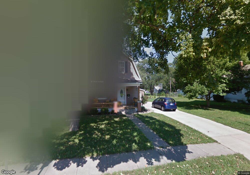
13316 W 91st St Lenexa, KS 66215
Estimated Value: $277,000 - $343,000
3
Beds
1
Bath
1,489
Sq Ft
$205/Sq Ft
Est. Value
About This Home
This home is located at 13316 W 91st St, Lenexa, KS 66215 and is currently estimated at $304,915, approximately $204 per square foot. 13316 W 91st St is a home located in Johnson County with nearby schools including Rising Star Elementary School, Westridge Middle School, and Shawnee Mission West High School.
Ownership History
Date
Name
Owned For
Owner Type
Purchase Details
Closed on
Nov 13, 2002
Sold by
Hoffine Richard K and Hoffine Carol
Bought by
Hoffine Carol Lea and Carol Lea Hoffine Revocable Tr
Current Estimated Value
Purchase Details
Closed on
Aug 9, 2002
Sold by
Loftus John A
Bought by
Hoffine Richard K and Hoffine Carol
Purchase Details
Closed on
Aug 8, 2002
Sold by
Loftus James E and Loftus Patricia S
Bought by
Hoffine Richard K and Hoffine Carol
Purchase Details
Closed on
Aug 23, 2001
Sold by
Loftus Mary and Loftus Mary A
Bought by
Loftus John A and Loftus James E
Create a Home Valuation Report for This Property
The Home Valuation Report is an in-depth analysis detailing your home's value as well as a comparison with similar homes in the area
Home Values in the Area
Average Home Value in this Area
Purchase History
| Date | Buyer | Sale Price | Title Company |
|---|---|---|---|
| Hoffine Carol Lea | -- | -- | |
| Hoffine Richard K | -- | Heartland Title Company | |
| Hoffine Richard K | -- | Heartland Title Company | |
| Loftus John A | -- | Heartland Title |
Source: Public Records
Tax History Compared to Growth
Tax History
| Year | Tax Paid | Tax Assessment Tax Assessment Total Assessment is a certain percentage of the fair market value that is determined by local assessors to be the total taxable value of land and additions on the property. | Land | Improvement |
|---|---|---|---|---|
| 2024 | $3,037 | $27,669 | $5,354 | $22,315 |
| 2023 | $2,887 | $25,599 | $4,863 | $20,736 |
| 2022 | $2,473 | $21,885 | $4,421 | $17,464 |
| 2021 | $2,197 | $18,250 | $4,204 | $14,046 |
| 2020 | $2,073 | $17,020 | $3,821 | $13,199 |
| 2019 | $2,035 | $16,698 | $3,187 | $13,511 |
| 2018 | $1,922 | $15,606 | $3,187 | $12,419 |
| 2017 | $1,777 | $13,949 | $2,900 | $11,049 |
| 2016 | $1,703 | $13,190 | $2,900 | $10,290 |
| 2015 | $1,654 | $12,891 | $2,900 | $9,991 |
| 2013 | -- | $10,718 | $2,900 | $7,818 |
Source: Public Records
Map
Nearby Homes
- 13312 W 91st St
- 13017 W 92nd St
- 12894 W 93rd St
- 8861 Carriage Dr
- 14101 W 88th Place
- 12122 W 92nd St
- 8641 Greenwood Ln
- 8545 Westgate St
- 9202 Greenway Ln
- 8919 Greenway Ln
- 13136 W 84th St
- 13212 W 84th St
- 9318 Greenway Ln
- 14424 W 84th Terrace
- 9124 Constance St
- 8946 Country Hill Ct
- 12808 W 82nd St
- 8215 Rosehill Rd
- 14620 W 84th St
- 8277 Monrovia St
- 13320 W 91st St
- 9033 Haskins St
- 13304 W 91st St
- 9101 Haskins St
- 13315 W 91st St
- 9029 Haskins St
- 9048 Haskins St
- 9040 Haskins St
- 13305 W 91st St
- 13301 W 90th Terrace
- 13218 W 91st St
- 13301 W 91st St
- 13221 W 91st St
- 9104 Haskins St
- 13219 W 90th Terrace
- 9117 Haskins St
- 13210 W 91st St
- 13217 W 91st St
- 9112 Haskins St