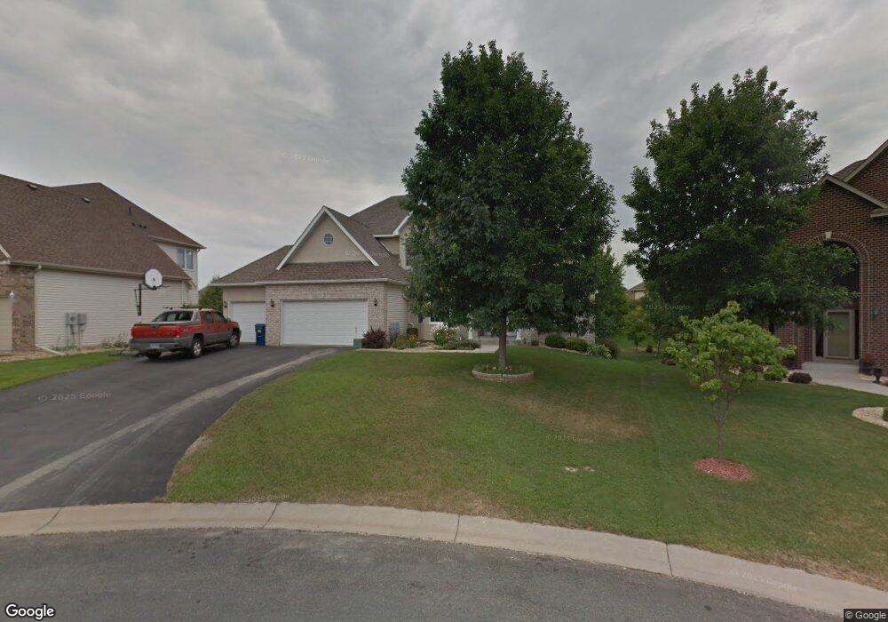
13335 Cranford Cir Rosemount, MN 55068
Estimated Value: $591,000 - $697,000
6
Beds
4
Baths
4,212
Sq Ft
$151/Sq Ft
Est. Value
About This Home
This home is located at 13335 Cranford Cir, Rosemount, MN 55068 and is currently estimated at $635,819, approximately $150 per square foot. 13335 Cranford Cir is a home located in Dakota County with nearby schools including Shannon Park Elementary School, Rosemount Middle School, and Rosemount Senior High School.
Ownership History
Date
Name
Owned For
Owner Type
Purchase Details
Closed on
Aug 29, 2016
Sold by
Birtzer Mark L and Birtzer Rebecca J
Bought by
George Anil and Chacko Mercy
Current Estimated Value
Home Financials for this Owner
Home Financials are based on the most recent Mortgage that was taken out on this home.
Original Mortgage
$310,000
Outstanding Balance
$248,013
Interest Rate
3.48%
Mortgage Type
New Conventional
Estimated Equity
$387,806
Purchase Details
Closed on
Feb 26, 2007
Sold by
Ramlall Sunil J and Ramlall Dhanmati
Bought by
Birtzer Mark L and Birtzer Rebecca J
Purchase Details
Closed on
Mar 28, 2003
Sold by
D R Horton Inc Mn
Bought by
Ramlall Sunil J and Ramlall Dhanmati S
Create a Home Valuation Report for This Property
The Home Valuation Report is an in-depth analysis detailing your home's value as well as a comparison with similar homes in the area
Home Values in the Area
Average Home Value in this Area
Purchase History
| Date | Buyer | Sale Price | Title Company |
|---|---|---|---|
| George Anil | $420,000 | Home Title Inc | |
| Birtzer Mark L | -- | -- | |
| Ramlall Sunil J | $386,407 | -- |
Source: Public Records
Mortgage History
| Date | Status | Borrower | Loan Amount |
|---|---|---|---|
| Open | George Anil | $310,000 |
Source: Public Records
Tax History
| Year | Tax Paid | Tax Assessment Tax Assessment Total Assessment is a certain percentage of the fair market value that is determined by local assessors to be the total taxable value of land and additions on the property. | Land | Improvement |
|---|---|---|---|---|
| 2024 | $7,258 | $615,300 | $204,100 | $411,200 |
| 2023 | $7,258 | $642,300 | $206,400 | $435,900 |
| 2022 | $5,744 | $600,500 | $205,500 | $395,000 |
| 2021 | $5,646 | $504,700 | $178,700 | $326,000 |
| 2020 | $5,874 | $485,700 | $170,200 | $315,500 |
| 2019 | $5,548 | $485,600 | $162,100 | $323,500 |
| 2018 | $5,616 | $479,300 | $154,400 | $324,900 |
| 2017 | $5,790 | $468,300 | $147,100 | $321,200 |
| 2016 | $5,681 | $461,500 | $142,800 | $318,700 |
| 2015 | $5,732 | $443,500 | $138,600 | $304,900 |
| 2014 | -- | $445,800 | $131,200 | $314,600 |
| 2013 | -- | $412,603 | $121,271 | $291,332 |
Source: Public Records
Map
Nearby Homes
- 13518 Crompton Ct
- 3275 Coleshire Path Unit 24
- 3348 137th St W
- 3324 137th St W
- 13267 Danner Path
- 13670 Carrach Ave Unit 308
- 13670 Carrach Ave Unit 311
- 13558 Dellwood Way
- 13880 Clare Downs Way
- 13341 Cadogan Way
- 13351 Cadogan Way
- 13371 Cadogan Way
- 13381 Cadogan Way
- 13721 Danbury Path
- 13526 Daisy Ct
- 13360 Cadogan Way
- 13370 Cadogan Way
- 13380 Cadogan Way
- 2894 138th St W Unit 48
- 13701 Brookside Path
- 13341 Cranford Cir
- 13329 Cranford Cir
- 13270 Creggs Cir
- 13276 Creggs Cir
- 13264 Creggs Cir
- 13347 Cranford Cir
- 13282 Creggs Cir
- 13330 Cranford Cir
- 13348 Cranford Cir
- 13336 Cranford Cir
- 13342 Cranford Cir
- 13288 Creggs Cir
- 13353 Cranford Cir
- 13258 Creggs Cir
- 13360 Cranford Cir
- 13275 Creggs Cir
- 13281 Creggs Cir
- 13257 Creggs Cir
- 13287 Creggs Cir
- 13269 Creggs Cir
Your Personal Tour Guide
Ask me questions while you tour the home.