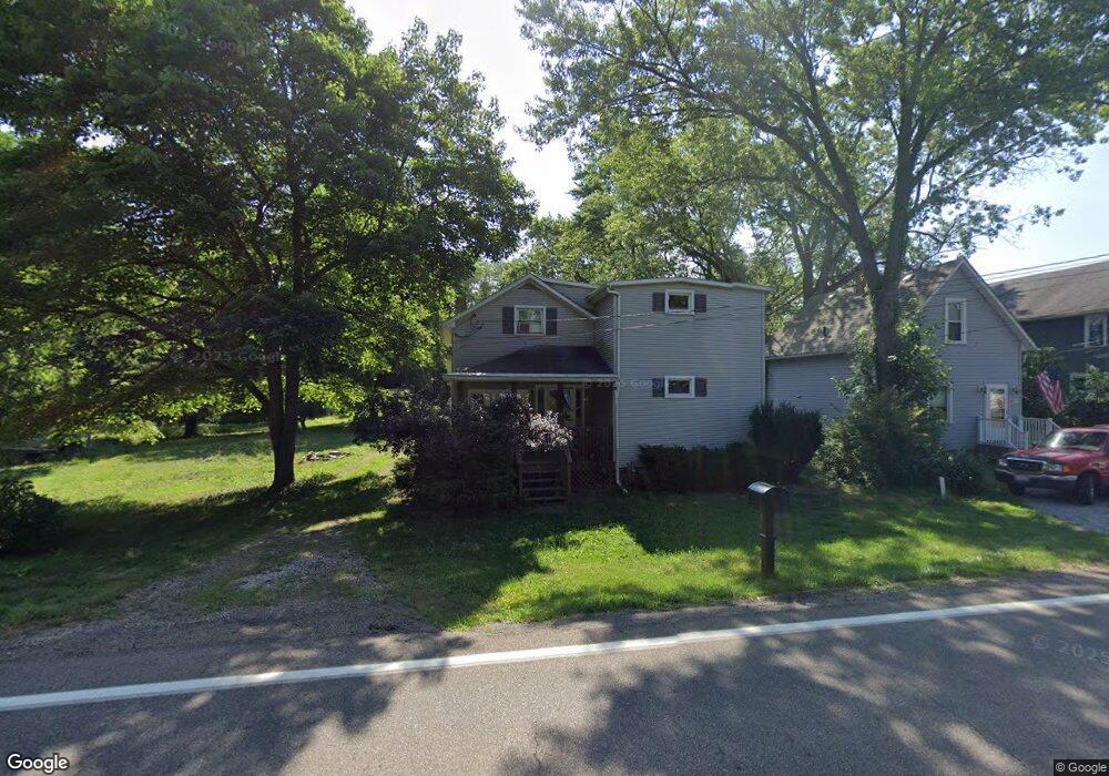
13341 N Main St Beloit, OH 44609
Estimated Value: $117,000 - $188,000
2
Beds
1
Bath
1,181
Sq Ft
$124/Sq Ft
Est. Value
About This Home
This home is located at 13341 N Main St, Beloit, OH 44609 and is currently estimated at $146,343, approximately $123 per square foot. 13341 N Main St is a home located in Mahoning County with nearby schools including West Branch Middle School and West Branch High School.
Ownership History
Date
Name
Owned For
Owner Type
Purchase Details
Closed on
Jan 15, 2019
Sold by
Ward Alice Marie
Bought by
Ward Walter
Current Estimated Value
Purchase Details
Closed on
Apr 30, 2008
Sold by
Ward Alice Marie
Bought by
State Of Ohio and Department Of Transportation
Purchase Details
Closed on
Jun 13, 1990
Bought by
Ward Alice M
Create a Home Valuation Report for This Property
The Home Valuation Report is an in-depth analysis detailing your home's value as well as a comparison with similar homes in the area
Purchase History
| Date | Buyer | Sale Price | Title Company |
|---|---|---|---|
| Ward Walter | -- | Sebring Title | |
| State Of Ohio | $725 | Attorney | |
| Ward Alice M | -- | -- |
Source: Public Records
Tax History
| Year | Tax Paid | Tax Assessment Tax Assessment Total Assessment is a certain percentage of the fair market value that is determined by local assessors to be the total taxable value of land and additions on the property. | Land | Improvement |
|---|---|---|---|---|
| 2025 | $1,334 | $29,380 | $4,830 | $24,550 |
| 2024 | $1,513 | $29,380 | $4,830 | $24,550 |
| 2023 | $905 | $29,380 | $4,830 | $24,550 |
| 2022 | $660 | $22,800 | $3,930 | $18,870 |
| 2021 | $1,137 | $22,800 | $3,930 | $18,870 |
| 2020 | $1,388 | $22,800 | $3,930 | $18,870 |
| 2019 | $562 | $18,670 | $3,930 | $14,740 |
| 2018 | $560 | $18,670 | $3,930 | $14,740 |
| 2017 | $557 | $18,670 | $3,930 | $14,740 |
| 2016 | $583 | $19,140 | $3,620 | $15,520 |
| 2015 | $570 | $19,140 | $3,620 | $15,520 |
| 2014 | $572 | $19,140 | $3,620 | $15,520 |
| 2013 | $565 | $19,140 | $3,620 | $15,520 |
Source: Public Records
Map
Nearby Homes
- 18280 5th St
- 18061 Derr Ave
- 18262 W Pine Lake Rd
- 11 Redwood St
- 57 Redwood St
- 17325 5th St
- 726 N 12th St
- 345 E Indiana Ave
- 945 N 12th St
- 1005 N 13th St
- 157 E Ohio Ave
- 166 E Michigan Ave
- 125 E Indiana Ave
- 430 Hillsdale St
- 423 S 14th St
- 0 W Nevada Ave Unit 5181868
- 175 W Ohio Ave
- 208 S 15th St
- 324 S 15th St
- 406 W Ohio Ave
- 13357 N Main St
- 13363 N Main St
- 13340 N Main St
- 13377 N Main St
- 13372 N Main St
- 13384 N Main St
- 13404 N Main St
- 13416 N Main St
- 17750 7th St
- 13327 Beloit Snodes Rd
- 13434 N Main St
- 13378 Church St
- 13435 N Main St
- 13433 Church St
- 13446 N Main St
- 17954 6th St
- 13290 Beloit Snodes Rd
- 13404 Church St
- 13464 N Main St
- 18066 6th St
Your Personal Tour Guide
Ask me questions while you tour the home.