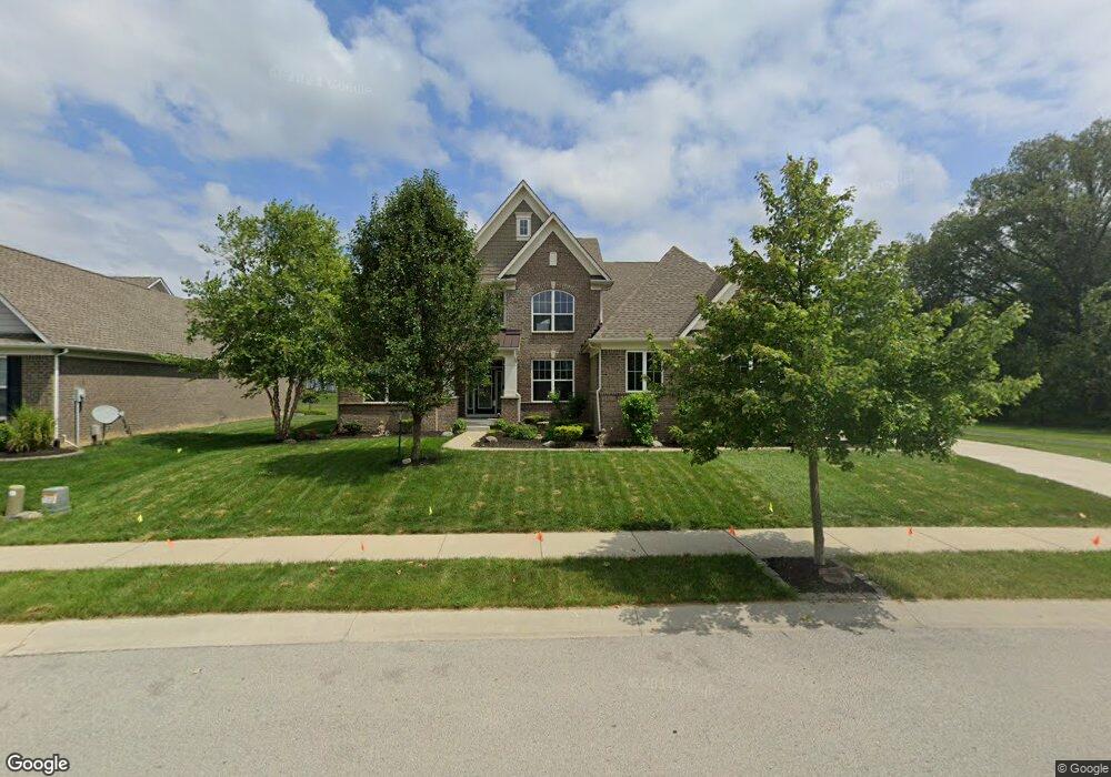
13349 Dennison Dr E Fishers, IN 46037
Estimated Value: $559,000 - $643,000
3
Beds
4
Baths
3,452
Sq Ft
$172/Sq Ft
Est. Value
About This Home
This home is located at 13349 Dennison Dr E, Fishers, IN 46037 and is currently estimated at $595,239, approximately $172 per square foot. 13349 Dennison Dr E is a home with nearby schools including Thorpe Creek Elementary School, Hamilton Southeastern Intermediate / Junior High, and Hamilton Southeastern High School.
Ownership History
Date
Name
Owned For
Owner Type
Purchase Details
Closed on
Dec 18, 2015
Sold by
Calatlantic Homes If Indiana Inc
Bought by
Kabra Sachin and Somani Mamta
Current Estimated Value
Home Financials for this Owner
Home Financials are based on the most recent Mortgage that was taken out on this home.
Original Mortgage
$345,168
Outstanding Balance
$273,049
Interest Rate
3.96%
Mortgage Type
New Conventional
Estimated Equity
$322,190
Purchase Details
Closed on
Aug 17, 2015
Sold by
Saratoga Development Llc
Bought by
Rh Of Indiana Lp
Create a Home Valuation Report for This Property
The Home Valuation Report is an in-depth analysis detailing your home's value as well as a comparison with similar homes in the area
Home Values in the Area
Average Home Value in this Area
Purchase History
| Date | Buyer | Sale Price | Title Company |
|---|---|---|---|
| Kabra Sachin | -- | Attorney | |
| Rh Of Indiana Lp | -- | First American Title Insuran |
Source: Public Records
Mortgage History
| Date | Status | Borrower | Loan Amount |
|---|---|---|---|
| Open | Kabra Sachin | $345,168 |
Source: Public Records
Tax History
| Year | Tax Paid | Tax Assessment Tax Assessment Total Assessment is a certain percentage of the fair market value that is determined by local assessors to be the total taxable value of land and additions on the property. | Land | Improvement |
|---|---|---|---|---|
| 2024 | $6,479 | $579,600 | $72,100 | $507,500 |
| 2023 | $6,514 | $558,800 | $72,100 | $486,700 |
| 2022 | $5,920 | $492,100 | $72,100 | $420,000 |
| 2021 | $5,291 | $436,400 | $72,100 | $364,300 |
| 2020 | $5,142 | $422,700 | $72,100 | $350,600 |
| 2019 | $5,102 | $419,500 | $68,900 | $350,600 |
| 2018 | $5,161 | $423,100 | $68,900 | $354,200 |
| 2017 | $4,977 | $418,100 | $68,900 | $349,200 |
| 2016 | $5,061 | $422,300 | $68,900 | $353,400 |
Source: Public Records
Map
Nearby Homes
- 15163 Farrington Way
- 15562 Alperton Rd
- 13661 Ruskin Ln
- 15472 Cardonia Rd
- 13673 Ruskin Ln
- 15546 Alperton Rd
- 15462 Postman Rd
- 15523 Postman Rd
- 15155 Farrington Way
- 15147 Farrington Way
- 15139 Farrington Way
- 13685 Ruskin Ln
- 15104 Downham Dr
- 13567 Moorcroft Dr
- 0 E 136th St Unit MBR22040185
- 15437 Eastpark Cir W
- 13324 Fielding Way
- 15175 Swallow Falls Way
- Springfield Plan at Abbott Commons - Heritage
- 15151 Swallow Falls Way
- 13361 Dennison Dr E
- 13348 Dennison Dr
- 13336 Dennison Dr
- 13348 Dennison Dr E
- 13373 Dennison Dr E
- 13360 Dennison Dr E
- 13336 Dennison Dr E
- 13336 Dennison Dr E
- 13384 Dennison Rd
- 13384 Dennison Dr
- 13385 Dennison Dr
- 13385 Dennison Dr E
- 13326 Lansbury Ln
- 14973 Bonner Cir
- 13338 Lansbury Ln
- 13312 Dennison Dr E
- 13350 Mancroft Dr S
- 13362 Mancroft Dr S
- 14921 Dennison Dr