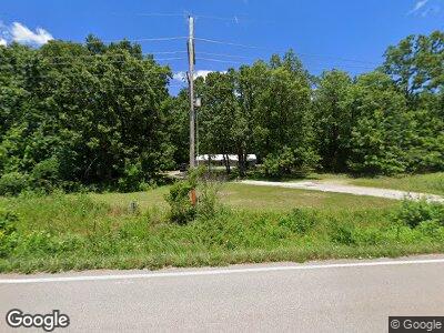
13355 State Highway U Mineral Point, MO 63660
Estimated Value: $94,000 - $227,000
2
Beds
1
Bath
1,560
Sq Ft
$87/Sq Ft
Est. Value
About This Home
This home is located at 13355 State Highway U, Mineral Point, MO 63660 and is currently estimated at $136,485, approximately $87 per square foot. 13355 State Highway U is a home located in Washington County with nearby schools including Potosi Elementary School, Trojan Intermediate School, and John A. Evans Middle School.
Ownership History
Date
Name
Owned For
Owner Type
Purchase Details
Closed on
Aug 14, 2009
Sold by
Short
Bought by
Collins Thomas and Collins Brenda
Current Estimated Value
Home Financials for this Owner
Home Financials are based on the most recent Mortgage that was taken out on this home.
Original Mortgage
$45,900
Outstanding Balance
$30,456
Interest Rate
5.16%
Estimated Equity
$108,428
Create a Home Valuation Report for This Property
The Home Valuation Report is an in-depth analysis detailing your home's value as well as a comparison with similar homes in the area
Home Values in the Area
Average Home Value in this Area
Purchase History
| Date | Buyer | Sale Price | Title Company |
|---|---|---|---|
| Collins Thomas | -- | -- |
Source: Public Records
Mortgage History
| Date | Status | Borrower | Loan Amount |
|---|---|---|---|
| Open | Collins Thomas | $45,900 | |
| Previous Owner | Short William A | $49,000 |
Source: Public Records
Tax History Compared to Growth
Tax History
| Year | Tax Paid | Tax Assessment Tax Assessment Total Assessment is a certain percentage of the fair market value that is determined by local assessors to be the total taxable value of land and additions on the property. | Land | Improvement |
|---|---|---|---|---|
| 2024 | $369 | $7,680 | $1,620 | $6,060 |
| 2023 | $367 | $7,680 | $1,620 | $6,060 |
| 2022 | $367 | $7,680 | $1,620 | $6,060 |
| 2021 | $369 | $7,680 | $1,620 | $6,060 |
| 2020 | $371 | $7,680 | $1,620 | $6,060 |
| 2019 | $370 | $7,680 | $1,620 | $6,060 |
| 2018 | $371 | $7,680 | $0 | $0 |
| 2017 | $369 | $7,680 | $1,620 | $6,060 |
| 2016 | $367 | $7,680 | $1,620 | $6,060 |
| 2014 | -- | $7,730 | $0 | $0 |
| 2013 | -- | $7,730 | $0 | $0 |
| 2012 | -- | $7,880 | $0 | $0 |
Source: Public Records
Map
Nearby Homes
- 13688 State Highway U
- 0 Ozarks Heights Unit 24005849
- 10040 Meadowbrook Ct
- 15 Aspen Trail Dr
- Lot 15 Ozark Heights
- Lot 14 Ozark Heights
- 10570 Old 8 E
- 14864 S State Highway 21
- 10148 Southern Pines Rd
- 0 Delbridge Rd Unit MIS25042846
- 0 Delbridge Rd Unit 22430197
- 0 Delbridge Rd Unit MAR25006320
- 10208 Old 21
- 10204 Riehl Farm Dr
- 10211 Riehl Farm Dr
- 0 State Highway P
- 7 Legacy Dr
- 11117 Delbridge Rd
- 0 Pond Creek Rd Unit 23002395
- 10629 Pheasant Farm Rd
- 13355 State Highway U
- 13399 State Highway U
- 13241 State Highway U
- 13623 State Highway U
- 12978 State Highway U
- 0 Enzone Rd Unit 16085055
- 10457 Mesabi Rd
- 12647 State Highway U
- 14262 State Highway U
- 14262 State Hwy U
- 14136 State Highway U
- 10703 Trailway Rd
- 14333 State Highway U
- 14348 State Highway U
- 12190 State Highway U
- 12190 State Highway U
- 12190 State Hwy U
- 12329 State Highway U
