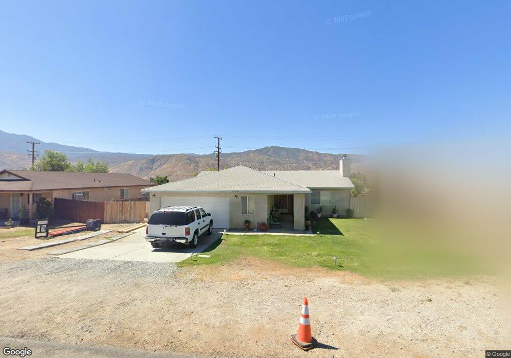
13358 Apache Trail Cabazon, CA 92230
Estimated Value: $368,000 - $443,000
3
Beds
2
Baths
1,322
Sq Ft
$297/Sq Ft
Est. Value
About This Home
This home is located at 13358 Apache Trail, Cabazon, CA 92230 and is currently estimated at $392,018, approximately $296 per square foot. 13358 Apache Trail is a home with nearby schools including Banning High School.
Ownership History
Date
Name
Owned For
Owner Type
Purchase Details
Closed on
Aug 8, 2019
Sold by
Sluder Jesse James
Bought by
Sluder Jesse James and Vazquez Sluder Argelia
Current Estimated Value
Purchase Details
Closed on
May 7, 2005
Sold by
Desert Hills Estates Inc
Bought by
Sluder Jesse James
Home Financials for this Owner
Home Financials are based on the most recent Mortgage that was taken out on this home.
Original Mortgage
$165,800
Interest Rate
5.97%
Mortgage Type
Fannie Mae Freddie Mac
Purchase Details
Closed on
Jun 1, 2003
Sold by
Whitman Richard L and Whitman Dorene
Bought by
Desert Hills Estates Inc
Purchase Details
Closed on
Oct 1, 2002
Sold by
Bourns Inc
Bought by
Whitman Richard L and Whitman Dorene
Home Financials for this Owner
Home Financials are based on the most recent Mortgage that was taken out on this home.
Original Mortgage
$475,000
Interest Rate
6.22%
Mortgage Type
Seller Take Back
Create a Home Valuation Report for This Property
The Home Valuation Report is an in-depth analysis detailing your home's value as well as a comparison with similar homes in the area
Home Values in the Area
Average Home Value in this Area
Purchase History
| Date | Buyer | Sale Price | Title Company |
|---|---|---|---|
| Sluder Jesse James | -- | None Available | |
| Sluder Jesse James | $207,681 | United Title Co Inland Empir | |
| Desert Hills Estates Inc | -- | -- | |
| Whitman Richard L | $475,000 | Stewart Title |
Source: Public Records
Mortgage History
| Date | Status | Borrower | Loan Amount |
|---|---|---|---|
| Previous Owner | Sluder Jesse James | $165,800 | |
| Previous Owner | Whitman Richard L | $475,000 |
Source: Public Records
Tax History
| Year | Tax Paid | Tax Assessment Tax Assessment Total Assessment is a certain percentage of the fair market value that is determined by local assessors to be the total taxable value of land and additions on the property. | Land | Improvement |
|---|---|---|---|---|
| 2025 | $3,770 | $274,652 | $68,314 | $206,338 |
| 2023 | $3,770 | $263,989 | $65,662 | $198,327 |
| 2022 | $3,591 | $258,814 | $64,375 | $194,439 |
| 2021 | $3,027 | $218,353 | $53,988 | $164,365 |
| 2020 | $2,703 | $194,958 | $48,204 | $146,754 |
| 2019 | $2,633 | $189,280 | $46,800 | $142,480 |
| 2018 | $2,809 | $182,000 | $45,000 | $137,000 |
| 2017 | $2,199 | $156,000 | $39,000 | $117,000 |
| 2016 | $1,730 | $127,000 | $32,000 | $95,000 |
| 2015 | $1,175 | $87,000 | $22,000 | $65,000 |
| 2014 | $1,190 | $87,000 | $22,000 | $65,000 |
Source: Public Records
Map
Nearby Homes
- 0 Bonita Ave Unit 26639551
- 49349 Blanche Ave
- 0 Aloma Dr Unit IV25239532
- 0 Aloma Dr Unit IV23231315
- 0 Na Unit EV23021645
- 0 Faryl Ave Unit OC25198467
- 0 Faryl Ave Unit IV26019283
- 0 Faryl Ave Unit JT25276974
- 0 Faryl Ave Unit DW25170317
- 0 Faryl Ave Unit IV26019292
- 0 Faryl Ave Unit 10
- 50292 Ramona St
- 49901 Mountain View Ave
- 14140 Broadway (Vicinity) St
- 50222 Aloma Dr
- 1368 Cedarwood Dr
- 5477 Indigo Way
- 1378 Cedarwood Dr
- 48 Lot Cryer Dr
- 0 Banning Apn538-272-004 Unit IG25172906
- 13366 Apache Trail
- 13350 Apache Trail
- 13344 Apache Trail
- 48828 Taos Rd
- 13374 Apache Trail
- 48812 Taos Rd
- 13361 Apache Trail
- 48844 Taos Rd
- 48796 Taos Rd
- 13353 Apache Trail
- 13382 Apache Trail
- 13371 Apache Trail
- 13379 Apache Trail
- 48852 Taos Rd
- 48862 Taos Rd
- 13385 Apache Trail
- 13390 Apache Trail
- 48781 Taos Rd
- 48893 Maumee Ln
- 48869 Maumee Ln
Your Personal Tour Guide
Ask me questions while you tour the home.