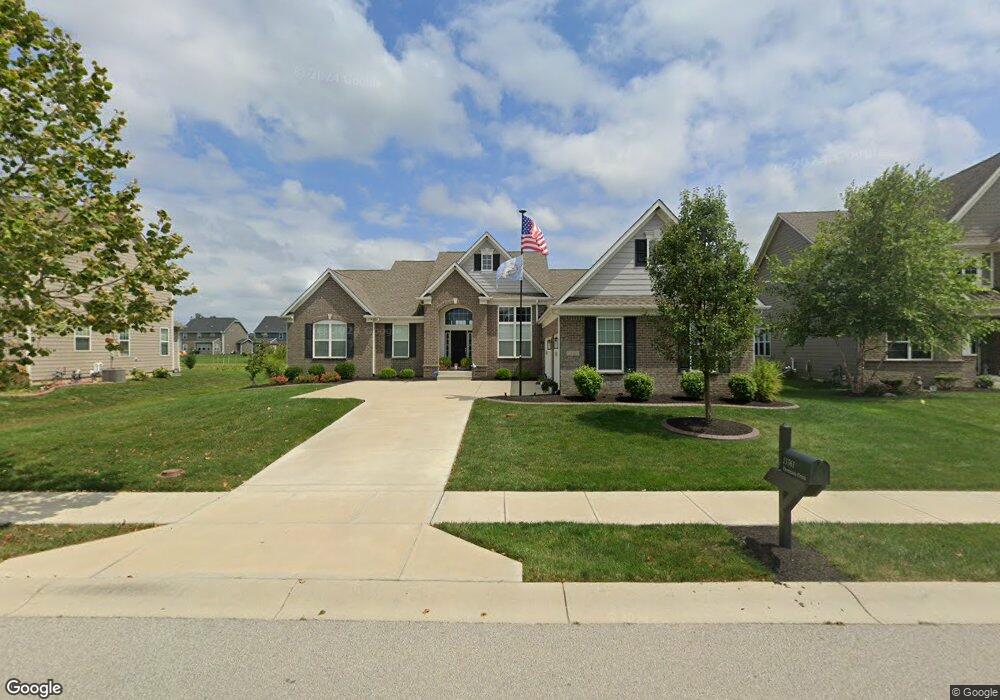
13361 Dennison Dr E Fishers, IN 46037
Estimated Value: $552,000 - $639,000
4
Beds
3
Baths
2,443
Sq Ft
$248/Sq Ft
Est. Value
About This Home
This home is located at 13361 Dennison Dr E, Fishers, IN 46037 and is currently estimated at $605,673, approximately $247 per square foot. 13361 Dennison Dr E is a home with nearby schools including Overland Park Elementary School, Southeastern Elementary School, and Hamilton Southeastern Intermediate / Junior High.
Ownership History
Date
Name
Owned For
Owner Type
Purchase Details
Closed on
Jun 10, 2016
Sold by
Calatlantic Homes Of Indiana Inc
Bought by
Eubanks Shirley J and Eubanks David W
Current Estimated Value
Home Financials for this Owner
Home Financials are based on the most recent Mortgage that was taken out on this home.
Original Mortgage
$343,388
Outstanding Balance
$271,812
Interest Rate
3.57%
Mortgage Type
New Conventional
Estimated Equity
$333,861
Purchase Details
Closed on
Jan 8, 2016
Sold by
Saratoga Development Llc and Thompson Corby D
Bought by
Calatlantic Homes Of Indiana Inc
Create a Home Valuation Report for This Property
The Home Valuation Report is an in-depth analysis detailing your home's value as well as a comparison with similar homes in the area
Home Values in the Area
Average Home Value in this Area
Purchase History
| Date | Buyer | Sale Price | Title Company |
|---|---|---|---|
| Eubanks Shirley J | -- | None Available | |
| Calatlantic Homes Of Indiana Inc | -- | None Available |
Source: Public Records
Mortgage History
| Date | Status | Borrower | Loan Amount |
|---|---|---|---|
| Open | Eubanks Shirley J | $343,388 |
Source: Public Records
Tax History Compared to Growth
Tax History
| Year | Tax Paid | Tax Assessment Tax Assessment Total Assessment is a certain percentage of the fair market value that is determined by local assessors to be the total taxable value of land and additions on the property. | Land | Improvement |
|---|---|---|---|---|
| 2024 | $6,769 | $579,500 | $71,600 | $507,900 |
| 2023 | $6,513 | $558,700 | $71,600 | $487,100 |
| 2022 | $5,918 | $491,900 | $71,600 | $420,300 |
| 2021 | $5,298 | $437,000 | $71,600 | $365,400 |
| 2020 | $5,104 | $419,600 | $71,600 | $348,000 |
| 2019 | $5,108 | $420,000 | $68,400 | $351,600 |
| 2018 | $5,122 | $420,000 | $68,400 | $351,600 |
| 2017 | $4,997 | $416,800 | $68,400 | $348,400 |
| 2016 | $35 | $600 | $600 | $0 |
Source: Public Records
Map
Nearby Homes
- 15063 Mancroft Dr
- 15163 Farrington Way
- 15472 Cardonia Rd
- 15131 Farrington Way
- 15198 Swallow Falls Way
- 15464 Cardonia Rd
- 15147 Farrington Way
- 15444 Postman Rd
- 15104 Downham Dr
- 15311 Forest Glade Dr
- 15269 Staffordshire Way
- 13538 Longrise Ln
- 0 E 136th St Unit MBR22040185
- 15175 Swallow Falls Way
- Springfield Plan at Abbott Commons - Heritage
- 15511 Postman Rd
- 15363 Alperton Rd
- Kingston Plan at Abbott Commons - Venture
- Chartwell Plan at Abbott Commons - Heritage
- Davidson Plan at Abbott Commons - Venture
- 13349 Dennison Dr E
- 13373 Dennison Dr E
- 13348 Dennison Dr
- 13336 Dennison Dr
- 13360 Dennison Dr E
- 13384 Dennison Rd
- 13348 Dennison Dr E
- 13385 Dennison Dr E
- 13385 Dennison Dr
- 13384 Dennison Dr
- 13336 Dennison Dr E
- 13336 Dennison Dr E
- 13397 Dennison Dr
- 14921 Dennison Dr
- 13374 Mancroft Dr
- 13362 Mancroft Dr S
- 13350 Mancroft Dr S
- 13326 Lansbury Ln