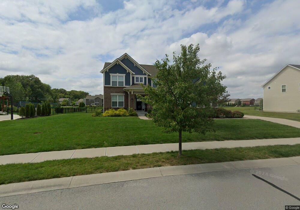
13362 Mancroft Dr S Fishers, IN 46037
Estimated Value: $493,000 - $586,000
3
Beds
3
Baths
3,068
Sq Ft
$181/Sq Ft
Est. Value
About This Home
This home is located at 13362 Mancroft Dr S, Fishers, IN 46037 and is currently estimated at $554,144, approximately $180 per square foot. 13362 Mancroft Dr S is a home with nearby schools including Overland Park Elementary School, Southeastern Elementary School, and Hamilton Southeastern Intermediate / Junior High.
Ownership History
Date
Name
Owned For
Owner Type
Purchase Details
Closed on
Dec 29, 2016
Sold by
Calatlantic Homes Of Indiana Inc
Bought by
Butler Kyler
Current Estimated Value
Home Financials for this Owner
Home Financials are based on the most recent Mortgage that was taken out on this home.
Original Mortgage
$379,316
Outstanding Balance
$312,233
Interest Rate
4.08%
Mortgage Type
New Conventional
Estimated Equity
$241,911
Purchase Details
Closed on
Jul 18, 2016
Sold by
Saratoga Development Llc
Bought by
Calatlantic Homes Of Indiana Inc
Create a Home Valuation Report for This Property
The Home Valuation Report is an in-depth analysis detailing your home's value as well as a comparison with similar homes in the area
Home Values in the Area
Average Home Value in this Area
Purchase History
| Date | Buyer | Sale Price | Title Company |
|---|---|---|---|
| Butler Kyler | -- | None Available | |
| Calatlantic Homes Of Indiana Inc | -- | First American Title |
Source: Public Records
Mortgage History
| Date | Status | Borrower | Loan Amount |
|---|---|---|---|
| Open | Butler Kyler | $379,316 |
Source: Public Records
Tax History Compared to Growth
Tax History
| Year | Tax Paid | Tax Assessment Tax Assessment Total Assessment is a certain percentage of the fair market value that is determined by local assessors to be the total taxable value of land and additions on the property. | Land | Improvement |
|---|---|---|---|---|
| 2024 | $6,021 | $538,900 | $72,800 | $466,100 |
| 2022 | $6,056 | $458,500 | $72,800 | $385,700 |
| 2021 | $4,950 | $408,700 | $72,800 | $335,900 |
| 2020 | $4,771 | $392,700 | $72,800 | $319,900 |
| 2019 | $4,772 | $392,800 | $69,600 | $323,200 |
| 2018 | $4,785 | $392,800 | $69,600 | $323,200 |
| 2017 | $4,696 | $392,100 | $69,600 | $322,500 |
| 2016 | $35 | $600 | $600 | $0 |
Source: Public Records
Map
Nearby Homes
- 15063 Mancroft Dr
- 15163 Farrington Way
- 15472 Cardonia Rd
- 15131 Farrington Way
- 15198 Swallow Falls Way
- 15464 Cardonia Rd
- 15147 Farrington Way
- 15123 Farrington Way
- 15444 Postman Rd
- 15311 Forest Glade Dr
- 15104 Downham Dr
- 15269 Staffordshire Way
- 13538 Longrise Ln
- 0 E 136th St Unit MBR22040185
- Springfield Plan at Abbott Commons - Heritage
- 15480 Postman Rd
- 15511 Postman Rd
- 15363 Alperton Rd
- Kingston Plan at Abbott Commons - Venture
- Chartwell Plan at Abbott Commons - Heritage
- 13374 Mancroft Dr
- 13350 Mancroft Dr S
- 15108 Lansbury Ln
- 15105 Betton Place
- 13338 Lansbury Ln
- 13339 Lansbury Ln
- 13398 Mancroft Dr S
- 15120 Lansbury Ln
- 15117 Betton Place
- 13327 Lansbury Ln
- 13326 Lansbury Ln
- 15121 Lansbury Ln
- 15129 Betton Place
- 13361 Dennison Dr E
- 15106 Betton Place
- 15132 Lansbury Ln
- 13349 Dennison Dr E
- 13373 Dennison Dr E
- 13315 Lansbury Ln