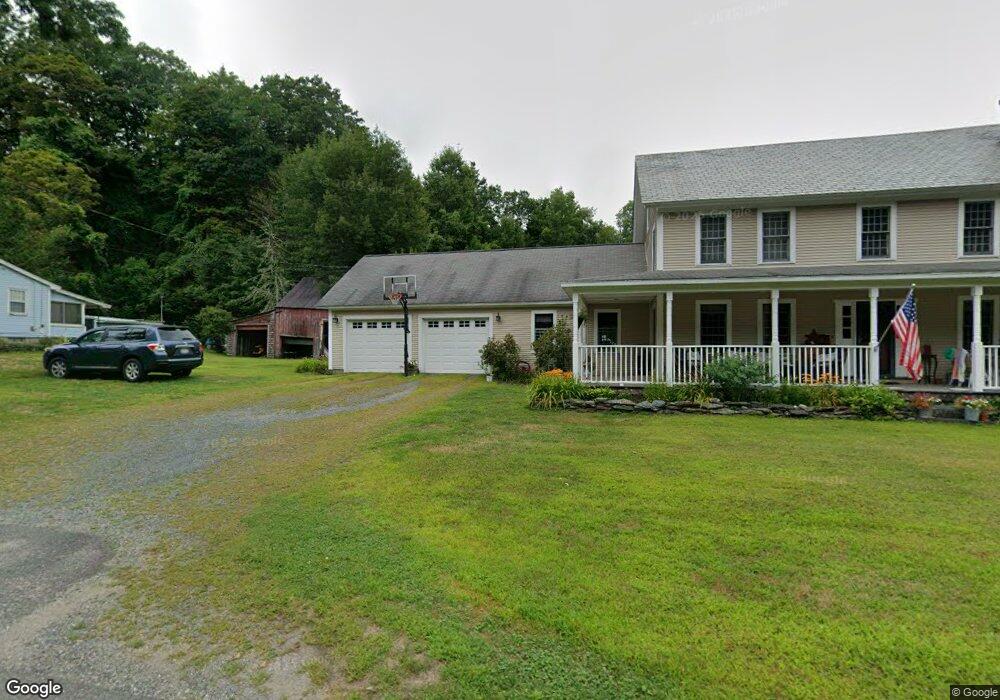
134 Clesson Brook Rd Buckland, MA 01338
Buckland NeighborhoodEstimated Value: $456,000 - $567,088
4
Beds
3
Baths
2,448
Sq Ft
$212/Sq Ft
Est. Value
About This Home
This home is located at 134 Clesson Brook Rd, Buckland, MA 01338 and is currently estimated at $518,022, approximately $211 per square foot. 134 Clesson Brook Rd is a home with nearby schools including Mohawk Trail Regional High School.
Ownership History
Date
Name
Owned For
Owner Type
Purchase Details
Closed on
Aug 12, 1998
Sold by
Fhln
Bought by
Guyette Pamela M
Current Estimated Value
Purchase Details
Closed on
Jun 19, 1998
Sold by
Moody Remedois M and Chitteden Trust Co
Bought by
Chitteden Trust Co and Mtg Svc Cntr New Engl
Create a Home Valuation Report for This Property
The Home Valuation Report is an in-depth analysis detailing your home's value as well as a comparison with similar homes in the area
Home Values in the Area
Average Home Value in this Area
Purchase History
| Date | Buyer | Sale Price | Title Company |
|---|---|---|---|
| Guyette Pamela M | $36,400 | -- | |
| Chitteden Trust Co | $55,000 | -- |
Source: Public Records
Mortgage History
| Date | Status | Borrower | Loan Amount |
|---|---|---|---|
| Open | Chitteden Trust Co | $217,000 | |
| Closed | Chitteden Trust Co | $50,000 | |
| Closed | Chitteden Trust Co | $111,630 |
Source: Public Records
Tax History Compared to Growth
Tax History
| Year | Tax Paid | Tax Assessment Tax Assessment Total Assessment is a certain percentage of the fair market value that is determined by local assessors to be the total taxable value of land and additions on the property. | Land | Improvement |
|---|---|---|---|---|
| 2025 | $7,704 | $454,800 | $50,500 | $404,300 |
| 2024 | $7,507 | $427,500 | $50,500 | $377,000 |
| 2023 | $6,556 | $387,000 | $50,500 | $336,500 |
| 2022 | $6,494 | $387,000 | $50,500 | $336,500 |
| 2021 | $6,201 | $347,600 | $50,500 | $297,100 |
| 2020 | $6,043 | $326,300 | $50,500 | $275,800 |
| 2019 | $5,718 | $306,900 | $50,500 | $256,400 |
| 2018 | $5,553 | $294,600 | $50,500 | $244,100 |
| 2017 | $5,318 | $294,600 | $50,500 | $244,100 |
| 2016 | $5,051 | $298,900 | $50,500 | $248,400 |
| 2015 | $5,022 | $298,900 | $50,500 | $248,400 |
Source: Public Records
Map
Nearby Homes
- 0 Ashfield Rd
- 0 Upper St
- Lot 3.2 East Rd
- 0, Lot 7 East Rd
- 143 Charlemont Rd
- 292 E Hawley Rd
- 153 E Hawley Rd
- 4 Plainfield Rd
- 2129 Route 2
- 0 S River Rd
- 156 Ashfield Rd
- 124 E Hawley Rd
- 0 Old Stage Rd Unit 73326639
- 310 S River Rd
- 688 Bear Swamp Rd
- 174 Main St
- 220 Hawley Rd
- 1769 Route 2
- 165 Main St
- 31 W Oxbow Rd
- 136 Clesson Brook Rd
- 132 Clesson Brook Rd
- 133 Clesson Rd
- 133 Clesson Brook Rd
- 130 Clesson Brook Rd
- 4 Labelle Rd
- 6 Labelle Rd
- 124 Clesson Brook Rd
- 122 Clesson Brook Rd
- 0 Clesson Brook Rd Unit 30401379
- 143 Clesson Brook Rd
- 13 Dodge Rd
- 119 Clesson Brook Rd
- 119 Clesson Brook Rd
- 15 Dodge Rd
- 117 Clesson Brook Rd
- 116 Clesson Brook Rd
- 152 Clesson Brook Rd
- 19 Dodge Rd
- 13 Forgette Rd