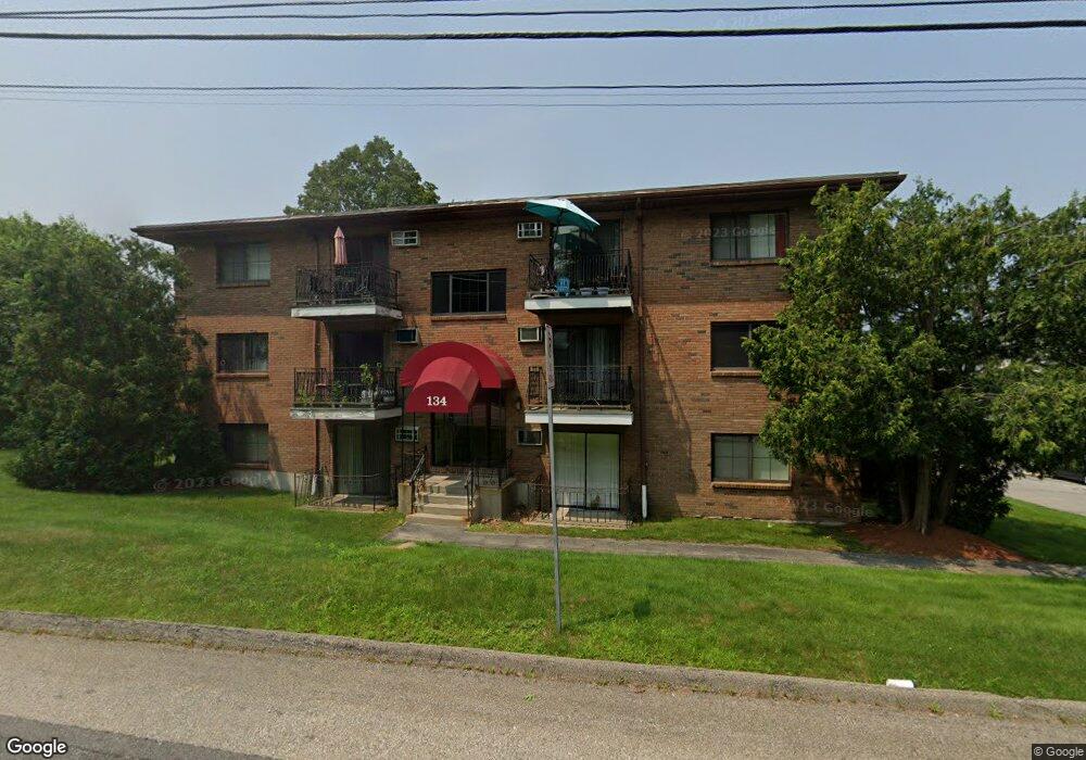
134 Mammoth Rd Unit 514 Hooksett, NH 03106
Estimated Value: $207,728 - $269,000
2
Beds
1
Bath
891
Sq Ft
$257/Sq Ft
Est. Value
About This Home
This home is located at 134 Mammoth Rd Unit 514, Hooksett, NH 03106 and is currently estimated at $229,182, approximately $257 per square foot. 134 Mammoth Rd Unit 514 is a home located in Merrimack County with nearby schools including Fred C. Underhill School, Hooksett Memorial School, and David R. Cawley Middle School.
Ownership History
Date
Name
Owned For
Owner Type
Purchase Details
Closed on
May 1, 2006
Sold by
J & L Family Lp 3
Bought by
Gontar Sergiy and Gontar Inna
Current Estimated Value
Home Financials for this Owner
Home Financials are based on the most recent Mortgage that was taken out on this home.
Original Mortgage
$79,200
Interest Rate
6.4%
Create a Home Valuation Report for This Property
The Home Valuation Report is an in-depth analysis detailing your home's value as well as a comparison with similar homes in the area
Home Values in the Area
Average Home Value in this Area
Purchase History
| Date | Buyer | Sale Price | Title Company |
|---|---|---|---|
| Gontar Sergiy | $99,000 | -- |
Source: Public Records
Mortgage History
| Date | Status | Borrower | Loan Amount |
|---|---|---|---|
| Open | Gontar Sergiy | $51,850 | |
| Closed | Gontar Sergiy | $72,000 | |
| Closed | Gontar Sergiy | $79,200 |
Source: Public Records
Tax History
| Year | Tax Paid | Tax Assessment Tax Assessment Total Assessment is a certain percentage of the fair market value that is determined by local assessors to be the total taxable value of land and additions on the property. | Land | Improvement |
|---|---|---|---|---|
| 2024 | $2,814 | $165,900 | $0 | $165,900 |
| 2023 | $2,651 | $165,900 | $0 | $165,900 |
| 2022 | $1,895 | $78,800 | $0 | $78,800 |
| 2021 | $1,751 | $78,800 | $0 | $78,800 |
| 2020 | $1,774 | $78,800 | $0 | $78,800 |
| 2019 | $1,698 | $78,800 | $0 | $78,800 |
| 2018 | $1,743 | $78,800 | $0 | $78,800 |
| 2017 | $1,436 | $53,700 | $0 | $53,700 |
| 2016 | $1,417 | $53,700 | $0 | $53,700 |
| 2015 | $1,327 | $53,700 | $0 | $53,700 |
| 2014 | $1,333 | $53,700 | $0 | $53,700 |
| 2013 | $1,261 | $53,700 | $0 | $53,700 |
Source: Public Records
Map
Nearby Homes
- 1095 1097 1099 Hooksett Rd Unit 73, 74, 75
- 1099 Hooksett Rd Unit 73
- 1097 Hooksett Rd Unit 74
- 1095 Hooksett Rd
- 9 Lancelot Dr
- 267 Londonderry Turnpike
- 286 Londonderry Turnpike Unit A
- 286B Londonderry Turnpike Unit A
- 36 Prescott Heights Rd
- 13 Johns Dr
- 192 Londonderry Turnpike
- 41 Golden Gate Dr
- 10 Dewberry Ln
- 6 Deerhead St
- 9 Berry Hill Rd
- 190 Chase Way
- 15 Joanne Dr
- 141 Chase Way
- 151 N Acres Rd
- 104 N Gate Rd
- 134 Mammoth Rd Unit 26
- 134 Mammoth Rd Unit 5
- 134 Mammoth Rd Unit 29
- 134 Mammoth Rd Unit 10
- 134 Mammoth Rd Unit 530
- 134 Mammoth Rd Unit 529
- 134 Mammoth Rd Unit 528
- 134 Mammoth Rd Unit 527
- 134 Mammoth Rd Unit 526
- 134 Mammoth Rd Unit 525
- 134 Mammoth Rd Unit 524
- 134 Mammoth Rd Unit 523
- 134 Mammoth Rd Unit 522
- 134 Mammoth Rd Unit 521
- 134 Mammoth Rd Unit 520
- 134 Mammoth Rd Unit 519
- 134 Mammoth Rd Unit 518
- 134 Mammoth Rd Unit 517
- 134 Mammoth Rd Unit 516
- 134 Mammoth Rd Unit 515
Your Personal Tour Guide
Ask me questions while you tour the home.