Estimated Value: $822,400 - $929,000
3
Beds
2
Baths
1,139
Sq Ft
$773/Sq Ft
Est. Value
About This Home
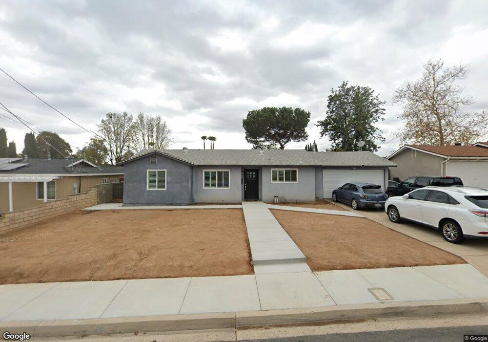
This home is located at 13402 Neddick Ave, Poway, CA 92064 and is currently estimated at $880,350, approximately $772 per square foot. 13402 Neddick Ave is a home located in San Diego County with nearby schools including Garden Road Elementary, Twin Peaks Middle, and Poway High.
Ownership History
Date
Name
Owned For
Owner Type
Purchase Details
Closed on
Oct 24, 2008
Sold by
Gilley John H
Bought by
Morales Paulo and Morales Silvia
Current Estimated Value
Home Financials for this Owner
Home Financials are based on the most recent Mortgage that was taken out on this home.
Original Mortgage
$329,110
Outstanding Balance
$213,205
Interest Rate
5.9%
Mortgage Type
FHA
Estimated Equity
$667,145
Purchase Details
Closed on
Nov 6, 1987
Purchase Details
Closed on
Mar 13, 1987
Create a Home Valuation Report for This Property
The Home Valuation Report is an in-depth analysis detailing your home's value as well as a comparison with similar homes in the area
Home Values in the Area
Average Home Value in this Area
Purchase History
| Date | Buyer | Sale Price | Title Company |
|---|---|---|---|
| Morales Paulo | $334,000 | Stewart Title Of California | |
| -- | $108,500 | -- | |
| -- | $96,500 | -- |
Source: Public Records
Mortgage History
| Date | Status | Borrower | Loan Amount |
|---|---|---|---|
| Open | Morales Paulo | $329,110 |
Source: Public Records
Tax History
| Year | Tax Paid | Tax Assessment Tax Assessment Total Assessment is a certain percentage of the fair market value that is determined by local assessors to be the total taxable value of land and additions on the property. | Land | Improvement |
|---|---|---|---|---|
| 2025 | $4,737 | $430,092 | $283,297 | $146,795 |
| 2024 | $4,737 | $421,660 | $277,743 | $143,917 |
| 2023 | $4,636 | $413,394 | $272,298 | $141,096 |
| 2022 | $4,558 | $405,289 | $266,959 | $138,330 |
| 2021 | $4,498 | $397,343 | $261,725 | $135,618 |
| 2020 | $4,437 | $393,270 | $259,042 | $134,228 |
| 2019 | $4,322 | $385,560 | $253,963 | $131,597 |
| 2018 | $4,200 | $378,001 | $248,984 | $129,017 |
| 2017 | $4,088 | $370,590 | $244,102 | $126,488 |
| 2016 | $4,003 | $363,324 | $239,316 | $124,008 |
| 2015 | $3,944 | $357,868 | $235,722 | $122,146 |
| 2014 | $3,851 | $350,859 | $231,105 | $119,754 |
Source: Public Records
Map
Nearby Homes
- 13419 Sebago Ave
- 14550 Dehia St
- 14610 Fairburn St
- 14118 Ipava Dr
- 13735 Fairgate Dr
- 000 Carlson Ct 9 Unit 9
- 13746 Paseo Bonita
- 14003 Jasmine Ave Unit 193
- 14089 Pomegranate Ave Unit 214
- 13908 Hibiscus Ave Unit 40
- 13941 Wisteria Ave
- 13716 Midland Rd
- 13947 Midland Rd
- 13850 Midgrove Ct
- 0 Indian Springs Rd Unit NDP2602071
- 13619 Sycamore Tree Ln
- 13329 Casa Vista St Unit 98
- 12959 Creek Park Dr
- 13972 Poway Valley Rd
- 13220 Dana Vista St Unit 114
- 13408 Neddick Ave
- 13356 Neddick Ave
- 13401 Montego Dr
- 13414 Neddick Ave
- 13407 Montego Dr
- 13350 Neddick Ave
- 13355 Montego Dr
- 14404 Springvale St
- 13413 Montego Dr
- 13349 Montego Dr
- 13409 Neddick Ave
- 13351 Neddick Ave
- 13420 Neddick Ave
- 13419 Montego Dr
- 13343 Montego Dr
- 13415 Neddick Ave
- 13320 Neddick Ave
- 14411 Springvale St
- 14416 Springvale St
- 13425 Montego Dr
Your Personal Tour Guide
Ask me questions while you tour the home.