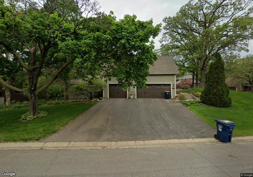
13415 Gunflint Ct Saint Paul, MN 55124
Alimagnet NeighborhoodEstimated Value: $577,548 - $613,000
5
Beds
4
Baths
2,144
Sq Ft
$280/Sq Ft
Est. Value
About This Home
This home is located at 13415 Gunflint Ct, Saint Paul, MN 55124 and is currently estimated at $599,637, approximately $279 per square foot. 13415 Gunflint Ct is a home located in Dakota County with nearby schools including Westview Elementary School, Falcon Ridge Middle School, and Apple Valley Senior High School.
Ownership History
Date
Name
Owned For
Owner Type
Purchase Details
Closed on
Mar 24, 2011
Sold by
Lynch Brian Joseph
Bought by
Larson Nicole Lynn and Lynch Nicole Lynn
Current Estimated Value
Purchase Details
Closed on
Mar 31, 2006
Sold by
Silberg Thomas F and Silberg Catherine I Klima
Bought by
Larson Nicole L and Lynch Brian J
Create a Home Valuation Report for This Property
The Home Valuation Report is an in-depth analysis detailing your home's value as well as a comparison with similar homes in the area
Home Values in the Area
Average Home Value in this Area
Purchase History
| Date | Buyer | Sale Price | Title Company |
|---|---|---|---|
| Larson Nicole Lynn | -- | None Available | |
| Larson Nicole L | $420,000 | -- |
Source: Public Records
Tax History Compared to Growth
Tax History
| Year | Tax Paid | Tax Assessment Tax Assessment Total Assessment is a certain percentage of the fair market value that is determined by local assessors to be the total taxable value of land and additions on the property. | Land | Improvement |
|---|---|---|---|---|
| 2024 | $6,512 | $551,600 | $165,800 | $385,800 |
| 2023 | $5,916 | $562,600 | $166,200 | $396,400 |
| 2022 | $5,408 | $547,700 | $165,600 | $382,100 |
| 2021 | $5,318 | $464,500 | $144,000 | $320,500 |
| 2020 | $5,352 | $446,500 | $137,200 | $309,300 |
| 2019 | $4,711 | $435,700 | $130,600 | $305,100 |
| 2018 | $4,492 | $401,100 | $124,400 | $276,700 |
| 2017 | $4,642 | $367,700 | $118,500 | $249,200 |
| 2016 | $4,836 | $360,600 | $112,800 | $247,800 |
| 2015 | $4,558 | $366,387 | $109,431 | $256,956 |
| 2014 | -- | $347,530 | $104,948 | $242,582 |
| 2013 | -- | $311,015 | $95,981 | $215,034 |
Source: Public Records
Map
Nearby Homes
- 13420 Gull Ct
- 7577 138th St W
- 13715 Grafton Ct
- 13101 Heritage Way
- 13413 Georgia Cir
- 13199 Gemstone Ct
- 13345 Huntington Cir
- 14010 140th Ct
- 13868 Glendale Ct
- 13720 Georgia Dr
- 14080 Guthrie Ave
- 12867 Pennock Ave
- 13306 Huntington Cir
- 13761 Hollybrook Cir
- 13751 Hollybrook Cir
- 14132 Heywood Path
- 7291 Upper 136th St W
- 110 Pony Ln E
- 13731 Hollybrook Cir
- 13727 Hollybrook Cir
- 13425 Gunflint Ct
- 7980 134th St W
- 7955 134th St W
- 13420 Gunflint Ct
- 7975 7975 134th-Street-w
- 7900 134th St W
- 7975 134th St W
- 13435 Gunflint Ct
- 13430 Gunflint Ct
- 7995 134th St W
- 13390 Gunflint Path
- 13440 Gunflint Ct
- 13445 Gunflint Ct
- 13425 Gull Ct
- 7970 133rd St W
- 13415 Gull Ct
- 7950 133rd St W
- 8025 134th St W
- 7895 134th St W
- 7990 133rd St W