Estimated Value: $617,898 - $692,000
3
Beds
2
Baths
1,104
Sq Ft
$587/Sq Ft
Est. Value
About This Home
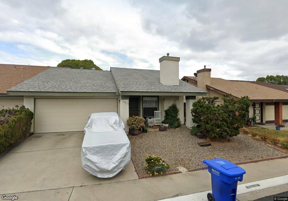
This home is located at 13415 Sutter Mill Rd, Poway, CA 92064 and is currently estimated at $648,225, approximately $587 per square foot. 13415 Sutter Mill Rd is a home located in San Diego County with nearby schools including Garden Road Elementary, Twin Peaks Middle, and Poway High.
Ownership History
Date
Name
Owned For
Owner Type
Purchase Details
Closed on
Aug 16, 1999
Sold by
Newman 1996 Revocable Family Trust
Bought by
Rebold Susan A
Current Estimated Value
Home Financials for this Owner
Home Financials are based on the most recent Mortgage that was taken out on this home.
Original Mortgage
$110,000
Interest Rate
7.97%
Mortgage Type
Purchase Money Mortgage
Purchase Details
Closed on
Jul 3, 1996
Sold by
Newman Roger L and Newman Denise
Bought by
Newman Roger L and Newman Denise D
Purchase Details
Closed on
Aug 8, 1986
Create a Home Valuation Report for This Property
The Home Valuation Report is an in-depth analysis detailing your home's value as well as a comparison with similar homes in the area
Home Values in the Area
Average Home Value in this Area
Purchase History
| Date | Buyer | Sale Price | Title Company |
|---|---|---|---|
| Rebold Susan A | $168,000 | First American Title | |
| Newman Roger L | -- | -- | |
| -- | $87,900 | -- |
Source: Public Records
Mortgage History
| Date | Status | Borrower | Loan Amount |
|---|---|---|---|
| Closed | Rebold Susan A | $110,000 |
Source: Public Records
Tax History Compared to Growth
Tax History
| Year | Tax Paid | Tax Assessment Tax Assessment Total Assessment is a certain percentage of the fair market value that is determined by local assessors to be the total taxable value of land and additions on the property. | Land | Improvement |
|---|---|---|---|---|
| 2025 | $2,856 | $258,187 | $80,669 | $177,518 |
| 2024 | $2,856 | $253,126 | $79,088 | $174,038 |
| 2023 | $2,795 | $248,164 | $77,538 | $170,626 |
| 2022 | $2,748 | $243,299 | $76,018 | $167,281 |
| 2021 | $2,712 | $238,529 | $74,528 | $164,001 |
| 2020 | $2,675 | $236,084 | $73,764 | $162,320 |
| 2019 | $2,606 | $231,456 | $72,318 | $159,138 |
| 2018 | $2,533 | $226,918 | $70,900 | $156,018 |
| 2017 | $2,466 | $222,469 | $69,510 | $152,959 |
| 2016 | $2,415 | $218,108 | $68,148 | $149,960 |
| 2015 | $2,379 | $214,833 | $67,125 | $147,708 |
| 2014 | $2,324 | $210,626 | $65,811 | $144,815 |
Source: Public Records
Map
Nearby Homes
- 13409 Sutter Mill Rd
- 14513 Mirando St
- 13255 Evanston Dr
- 14550 Dehia St
- 13230 Johannesberg Way Unit 10
- 13435 Frey Ct
- 14036 Tierra Bonita Rd
- 13648 Putney Rd
- 13654 Somerset Rd
- 13941 Wisteria Ave Unit 53
- 13725 Adrian St
- 14082 Pomegranate Ave Unit 146
- 13403 Little Dawn Ln
- 13544 Comuna Dr
- 14153 Ezra Ln
- 13329 Casa Vista St Unit 98
- 13308 Alpine Dr
- 13325 Alpine Dr Unit 11
- 13056 Poway Rd
- 13104 Corona Way Unit 324
- 14213 Eagle Mine Dr
- 14216 Sutter Mill Way
- 14220 Eagle Mine Dr
- 13340 Sutter Mill Rd
- 13420 Sutter Mill Rd
- 13418 Sutter Mill Rd
- 14210 Lost Dutchman Dr
- 14208 Lost Dutchman Dr
- 14209 Lost Dutchman Dr
- 13354 Sutter Mill Rd Unit 38
- 14226 Eagle Mine Dr
- 14218 Eagle Mine Dr
- 14214 Eagle Mine Dr
- 14207 Eagle Mine Dr Unit 30
- 14215 Eagle Mine Dr
- 14219 Eagle Mine Dr
- 13342 Sutter Mill Rd
- 13341 Sutter Mill Rd
- 13345 Sutter Mill Rd Unit 20
- 13347 Sutter Mill Rd Unit 19