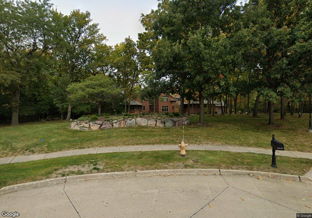
13415 Wilden Cir Urbandale, IA 50323
Estimated Value: $766,000 - $2,083,000
6
Beds
4
Baths
4,387
Sq Ft
$335/Sq Ft
Est. Value
About This Home
This home is located at 13415 Wilden Cir, Urbandale, IA 50323 and is currently estimated at $1,470,508, approximately $335 per square foot. 13415 Wilden Cir is a home located in Polk County with nearby schools including Webster Elementary School, Urbandale Middle School, and Urbandale High School.
Ownership History
Date
Name
Owned For
Owner Type
Purchase Details
Closed on
Jul 25, 2011
Sold by
Thurness Brent R and Thurness Shelly K
Bought by
Martin Brian and Martin Lori
Current Estimated Value
Home Financials for this Owner
Home Financials are based on the most recent Mortgage that was taken out on this home.
Original Mortgage
$950,000
Outstanding Balance
$683,249
Interest Rate
5.5%
Mortgage Type
Adjustable Rate Mortgage/ARM
Estimated Equity
$787,259
Purchase Details
Closed on
Nov 2, 2001
Sold by
Antier Point Llc
Bought by
Corner Post Corp Llc
Home Financials for this Owner
Home Financials are based on the most recent Mortgage that was taken out on this home.
Original Mortgage
$393,317
Interest Rate
6.8%
Create a Home Valuation Report for This Property
The Home Valuation Report is an in-depth analysis detailing your home's value as well as a comparison with similar homes in the area
Home Values in the Area
Average Home Value in this Area
Purchase History
| Date | Buyer | Sale Price | Title Company |
|---|---|---|---|
| Martin Brian | $1,199,500 | Itc | |
| Corner Post Corp Llc | $249,500 | -- |
Source: Public Records
Mortgage History
| Date | Status | Borrower | Loan Amount |
|---|---|---|---|
| Open | Martin Brian | $950,000 | |
| Previous Owner | Corner Post Corp Llc | $393,317 |
Source: Public Records
Tax History Compared to Growth
Tax History
| Year | Tax Paid | Tax Assessment Tax Assessment Total Assessment is a certain percentage of the fair market value that is determined by local assessors to be the total taxable value of land and additions on the property. | Land | Improvement |
|---|---|---|---|---|
| 2025 | $29,592 | $1,858,400 | $423,700 | $1,434,700 |
| 2024 | $29,592 | $1,633,820 | $328,320 | $1,305,500 |
| 2023 | $27,696 | $1,681,600 | $376,100 | $1,305,500 |
| 2022 | $27,378 | $1,329,900 | $307,700 | $1,022,200 |
| 2021 | $29,562 | $1,329,900 | $307,700 | $1,022,200 |
| 2020 | $29,066 | $1,363,100 | $314,600 | $1,048,500 |
| 2019 | $29,820 | $1,363,100 | $314,600 | $1,048,500 |
| 2018 | $28,774 | $1,314,800 | $298,300 | $1,016,500 |
| 2017 | $24,294 | $1,314,800 | $298,300 | $1,016,500 |
| 2016 | $23,724 | $1,090,000 | $254,200 | $835,800 |
| 2015 | $23,724 | $1,090,000 | $254,200 | $835,800 |
| 2014 | $22,054 | $1,042,300 | $239,900 | $802,400 |
Source: Public Records
Map
Nearby Homes
- 14136 Wilden Dr
- 14134 Wilden Dr
- 14130 Wilden Dr
- 12926 Timberline Dr
- 13282 Oak Brook Dr
- 12993 Oak Brook Dr
- 4111 140th St
- 14111 Oak Brook Dr
- 13425 Ridgeview Dr
- 12723 Sunflower Dr
- 4016 127th St
- 13208 Rocklyn Dr
- 13504 Sheridan Ave
- 12527 Airline Ave
- 12515 Airline Ave
- 12510 Prairie Dr
- 4622 173rd St
- 4616 173rd St
- 4647 173rd St
- 3943 NW 181st St
- 13403 Wilden Cir
- 13410 Wilden Cir
- 13402 Wilden Cir
- 13409 Douglas Pkwy
- 13415 Douglas Pkwy
- 3723 134th St
- 13421 Douglas Pkwy
- 3712 134th St
- 3717 134th St
- 13403 Douglas Pkwy
- 13321 Douglas Pkwy
- 3711 134th St
- 3714 133rd St
- 3720 133rd St
- 13315 Douglas Pkwy
- 3702 134th St
- 3708 133rd St
- 3705 134th St
- 14167 Wilden Dr
- 14165 Wilden Dr