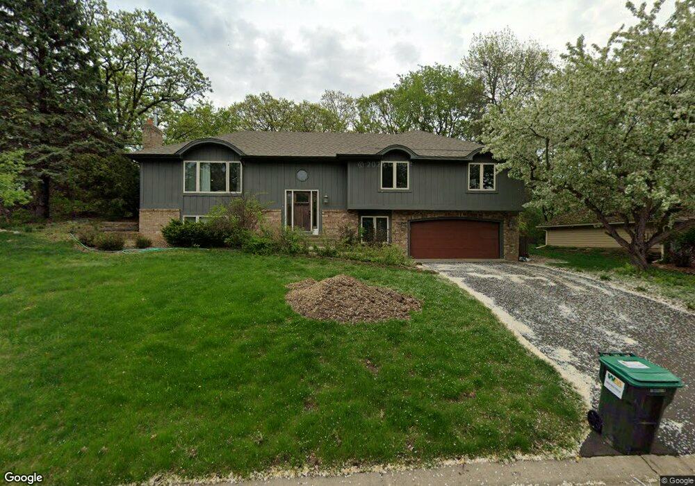
13420 Gunflint Ct Saint Paul, MN 55124
Alimagnet NeighborhoodEstimated Value: $495,000 - $545,000
4
Beds
3
Baths
2,856
Sq Ft
$182/Sq Ft
Est. Value
About This Home
This home is located at 13420 Gunflint Ct, Saint Paul, MN 55124 and is currently estimated at $518,854, approximately $181 per square foot. 13420 Gunflint Ct is a home located in Dakota County with nearby schools including Westview Elementary School, Falcon Ridge Middle School, and Apple Valley Senior High School.
Ownership History
Date
Name
Owned For
Owner Type
Purchase Details
Closed on
Apr 7, 2021
Sold by
Eilers April D and Eilers William S
Bought by
Harrold Julie Anne and Peck Theodore Tuttle
Current Estimated Value
Home Financials for this Owner
Home Financials are based on the most recent Mortgage that was taken out on this home.
Original Mortgage
$345,000
Outstanding Balance
$311,493
Interest Rate
3%
Mortgage Type
New Conventional
Estimated Equity
$207,361
Purchase Details
Closed on
Jun 15, 2007
Sold by
Kelly Laurel Ann
Bought by
Eilers William S and Eilers April D
Purchase Details
Closed on
Jun 5, 1996
Sold by
Brock Gene N and Brock Vera L
Bought by
Kelly Michael D and Kelly Laurel A
Create a Home Valuation Report for This Property
The Home Valuation Report is an in-depth analysis detailing your home's value as well as a comparison with similar homes in the area
Home Values in the Area
Average Home Value in this Area
Purchase History
| Date | Buyer | Sale Price | Title Company |
|---|---|---|---|
| Harrold Julie Anne | $460,000 | On Site Title | |
| Eilers William S | $319,900 | -- | |
| Kelly Michael D | $171,000 | -- | |
| Harrold Julie Julie | $460,000 | -- |
Source: Public Records
Mortgage History
| Date | Status | Borrower | Loan Amount |
|---|---|---|---|
| Open | Harrold Julie Anne | $345,000 | |
| Closed | Harrold Julie Julie | $345,000 |
Source: Public Records
Tax History Compared to Growth
Tax History
| Year | Tax Paid | Tax Assessment Tax Assessment Total Assessment is a certain percentage of the fair market value that is determined by local assessors to be the total taxable value of land and additions on the property. | Land | Improvement |
|---|---|---|---|---|
| 2024 | $5,232 | $449,100 | $165,800 | $283,300 |
| 2023 | $5,232 | $461,000 | $166,200 | $294,800 |
| 2022 | $4,432 | $451,800 | $165,600 | $286,200 |
| 2021 | $4,336 | $382,600 | $144,000 | $238,600 |
| 2020 | $4,342 | $367,100 | $137,200 | $229,900 |
| 2019 | $4,173 | $357,100 | $130,600 | $226,500 |
| 2018 | $3,855 | $358,300 | $124,400 | $233,900 |
| 2017 | $3,967 | $319,400 | $118,500 | $200,900 |
| 2016 | $3,972 | $312,100 | $112,800 | $199,300 |
| 2015 | $3,673 | $299,570 | $107,225 | $192,345 |
| 2014 | -- | $278,642 | $102,496 | $176,146 |
| 2013 | -- | $249,539 | $93,518 | $156,021 |
Source: Public Records
Map
Nearby Homes
- 13420 Gull Ct
- 7577 138th St W
- 13715 Grafton Ct
- 13413 Georgia Cir
- 14010 140th Ct
- 13199 Gemstone Ct
- 13868 Glendale Ct
- 13101 Heritage Way
- 13720 Georgia Dr
- 14080 Guthrie Ave
- 13345 Huntington Cir
- 12867 Pennock Ave
- 7291 Upper 136th St W
- 13306 Huntington Cir
- 13761 Hollybrook Cir
- 14132 Heywood Path
- 13751 Hollybrook Cir
- 7342 Upper 139th St W
- 13731 Hollybrook Cir
- 13727 Hollybrook Cir
- 7900 134th St W
- 13430 Gunflint Ct
- 13425 Gull Ct
- 13415 Gull Ct
- 13435 Gull Ct
- 13415 Gunflint Ct
- 13440 Gunflint Ct
- 13425 Gunflint Ct
- 13390 Gunflint Path
- 7943 Guild Ct
- 7955 134th St W
- 7895 134th St W
- 13435 Gunflint Ct
- 13445 Gunflint Ct
- 7980 134th St W
- 13430 Gull Ct
- 13410 Gull Ct
- 7923 Guild Ct
- 7975 7975 134th-Street-w
- 7975 134th St W