S
Seller's Agent in 2026
Shannon Burton
Platinum Partners Real Estate
(707) 462-1600
10 Total Sales
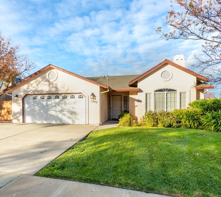
Welcome Home!
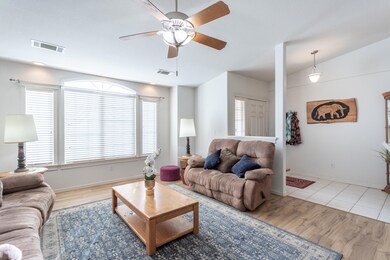
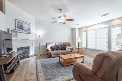
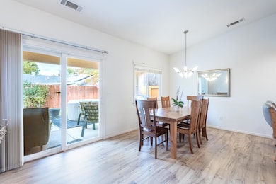
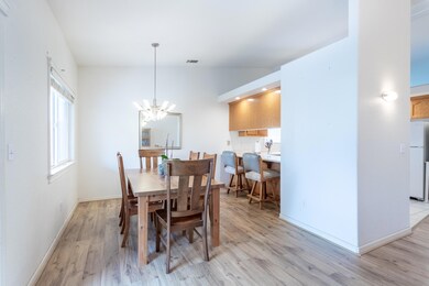
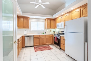
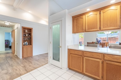
This beautifully refreshed residence blends thoughtful updates with timeless charm. New laminate flooring flows throughout, creating a bright, cohesive feel. The spacious formal dining room invites family gatherings, while the open kitchen with its new gas range, pantry, and breakfast counter is perfect for cooking together or hosting friends. Step outside to your own private retreat featuring a peaceful patio, mature rose bushes, and a garden area ready for your green thumb. The finished garage offers built-in shelving, cabinets, and a workbench for projects or storage, and a 10x12 Tuff Shed adds even more room for your hobbies. RV and boat parking complete the package. Located in a walkable neighborhood within the Red Bluff Elementary School District, this home combines comfort, convenience, and lasting charm, all ready for you to move right in.
Last Agent to Sell the Property
Platinum Partners Real Estate License #02211512 Listed on: 11/18/2025

Last Buyer's Agent
Platinum Partners Real Estate License #02211512 Listed on: 11/18/2025
| Date | Type | Sale Price | Title Company |
|---|---|---|---|
| Grant Deed | $350,000 | Chicago Title | |
| Deed | -- | None Listed On Document | |
| Grant Deed | $199,000 | Alliance Title Co |
| Date | Status | Loan Amount | Loan Type |
|---|---|---|---|
| Previous Owner | $60,000 | Purchase Money Mortgage |
| Date | Event | Price | List to Sale | Price per Sq Ft |
|---|---|---|---|---|
| 01/07/2026 01/07/26 | Sold | $350,000 | -4.1% | $213 / Sq Ft |
| 12/08/2025 12/08/25 | Pending | -- | -- | -- |
| 11/18/2025 11/18/25 | For Sale | $365,000 | -- | $222 / Sq Ft |
| Year | Tax Paid | Tax Assessment Tax Assessment Total Assessment is a certain percentage of the fair market value that is determined by local assessors to be the total taxable value of land and additions on the property. | Land | Improvement |
|---|---|---|---|---|
| 2025 | $2,802 | $282,929 | $63,975 | $218,954 |
| 2023 | $2,753 | $271,944 | $61,492 | $210,452 |
| 2022 | $2,734 | $266,613 | $60,287 | $206,326 |
| 2021 | $2,622 | $261,386 | $59,105 | $202,281 |
| 2020 | $2,409 | $233,546 | $52,811 | $180,735 |
| 2019 | $2,352 | $222,425 | $50,296 | $172,129 |
| 2018 | $2,010 | $202,205 | $45,724 | $156,481 |
| 2017 | $1,875 | $183,822 | $41,567 | $142,255 |
| 2016 | $1,698 | $175,069 | $39,588 | $135,481 |
| 2015 | -- | $175,069 | $39,588 | $135,481 |
| 2014 | $1,475 | $152,235 | $34,425 | $117,810 |
S
Seller's Agent in 2026
Shannon Burton
Platinum Partners Real Estate
(707) 462-1600
10 Total Sales
Source: Shasta Association of REALTORS®
MLS Number: 25-5038
APN: 031-290-067-000
Disclaimer: Certain information contained herein is derived from information provided by parties other than Homes.com. All information provided is deemed reliable, but is not guaranteed to be accurate and should be independently verified.
![]() IDX information is provided exclusively for personal, non-commercial use, and may not be used for any purpose other than to identify prospective properties consumers may be interested in purchasing. Information is deemed reliable but not guaranteed.
IDX information is provided exclusively for personal, non-commercial use, and may not be used for any purpose other than to identify prospective properties consumers may be interested in purchasing. Information is deemed reliable but not guaranteed.
Ask me questions while you tour the home.