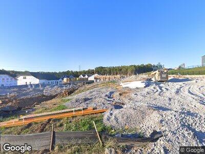
1346 Harmony Hill Ln Mt. Juliet, TN 37122
Estimated Value: $507,000 - $519,000
2
Beds
2
Baths
2,180
Sq Ft
$236/Sq Ft
Est. Value
About This Home
This home is located at 1346 Harmony Hill Ln, Mt. Juliet, TN 37122 and is currently estimated at $515,414, approximately $236 per square foot. 1346 Harmony Hill Ln is a home located in Wilson County with nearby schools including Stoner Creek Elementary School, West Wilson Middle School, and Mt. Juliet High School.
Ownership History
Date
Name
Owned For
Owner Type
Purchase Details
Closed on
Feb 19, 2025
Sold by
Beazer Homes Llc
Bought by
Rockstead Rachel and Carson Christopher
Current Estimated Value
Home Financials for this Owner
Home Financials are based on the most recent Mortgage that was taken out on this home.
Original Mortgage
$259,850
Outstanding Balance
$259,198
Interest Rate
6.93%
Mortgage Type
New Conventional
Estimated Equity
$256,216
Purchase Details
Closed on
Feb 18, 2025
Sold by
Beazer Homes Llc
Bought by
Beauchamp Kenneth Wayne and Beauchamp Hilda Hunt
Home Financials for this Owner
Home Financials are based on the most recent Mortgage that was taken out on this home.
Original Mortgage
$259,850
Outstanding Balance
$259,198
Interest Rate
6.93%
Mortgage Type
New Conventional
Estimated Equity
$256,216
Create a Home Valuation Report for This Property
The Home Valuation Report is an in-depth analysis detailing your home's value as well as a comparison with similar homes in the area
Home Values in the Area
Average Home Value in this Area
Purchase History
| Date | Buyer | Sale Price | Title Company |
|---|---|---|---|
| Rockstead Rachel | $510,285 | None Listed On Document | |
| Rockstead Rachel | $510,285 | None Listed On Document | |
| Beauchamp Kenneth Wayne | $515,850 | None Listed On Document | |
| Beauchamp Kenneth Wayne | $515,850 | None Listed On Document |
Source: Public Records
Mortgage History
| Date | Status | Borrower | Loan Amount |
|---|---|---|---|
| Open | Beauchamp Kenneth Wayne | $259,850 | |
| Closed | Beauchamp Kenneth Wayne | $259,850 |
Source: Public Records
Tax History Compared to Growth
Tax History
| Year | Tax Paid | Tax Assessment Tax Assessment Total Assessment is a certain percentage of the fair market value that is determined by local assessors to be the total taxable value of land and additions on the property. | Land | Improvement |
|---|---|---|---|---|
| 2024 | $317 | $16,625 | $16,250 | $375 |
Source: Public Records
Map
Nearby Homes
- 1350 Harmony Hill Ln
- 950 Pleasant Ridge
- 105 Brookcliff Dr
- 107 Brookcliff Dr
- 949 Pleasant Ridge Run
- 947 Pleasant Ridge Run
- 945 Pleasant Ridge Run
- 952 Pleasant Ridge Run
- 954 Pleasant Ridge Run
- 129 Willow Bend Dr
- 1080 Laurel Valley Ln
- 1123 Aster Place
- 1127 Aster Place
- 1126 Aster Place
- 1129 Aster Place
- 1406 Autumn Leaf Ln
- 452 Mabels Way
- 450 Mabels Way
- 434 Mabels Way
- 120 Bluegrass Pkwy
- 1346 Harmony Hill Ln
- 1327 Harmony Hill Ln
- 1333 Harmony Hill Ln
- 1972 Harmony Hill Ln
- 2321 Harmony Hill Ln
- 2525 Harmony Hill Ln
- 2899 Harmony Hill Ln
- 1359 Harmony Hill Ln
- 1322 Harmony Hill Ln
- 493 Mabels Way
- 926 Pleasant Ridge Run
- 928 Pleasant Ridge Run
- 933 Pleasant Ridge Run
- 1209 Shady Pine Dr
- 934 Pleasant Ridge Run
- 140 Willow Bend Dr
- 144 Willow Bend Dr
- 484 Mabels Way
- 146 Willow Bend Dr
- 0 Willow Bend Dr Unit RTC2394249
