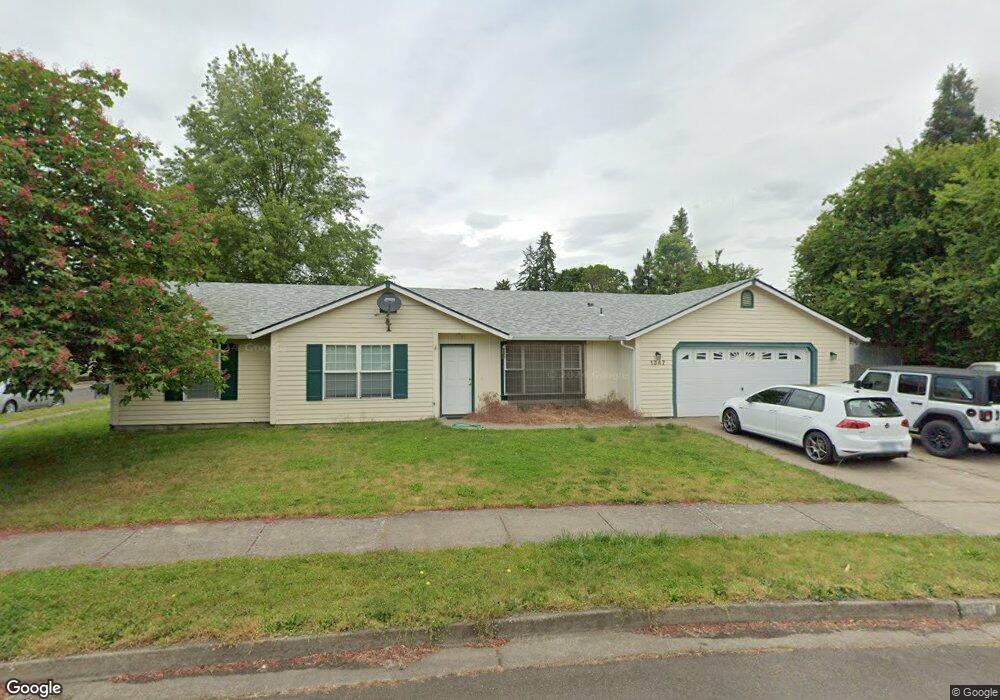
1347 David Ave Eugene, OR 97404
River Road NeighborhoodEstimated Value: $396,000 - $419,000
3
Beds
2
Baths
1,252
Sq Ft
$328/Sq Ft
Est. Value
About This Home
This home is located at 1347 David Ave, Eugene, OR 97404 and is currently estimated at $410,038, approximately $327 per square foot. 1347 David Ave is a home located in Lane County with nearby schools including Irving Elementary School, Shasta Middle School, and Willamette High School.
Ownership History
Date
Name
Owned For
Owner Type
Purchase Details
Closed on
Nov 15, 2000
Sold by
Ward Anna Lorraine
Bought by
Ward Bruce Nordahl
Current Estimated Value
Purchase Details
Closed on
Nov 13, 1998
Sold by
Masada Development Inc
Bought by
Ward Bruce N and Ward Daniel J
Home Financials for this Owner
Home Financials are based on the most recent Mortgage that was taken out on this home.
Original Mortgage
$94,425
Outstanding Balance
$20,033
Interest Rate
6.54%
Estimated Equity
$390,005
Purchase Details
Closed on
Nov 6, 1998
Sold by
Masada Development Inc
Bought by
Newell Carrie
Home Financials for this Owner
Home Financials are based on the most recent Mortgage that was taken out on this home.
Original Mortgage
$94,425
Outstanding Balance
$20,033
Interest Rate
6.54%
Estimated Equity
$390,005
Purchase Details
Closed on
Mar 2, 1998
Sold by
Wilson Carl L and Wilson Celia C
Bought by
Wilson Margaret L and Margaret L Wilson Living Trust
Create a Home Valuation Report for This Property
The Home Valuation Report is an in-depth analysis detailing your home's value as well as a comparison with similar homes in the area
Home Values in the Area
Average Home Value in this Area
Purchase History
| Date | Buyer | Sale Price | Title Company |
|---|---|---|---|
| Ward Bruce Nordahl | -- | Western Title & Escrow Compa | |
| Ward Bruce N | $125,900 | Oregon Title Insurance Co | |
| Newell Carrie | -- | -- | |
| Wilson Margaret L | -- | Western Pioneer Title Co |
Source: Public Records
Mortgage History
| Date | Status | Borrower | Loan Amount |
|---|---|---|---|
| Open | Ward Bruce N | $94,425 |
Source: Public Records
Tax History
| Year | Tax Paid | Tax Assessment Tax Assessment Total Assessment is a certain percentage of the fair market value that is determined by local assessors to be the total taxable value of land and additions on the property. | Land | Improvement |
|---|---|---|---|---|
| 2025 | $3,844 | $221,008 | -- | -- |
| 2024 | $3,747 | $214,571 | -- | -- |
| 2023 | $3,747 | $208,322 | $0 | $0 |
| 2022 | $3,488 | $202,255 | $0 | $0 |
| 2021 | $3,415 | $196,365 | $0 | $0 |
| 2020 | $3,315 | $190,646 | $0 | $0 |
| 2019 | $3,152 | $185,094 | $0 | $0 |
| 2018 | $3,064 | $174,469 | $0 | $0 |
| 2017 | $2,928 | $174,469 | $0 | $0 |
| 2016 | $2,854 | $169,387 | $0 | $0 |
| 2015 | $2,797 | $164,453 | $0 | $0 |
| 2014 | $2,755 | $159,663 | $0 | $0 |
Source: Public Records
Map
Nearby Homes
- 1307 Bramblewood Ln
- 2488 Northampton
- 1755 Brentwood Ave
- 0 Pacific Hwy W
- 1682 Hemlock St
- 805 Impala Ave
- 541 Durham Ave
- 2563 York St
- 1566 Maywood Ave
- 3906 Century Dr
- 2580 Crowther Dr
- 2610 Crowther Dr
- 1215 Irving Rd
- 3717 Riviera
- 3886 Aerial Way
- 2721 La Darrah St
- 333 Lenore Loop
- 2931 Shelby Way
- 303 Lenore Loop
- 401 Sterling Dr
- 1937 Anthony Way
- 560 Bushnell Ln
- 1959 Anthony Way
- 1346 David Ave
- 1350 David St
- 1930 Anthony Way
- 1350 David Ave
- 1337 David St
- 1983 Anthony Way
- 1944 Anthony Way
- 1920 Debra Sue Ct
- 1361 David Ave
- 1362 David Ave
- 1914 Debra Sue Ct
- 1336 David Ave
- 1924 Debra Sue Ct
- 1970 Anthony Way
- 2017 Anthony Way
- 1313 Bramblewood Ln
- 1315 Bramblewood Ln
Your Personal Tour Guide
Ask me questions while you tour the home.