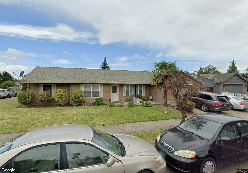
1930 Anthony Way Eugene, OR 97404
River Road NeighborhoodEstimated Value: $379,000 - $410,000
About This Home
This home is located at 1930 Anthony Way, Eugene, OR 97404 and is currently estimated at $400,805, approximately $324 per square foot. 1930 Anthony Way is a home located in Lane County with nearby schools including Irving Elementary School, Shasta Middle School, and Willamette High School.
Ownership History
We collect this data history from publicly available records. To have your information removed, we recommend requesting removal directly through your county’s website.
Purchase Details
Home Financials for this Owner
Home Financials are based on the most recent Mortgage that was taken out on this home.Purchase Details
Home Financials for this Owner
Home Financials are based on the most recent Mortgage that was taken out on this home.Purchase Details
Home Financials for this Owner
Home Financials are based on the most recent Mortgage that was taken out on this home.Purchase Details
Home Financials for this Owner
Home Financials are based on the most recent Mortgage that was taken out on this home.Home Values in the Area
Average Home Value in this Area
Purchase History
We collect this data history from publicly available records. To have your information removed, we recommend requesting removal directly through your county’s website.
| Date | Buyer | Sale Price | Title Company |
|---|---|---|---|
| $199,500 | First American Title | ||
| $146,900 | Fidelity National Title Insu | ||
| $123,180 | Oregon Title Insurance Co | ||
| $29,310 | Oregon Title Insurance Co |
Mortgage History
We collect this data history from publicly available records. To have your information removed, we recommend requesting removal directly through your county’s website.
| Date | Status | Borrower | Loan Amount |
|---|---|---|---|
| Open | $195,886 | ||
| Previous Owner | $117,500 | ||
| Previous Owner | $110,850 | ||
| Previous Owner | $29,310 | ||
| Closed | $29,300 |
Tax History
We collect this data history from publicly available records. To have your information removed, we recommend requesting removal directly through your county’s website.
| Year | Tax Paid | Tax Assessment Tax Assessment Total Assessment is a certain percentage of the fair market value that is determined by local assessors to be the total taxable value of land and additions on the property. | Land | Improvement |
|---|---|---|---|---|
| 2025 | $3,907 | $224,609 | -- | -- |
| 2024 | $3,808 | $218,067 | -- | -- |
| 2023 | $3,808 | $211,716 | -- | -- |
| 2022 | $3,545 | $205,550 | $0 | $0 |
| 2021 | $3,470 | $199,564 | $0 | $0 |
| 2020 | $3,369 | $193,752 | $0 | $0 |
| 2019 | $3,203 | $188,109 | $0 | $0 |
| 2018 | $3,114 | $177,312 | $0 | $0 |
| 2017 | $2,976 | $177,312 | $0 | $0 |
| 2016 | $2,900 | $172,148 | $0 | $0 |
| 2015 | $2,843 | $167,134 | $0 | $0 |
| 2014 | $2,800 | $162,266 | $0 | $0 |
Map
- 1764 Allea Dr
- 1140 Molly Ln
- 831 Greenwich Ave
- 987 Pennington Ct
- 963 Pennington Ct
- 907 Howard Ave
- 1805 Hemlock St
- 903 Howard Ave
- 1682 Hemlock St
- 2610 Crowther Dr
- 3717 Riviera
- 3886 Aerial Way
- 352 Ruby Ave
- 605 Kourt Dr
- 2693 Arnold Ave
- 2562 Dover Dr
- 2923 Dry Creek Rd
- 2952 Shelby Way
- 445 Sterling Dr
- 2565 Dover Dr
- 1944 Anthony Way
- 1970 Anthony Way
- 1361 David Ave
- 2010 Anthony Way
- 1365 David Ave
- 1363 David Ave
- 1937 Anthony Way
- 1959 Anthony Way
- 2026 Anthony Way
- 1983 Anthony Way
- 1347 David Ave
- 1367 David Ave
- 650 Bushnell Ln
- 2017 Anthony Way
- 1362 David Ave
- 1370 David Ave
- 1350 David Ave
- 2048 Anthony Way
- 1350 David St
- 1376 David Ave
Ask me questions while you tour the home.