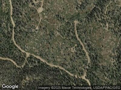
135 Aspen Way Cotopaxi, CO 81223
Estimated Value: $95,786 - $126,000
--
Bed
--
Bath
--
Sq Ft
8
Acres
About This Home
This home is located at 135 Aspen Way, Cotopaxi, CO 81223 and is currently estimated at $112,595. 135 Aspen Way is a home located in Fremont County with nearby schools including Cotopaxi Elementary School and Cotopaxi Junior/Senior High School.
Ownership History
Date
Name
Owned For
Owner Type
Purchase Details
Closed on
Jan 8, 2016
Sold by
Brent Susan S and Brent Joseph L
Bought by
Lawrence Ronnie W and Lawrence Andrea E
Current Estimated Value
Home Financials for this Owner
Home Financials are based on the most recent Mortgage that was taken out on this home.
Original Mortgage
$39,375
Outstanding Balance
$18,114
Interest Rate
3.94%
Mortgage Type
Purchase Money Mortgage
Estimated Equity
$101,682
Purchase Details
Closed on
Jun 16, 2008
Sold by
Pfeiffer Earl A and Pfeiffer Debra J
Bought by
Brent Susan S and Brent Joseph L
Home Financials for this Owner
Home Financials are based on the most recent Mortgage that was taken out on this home.
Original Mortgage
$33,000
Interest Rate
6.07%
Mortgage Type
Purchase Money Mortgage
Purchase Details
Closed on
Mar 8, 2004
Sold by
Olson George H and Olson Mary A
Bought by
Pfeiffer Earl A and Pfeiffer Debra J
Purchase Details
Closed on
Jan 1, 1979
Sold by
Spruce Basin
Bought by
Olson
Create a Home Valuation Report for This Property
The Home Valuation Report is an in-depth analysis detailing your home's value as well as a comparison with similar homes in the area
Home Values in the Area
Average Home Value in this Area
Purchase History
| Date | Buyer | Sale Price | Title Company |
|---|---|---|---|
| Lawrence Ronnie W | $52,500 | None Available | |
| Brent Susan S | $53,096 | Security Title | |
| Pfeiffer Earl A | $42,000 | -- | |
| Olson | $4,900 | -- |
Source: Public Records
Mortgage History
| Date | Status | Borrower | Loan Amount |
|---|---|---|---|
| Open | Lawrence Ronnie W | $39,375 | |
| Previous Owner | Brent Susan S | $33,000 |
Source: Public Records
Tax History Compared to Growth
Tax History
| Year | Tax Paid | Tax Assessment Tax Assessment Total Assessment is a certain percentage of the fair market value that is determined by local assessors to be the total taxable value of land and additions on the property. | Land | Improvement |
|---|---|---|---|---|
| 2024 | $789 | $19,494 | $19,494 | $0 |
| 2023 | $789 | $19,494 | $19,494 | $0 |
| 2022 | $477 | $12,396 | $12,396 | $0 |
| 2021 | $464 | $12,396 | $12,396 | $0 |
| 2020 | $453 | $12,396 | $12,396 | $0 |
| 2019 | $453 | $12,396 | $12,396 | $0 |
| 2018 | $453 | $12,396 | $0 | $0 |
| 2017 | $454 | $12,396 | $0 | $0 |
| 2016 | $524 | $14,300 | $0 | $0 |
| 2015 | $522 | $14,300 | $0 | $0 |
| 2012 | $531 | $14,303 | $14,303 | $0 |
Source: Public Records
Map
Nearby Homes
- 838 Ridge Way Dr
- 160 Nuthatch Dr
- 0 Trail Dr Unit 17 REC3689536
- 0 Basin Dr Unit 1 REC3358120
- 1135 Ogden Loop
- 390 North Ln
- 1136 Bird Point Dr
- TBD Big Bow Dr
- 000 Bird Point Dr
- 8617 County Road 12
- 3635 Bird Point Dr
- 1810 Bird Point Dr
- 14527 U S 50
- 10240 U S 50
- 530 & 592 Red Feather Rd
- 10817 U S 50
- 9825 Us Highway 50
- 1111 Red Feather Rd
- 35 Shillelagh Place
- 110 Triple j Ct
