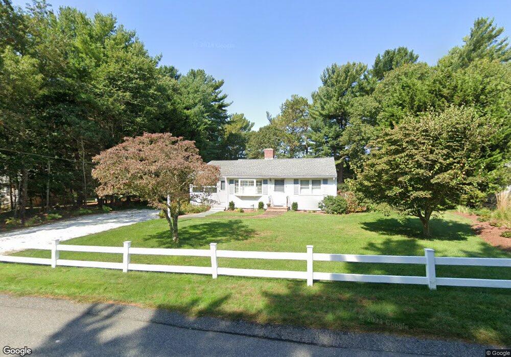
135 Crockers Neck Rd Cotuit, MA 02635
Cotuit NeighborhoodEstimated Value: $564,000 - $695,000
2
Beds
2
Baths
1,201
Sq Ft
$508/Sq Ft
Est. Value
About This Home
This home is located at 135 Crockers Neck Rd, Cotuit, MA 02635 and is currently estimated at $610,517, approximately $508 per square foot. 135 Crockers Neck Rd is a home located in Barnstable County with nearby schools including West Villages Elementary School, Barnstable United Elementary School, and Barnstable Intermediate School.
Ownership History
Date
Name
Owned For
Owner Type
Purchase Details
Closed on
Jan 22, 2015
Sold by
Deskus Patricia and Deskus Robert
Bought by
Burke Katy D
Current Estimated Value
Home Financials for this Owner
Home Financials are based on the most recent Mortgage that was taken out on this home.
Original Mortgage
$144,500
Outstanding Balance
$111,169
Interest Rate
3.96%
Mortgage Type
New Conventional
Estimated Equity
$499,348
Purchase Details
Closed on
Apr 10, 2003
Sold by
Campbell Valente Rt and Valente Anna M
Bought by
Burke Katy D and Deskus Patricia
Purchase Details
Closed on
Aug 1, 2000
Sold by
Conway Joseph P and Conway Marjorie J
Bought by
Campbell William B and Valente Anna M
Create a Home Valuation Report for This Property
The Home Valuation Report is an in-depth analysis detailing your home's value as well as a comparison with similar homes in the area
Home Values in the Area
Average Home Value in this Area
Purchase History
| Date | Buyer | Sale Price | Title Company |
|---|---|---|---|
| Burke Katy D | -- | -- | |
| Burke Katy D | $265,000 | -- | |
| Campbell William B | $150,000 | -- |
Source: Public Records
Mortgage History
| Date | Status | Borrower | Loan Amount |
|---|---|---|---|
| Open | Burke Katy D | $144,500 | |
| Previous Owner | Campbell William B | $25,000 |
Source: Public Records
Tax History Compared to Growth
Tax History
| Year | Tax Paid | Tax Assessment Tax Assessment Total Assessment is a certain percentage of the fair market value that is determined by local assessors to be the total taxable value of land and additions on the property. | Land | Improvement |
|---|---|---|---|---|
| 2025 | $3,839 | $459,800 | $179,200 | $280,600 |
| 2024 | $3,603 | $457,200 | $179,200 | $278,000 |
| 2023 | $3,457 | $413,000 | $177,100 | $235,900 |
| 2022 | $3,266 | $315,900 | $125,900 | $190,000 |
| 2021 | $0 | $277,800 | $125,900 | $151,900 |
| 2020 | $3,183 | $271,800 | $125,900 | $145,900 |
| 2019 | $2,989 | $251,600 | $125,900 | $125,700 |
| 2018 | $0 | $240,800 | $138,100 | $102,700 |
| 2017 | $3,075 | $234,300 | $138,100 | $96,200 |
| 2016 | $2,712 | $235,600 | $139,400 | $96,200 |
| 2015 | $2,789 | $242,100 | $136,200 | $105,900 |
Source: Public Records
Map
Nearby Homes
- 266 School St
- 105 Bay Rd
- 30 Wings Ln
- 1081 Main St
- 6 Cedar St
- 6 Cedar St
- 43 Poponessett Rd
- 46 Oak St
- 46 Oak St
- 15 Riverview Ave Unit 15E
- 15 E Riverview Ave Unit 15E
- 16 Cedar St
- 916 Main St
- 188 Ocean View Ave
- 1311 Main St
- 640 Poponessett Rd
- 640 Poponessett Rd
- 5 Putnam Ave
- 320 Quinaquisset Ave
- 61 Shoestring Bay Rd
- 125 Crockers Neck Rd
- 145 Crockers Neck Rd
- 113 Crockers Neck Rd
- 113 Crockers Neck Rd
- 155 Crockers Neck Rd
- 134 Crockers Neck Rd
- 146 Crockers Neck Rd
- 124 Crockers Neck Rd
- 101 Crockers Neck Rd
- 96 Grove St
- 165 Crockers Neck Rd
- 106 Grove St
- 86 Grove St
- 158 Crockers Neck Rd
- 112 Crockers Neck Rd
- 93 Crockers Neck Rd
- 102 Crockers Neck Rd
- 172 Crockers Neck Rd
- 76 Grove St
- 276 Poponessett Rd