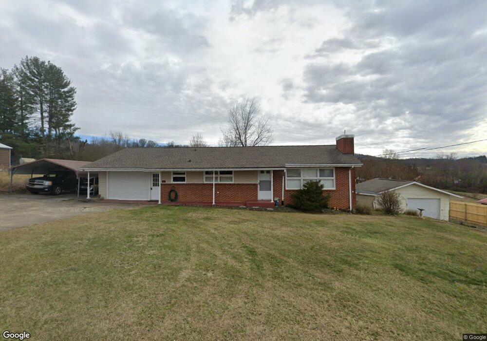
135 Forrest Rd Fall Branch, TN 37656
Estimated Value: $213,000 - $282,000
Studio
2
Baths
1,404
Sq Ft
$175/Sq Ft
Est. Value
About This Home
This home is located at 135 Forrest Rd, Fall Branch, TN 37656 and is currently estimated at $245,285, approximately $174 per square foot. 135 Forrest Rd is a home located in Washington County with nearby schools including Fall Branch Elementary School, Daniel Boone High School, and Comprehensive Community Services.
Ownership History
Date
Name
Owned For
Owner Type
Purchase Details
Closed on
Mar 14, 2014
Sold by
English Shelby J
Bought by
Harris Herbert Nelson and Harris Ginger Renee
Current Estimated Value
Purchase Details
Closed on
Nov 22, 2004
Sold by
English Shelby J
Bought by
Guy Trinka L
Purchase Details
Closed on
Aug 23, 2004
Sold by
Harris Herbert Nelson
Bought by
English Shelby J
Purchase Details
Closed on
Jan 7, 1999
Bought by
Harris Herbert Nelson and Harris Ginger Renee
Create a Home Valuation Report for This Property
The Home Valuation Report is an in-depth analysis detailing your home's value as well as a comparison with similar homes in the area
Home Values in the Area
Average Home Value in this Area
Purchase History
| Date | Buyer | Sale Price | Title Company |
|---|---|---|---|
| Harris Herbert Nelson | -- | -- | |
| Guy Trinka L | -- | -- | |
| English Shelby J | -- | -- | |
| Harris Herbert Nelson | $60,000 | -- |
Source: Public Records
Tax History
| Year | Tax Paid | Tax Assessment Tax Assessment Total Assessment is a certain percentage of the fair market value that is determined by local assessors to be the total taxable value of land and additions on the property. | Land | Improvement |
|---|---|---|---|---|
| 2025 | $1,013 | $61,325 | $5,150 | $56,175 |
| 2024 | $1,013 | $59,225 | $5,150 | $54,075 |
| 2022 | $725 | $33,725 | $4,225 | $29,500 |
| 2021 | $725 | $33,725 | $4,225 | $29,500 |
| 2020 | $725 | $33,725 | $4,225 | $29,500 |
| 2019 | $700 | $33,725 | $4,225 | $29,500 |
| 2018 | $700 | $29,400 | $4,225 | $25,175 |
| 2017 | $700 | $29,400 | $4,225 | $25,175 |
| 2016 | $700 | $29,400 | $4,225 | $25,175 |
| 2015 | $582 | $29,400 | $4,225 | $25,175 |
| 2014 | $582 | $29,400 | $4,225 | $25,175 |
Source: Public Records
Map
Nearby Homes
- 2145 Tennessee 93
- 238 Cherry Ln
- 207 Hermosa Dr
- Lot 6 Tbd Tennessee 93
- Lot 4 Tbd Tennessee 93
- Lot 5 Tbd Tennessee 93
- Lot 2 Tbd Tennessee 93
- Lot 3 Tbd Tennessee 93
- Lot 1 Tbd Tennessee 93
- 211 Sunny Hill Ct
- 1427 Highway 93
- TBD Tennessee 93
- 137 Crestview Dr
- Tbd Oak Glen Cir
- Lots 3-4 Double Springs Rd
- Lot 2 Double Springs Rd
- 176 Moulton Rd
- 0 Jearoldstown Rd Unit 40/41
- 901 Old Blairs Gap Rd
- 704 Church Hill Dr
Your Personal Tour Guide
Ask me questions while you tour the home.