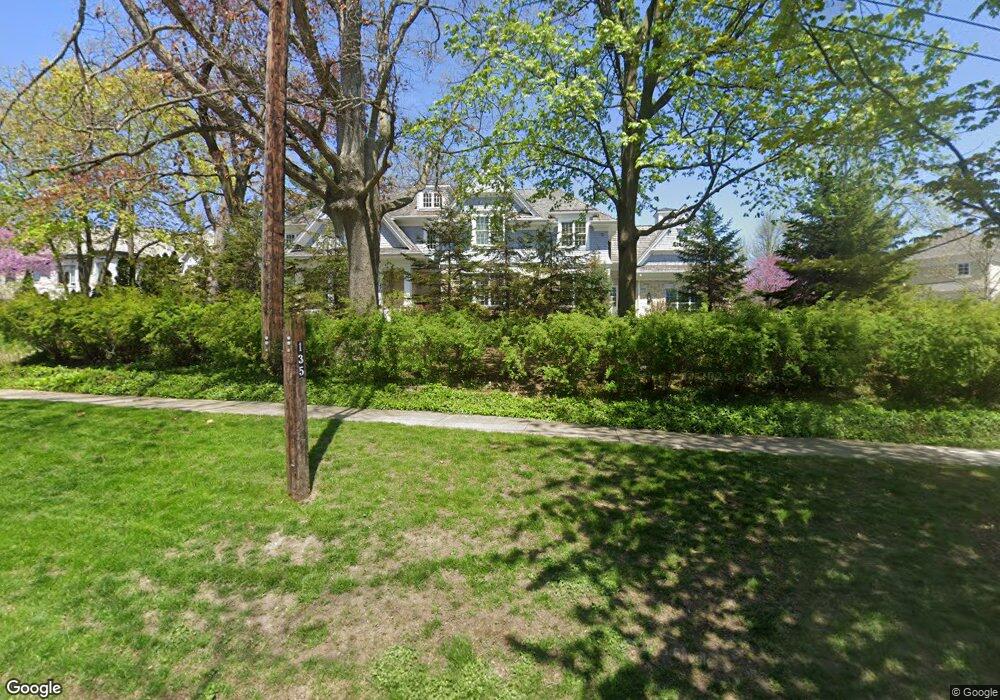
135 Maple Hill Rd Glencoe, IL 60022
Estimated Value: $1,630,000 - $1,979,000
Studio
1
Bath
1,340
Sq Ft
$1,347/Sq Ft
Est. Value
About This Home
This home is located at 135 Maple Hill Rd, Glencoe, IL 60022 and is currently estimated at $1,804,500, approximately $1,346 per square foot. 135 Maple Hill Rd is a home located in Cook County with nearby schools including South Elementary School, Central School, and West School.
Ownership History
Date
Name
Owned For
Owner Type
Purchase Details
Closed on
Oct 28, 2022
Sold by
Kaufmann Mark and Kaufmann Jayme
Bought by
Jayme Kaufmann 2012 Trust
Current Estimated Value
Purchase Details
Closed on
Jul 1, 2014
Sold by
Mitchell Lee M and Mitchell Barbara L
Bought by
Kaufmann Mark and Kaufmann Jayme
Home Financials for this Owner
Home Financials are based on the most recent Mortgage that was taken out on this home.
Original Mortgage
$1,540,000
Interest Rate
2.75%
Mortgage Type
Adjustable Rate Mortgage/ARM
Create a Home Valuation Report for This Property
The Home Valuation Report is an in-depth analysis detailing your home's value as well as a comparison with similar homes in the area
Home Values in the Area
Average Home Value in this Area
Purchase History
| Date | Buyer | Sale Price | Title Company |
|---|---|---|---|
| Jayme Kaufmann 2012 Trust | -- | None Listed On Document | |
| Kaufmann Mark | $1,637,500 | Chicago Title Insurance Co |
Source: Public Records
Mortgage History
| Date | Status | Borrower | Loan Amount |
|---|---|---|---|
| Previous Owner | Kaufmann Mark | $1,540,000 |
Source: Public Records
Tax History
| Year | Tax Paid | Tax Assessment Tax Assessment Total Assessment is a certain percentage of the fair market value that is determined by local assessors to be the total taxable value of land and additions on the property. | Land | Improvement |
|---|---|---|---|---|
| 2025 | $3,147 | $12,400 | $11,680 | $720 |
| 2024 | $3,147 | $12,848 | $12,848 | -- |
| 2023 | $2,938 | $12,848 | $12,848 | -- |
| 2022 | $2,938 | $12,848 | $12,848 | $0 |
| 2021 | $3,516 | $12,264 | $12,264 | $0 |
| 2020 | $3,414 | $12,264 | $12,264 | $0 |
| 2019 | $3,033 | $12,264 | $12,264 | $0 |
| 2018 | $2,672 | $10,512 | $10,512 | $0 |
| 2017 | $2,596 | $10,512 | $10,512 | $0 |
| 2016 | $2,438 | $10,512 | $10,512 | $0 |
| 2015 | $2,085 | $7,959 | $7,884 | $75 |
| 2014 | $2,205 | $8,634 | $7,884 | $750 |
| 2013 | $2,104 | $8,634 | $7,884 | $750 |
Source: Public Records
Map
Nearby Homes
- 130 Maple Hill Rd
- 219 Lincoln Dr
- 64 Crescent Dr
- 677 Greenleaf Ave
- 1077 Green Bay Rd
- 794 Greenwood Ave
- 396 Forest Edge Dr
- 735 Grove St
- 1036 Elm Ridge Dr
- 55 S Deere Park Dr
- 476 Park Ave
- 488 Park Ave
- 1200 Green Bay Rd
- 679 Bluff St
- 1180 Oak Ridge Dr
- 378 South Ave
- 1106 Hohlfelder Rd
- 808 Prairie Rd
- 1133 Mayfair Ln
- 410 Green Bay Rd
- 135 Maple Hill Rd
- 926 Sheridan Rd
- 918 Sheridan Rd
- 165 Maple Hill Rd
- 940 Sheridan Rd
- 167 Maple Hill Rd
- 133 Maple Hill Rd
- 927 Forest Ave
- 931 Forest Ave
- 950 Sheridan Rd
- 925 Sheridan Rd
- 941 Forest Ave
- 951 Sheridan Rd
- 921 Sheridan Rd
- 909 Sheridan Rd
- 953 Sheridan Rd
- 156 Maple Hill Rd
- 964 Sheridan Rd
- 160 Maple Hill Rd
- 905 Sheridan Rd
Your Personal Tour Guide
Ask me questions while you tour the home.