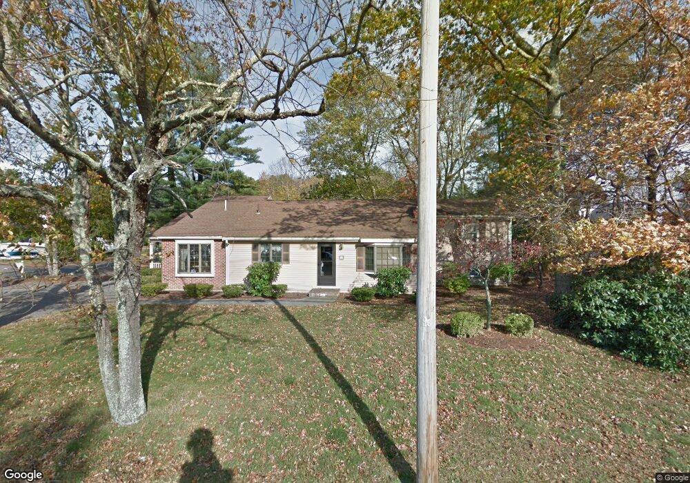
135 Oak St Franklin, MA 02038
Estimated Value: $530,000 - $659,000
4
Beds
2
Baths
1,496
Sq Ft
$401/Sq Ft
Est. Value
About This Home
This home is located at 135 Oak St, Franklin, MA 02038 and is currently estimated at $600,097, approximately $401 per square foot. 135 Oak St is a home located in Norfolk County with nearby schools including Oak Street Elementary School, Horace Mann Middle School, and Franklin High School.
Ownership History
Date
Name
Owned For
Owner Type
Purchase Details
Closed on
May 2, 2025
Sold by
Fish Dean A and Lafauci Christina R
Bought by
Fish Dean A and Fish Christina R
Current Estimated Value
Purchase Details
Closed on
Oct 6, 2022
Sold by
Fish Linda M
Bought by
Fish Dean A and Lafauci Christina R
Home Financials for this Owner
Home Financials are based on the most recent Mortgage that was taken out on this home.
Original Mortgage
$390,000
Interest Rate
5.55%
Mortgage Type
Purchase Money Mortgage
Purchase Details
Closed on
Sep 28, 2022
Sold by
Fish Nt and Fish
Bought by
Fish Linda M
Home Financials for this Owner
Home Financials are based on the most recent Mortgage that was taken out on this home.
Original Mortgage
$390,000
Interest Rate
5.55%
Mortgage Type
Purchase Money Mortgage
Purchase Details
Closed on
Nov 7, 2014
Sold by
Fish Linda M and Fish Dean S
Bought by
Fish Nt and Fish
Create a Home Valuation Report for This Property
The Home Valuation Report is an in-depth analysis detailing your home's value as well as a comparison with similar homes in the area
Home Values in the Area
Average Home Value in this Area
Purchase History
| Date | Buyer | Sale Price | Title Company |
|---|---|---|---|
| Fish Dean A | -- | None Available | |
| Fish Dean A | -- | None Available | |
| Fish Dean A | $420,000 | None Available | |
| Fish Dean A | $420,000 | None Available | |
| Fish Linda M | -- | None Available | |
| Fish Linda M | -- | None Available | |
| Fish Nt | -- | -- | |
| Fish Nt | -- | -- | |
| Fish Nt | -- | -- |
Source: Public Records
Mortgage History
| Date | Status | Borrower | Loan Amount |
|---|---|---|---|
| Previous Owner | Fish Dean A | $390,000 | |
| Previous Owner | Fish Nt | $89,000 |
Source: Public Records
Tax History Compared to Growth
Tax History
| Year | Tax Paid | Tax Assessment Tax Assessment Total Assessment is a certain percentage of the fair market value that is determined by local assessors to be the total taxable value of land and additions on the property. | Land | Improvement |
|---|---|---|---|---|
| 2025 | $6,437 | $554,000 | $236,700 | $317,300 |
| 2024 | $6,153 | $521,900 | $236,700 | $285,200 |
| 2023 | $6,266 | $498,100 | $258,400 | $239,700 |
| 2022 | $5,738 | $408,400 | $197,200 | $211,200 |
| 2021 | $5,483 | $374,300 | $205,400 | $168,900 |
| 2020 | $5,337 | $367,800 | $207,200 | $160,600 |
| 2019 | $5,020 | $342,400 | $181,800 | $160,600 |
| 2018 | $4,824 | $329,300 | $185,400 | $143,900 |
| 2017 | $4,749 | $325,700 | $181,800 | $143,900 |
| 2016 | $4,578 | $315,700 | $188,700 | $127,000 |
| 2015 | $4,415 | $297,500 | $170,500 | $127,000 |
| 2014 | $4,227 | $292,500 | $165,500 | $127,000 |
Source: Public Records
Map
Nearby Homes
- 14 Pleasant St Unit A
- 57 Raymond St Unit 2
- 31 Highwood Dr
- 66 Highwood Dr
- 83 Highwood Dr Unit 83
- 0 Upper Union St Unit 73230551
- 17 Longhill Rd
- 48 Pinehurst St
- 6 Buena Vista Dr
- 159 Highwood Dr
- 204 Lincoln St
- 150 Pleasant St
- 120 Union St Unit 1
- 2 Kayla Dr
- 336 Maple St
- 2211 Franklin Crossing Rd Unit 2211
- 1805 Franklin Crossing Rd
- 605 Franklin Crossing Rd
- 208 Irondequoit Rd
- 76 Dean Ave
- Lot 17 Molly Ln
- Lot 18 Molly Ln
- Lot 15 Molly Ln
- 139 Oak St
- 1 Pine Knoll Rd
- 1 Molly Ln
- 2 Pine Knoll Rd
- lot 8(3) Brielle Way
- 0 Onset Cir Unit 72243216
- 0 Dick Armstrong Ct Unit 70764554
- LOT Daniels St
- land S Street After No46
- 0 Onset Cir Unit 71141736
- 0 Onset Cir Unit 71262086
- 0 Onset Cir Unit 72798075
- 0 Onset Cir Unit 72417057
- 5 Molly Ln
- 141 Oak St
- 3 Pine Knoll Rd
- 4 Pine Knoll Rd