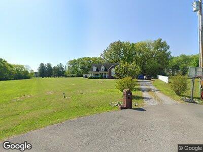
135 Surevue Dr Murfreesboro, TN 37127
Plainview NeighborhoodEstimated Value: $419,901 - $536,000
--
Bed
3
Baths
2,319
Sq Ft
$210/Sq Ft
Est. Value
About This Home
This home is located at 135 Surevue Dr, Murfreesboro, TN 37127 and is currently estimated at $487,475, approximately $210 per square foot. 135 Surevue Dr is a home located in Rutherford County with nearby schools including Buchanan Elementary School, Whitworth-Buchanan Middle School, and Riverdale High School.
Ownership History
Date
Name
Owned For
Owner Type
Purchase Details
Closed on
Jul 24, 2002
Sold by
Austin and Brenda
Bought by
Christopher Young
Current Estimated Value
Home Financials for this Owner
Home Financials are based on the most recent Mortgage that was taken out on this home.
Original Mortgage
$135,640
Interest Rate
6.62%
Purchase Details
Closed on
Jan 30, 2002
Sold by
Countrywide
Bought by
Federal National Mortgage
Purchase Details
Closed on
Aug 31, 2001
Sold by
Lee Ford Nova and Lee Sophia J
Bought by
Countrywide
Purchase Details
Closed on
Dec 3, 1997
Sold by
Denny Hastings Famil L P
Bought by
Ford and Sophia
Home Financials for this Owner
Home Financials are based on the most recent Mortgage that was taken out on this home.
Original Mortgage
$136,975
Interest Rate
7.19%
Create a Home Valuation Report for This Property
The Home Valuation Report is an in-depth analysis detailing your home's value as well as a comparison with similar homes in the area
Home Values in the Area
Average Home Value in this Area
Purchase History
| Date | Buyer | Sale Price | Title Company |
|---|---|---|---|
| Christopher Young | $169,550 | -- | |
| Federal National Mortgage | -- | -- | |
| Countrywide | $120,907 | -- | |
| Ford | $144,185 | -- | |
| Denny Hastings Family L P | -- | -- |
Source: Public Records
Mortgage History
| Date | Status | Borrower | Loan Amount |
|---|---|---|---|
| Open | Young Christopher W | $143,350 | |
| Closed | Denny Hastings Family L P | $135,640 | |
| Previous Owner | Denny Hastings Family L P | $136,975 |
Source: Public Records
Tax History Compared to Growth
Tax History
| Year | Tax Paid | Tax Assessment Tax Assessment Total Assessment is a certain percentage of the fair market value that is determined by local assessors to be the total taxable value of land and additions on the property. | Land | Improvement |
|---|---|---|---|---|
| 2024 | $1,742 | $92,850 | $13,750 | $79,100 |
| 2023 | $1,742 | $92,850 | $13,750 | $79,100 |
| 2022 | $1,494 | $92,450 | $13,750 | $78,700 |
| 2021 | $1,488 | $67,025 | $11,250 | $55,775 |
| 2020 | $1,488 | $67,025 | $11,250 | $55,775 |
| 2019 | $1,488 | $67,025 | $11,250 | $55,775 |
| 2018 | $1,407 | $67,025 | $0 | $0 |
| 2017 | $1,225 | $45,725 | $0 | $0 |
| 2016 | $1,225 | $45,725 | $0 | $0 |
| 2015 | $1,225 | $45,725 | $0 | $0 |
| 2014 | $1,137 | $45,725 | $0 | $0 |
| 2013 | -- | $46,125 | $0 | $0 |
Source: Public Records
Map
Nearby Homes
- 4349 Doral Dr
- 4357 Aurora Cir
- 4332 Doral Dr
- 4211 Aurora Cir Unit 5
- 1840 Bethpage Dr
- 4311 Spyglass Dr
- 4257 Aurora Cir
- 4312 Spyglass Dr
- 4305 Doral Dr
- 1508 Sunray Dr
- 1843 Streamsong Dr
- 1845 Streamsong Dr
- 1847 Streamsong Dr
- 4204 Spyglass Dr
- 4203 Sarazen Ln
- 4218 Golden Sun Ct
- 5616 Maples Retreat Dr
- 3927 Runyan Cove
- 4003 Runyan Cove
- 3639 Lavender Trail
- 135 Surevue Dr
- 138 Surevue Dr
- 129 Surevue Dr
- 134 Surevue Dr
- 119 Surevue Dr
- 314 Fieldstone Dr
- 310 Fieldstone Dr
- 115 Surevue Dr
- 130 Surevue Dr
- 126 Surevue Dr
- 306 Fieldstone Dr
- 107 Surevue Dr
- 302 Fieldstone Dr
- 103 Callaway Ct
- 111 Surevue Dr
- 115 Iona Ct
- 103 Surevue Dr
- 231 Ramsey Rd
- 116 Surevue Dr
- 111 Iona Ct