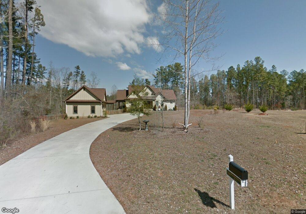
135 Weatherstone Dr Unit Weatherstone Subdivi Central, SC 29630
Estimated Value: $525,000 - $914,000
4
Beds
3
Baths
2,353
Sq Ft
$271/Sq Ft
Est. Value
About This Home
This home is located at 135 Weatherstone Dr Unit Weatherstone Subdivi, Central, SC 29630 and is currently estimated at $636,698, approximately $270 per square foot. 135 Weatherstone Dr Unit Weatherstone Subdivi is a home located in Pickens County with nearby schools including Clemson Elementary School, R.C. Edwards Middle School, and D.W. Daniel High School.
Ownership History
Date
Name
Owned For
Owner Type
Purchase Details
Closed on
Mar 10, 2011
Sold by
Williams Michael E and Williams Mary B
Bought by
Burns Robert R and Burns Brenda L
Current Estimated Value
Home Financials for this Owner
Home Financials are based on the most recent Mortgage that was taken out on this home.
Original Mortgage
$180,000
Outstanding Balance
$68,383
Interest Rate
4.99%
Estimated Equity
$568,315
Purchase Details
Closed on
Feb 6, 2008
Sold by
Smith Elizabeth Shelton and Cox Elizabeth S
Bought by
Williams Michael E and Williams Mary B
Create a Home Valuation Report for This Property
The Home Valuation Report is an in-depth analysis detailing your home's value as well as a comparison with similar homes in the area
Home Values in the Area
Average Home Value in this Area
Purchase History
| Date | Buyer | Sale Price | Title Company |
|---|---|---|---|
| Burns Robert R | $300,000 | -- | |
| Williams Michael E | $38,000 | Attorney |
Source: Public Records
Mortgage History
| Date | Status | Borrower | Loan Amount |
|---|---|---|---|
| Open | Burns Robert R | $180,000 |
Source: Public Records
Tax History Compared to Growth
Tax History
| Year | Tax Paid | Tax Assessment Tax Assessment Total Assessment is a certain percentage of the fair market value that is determined by local assessors to be the total taxable value of land and additions on the property. | Land | Improvement |
|---|---|---|---|---|
| 2024 | $1,536 | $12,790 | $1,520 | $11,270 |
| 2023 | $1,536 | $12,790 | $1,520 | $11,270 |
| 2022 | $1,543 | $12,790 | $1,520 | $11,270 |
| 2021 | $1,482 | $12,790 | $1,520 | $11,270 |
| 2020 | $1,251 | $12,792 | $1,520 | $11,272 |
| 2019 | $1,278 | $12,790 | $1,520 | $11,270 |
| 2018 | $1,250 | $11,980 | $1,520 | $10,460 |
| 2017 | $1,214 | $11,980 | $1,520 | $10,460 |
| 2015 | $1,247 | $11,980 | $0 | $0 |
| 2008 | -- | $1,680 | $1,680 | $0 |
Source: Public Records
Map
Nearby Homes
- 210 Briarcliff Rd
- 117 Ridgestone Dr
- 102 Brookstone Way
- 132 Shale Dr
- 139 Shale Dr
- 121 Somerset Ln
- 114 Shale Dr
- 108 Shale Dr
- 102 Shale Dr
- Audrey II Plan at Edwards Ridge
- Madeline II Plan at Edwards Ridge
- Gardener ll Plan at Edwards Ridge
- Baymore II Plan at Edwards Ridge
- Sonoma II Plan at Edwards Ridge
- Connor II Plan at Edwards Ridge
- Ariel II Plan at Edwards Ridge
- Austin II Plan at Edwards Ridge
- 205 Catawbah Rd
- 122 Franklin Dr
- 222 Grange Valley Ln
- 135 Weatherstone Dr
- 1604 Six Mile Hwy
- 128 Weatherstone Dr
- 147 Weatherstone Dr
- 123 Weatherstone Dr
- 1616 Six Mile Hwy
- 119 Weatherstone Dr
- 151 Weatherstone Dr
- 160 Weatherstone Dr
- 110 Weatherstone Dr
- 110 Weatherstone Dr Unit Central
- 1618 Six Mile Hwy
- 101 Woodbine Terrace
- 115 Weatherstone Dr
- 155 Weatherstone Dr
- 2 Weatherstone Dr
- 1627 Six Mile Hwy
- 1517 6 Mile Hwy
- 111 Weatherstone Dr
- 109 Woodbine Terrace