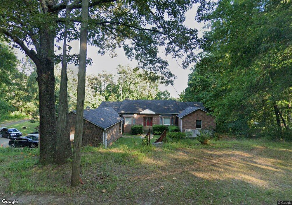
1350 Gresham Rd Marietta, GA 30062
Estimated Value: $441,000 - $686,000
4
Beds
3
Baths
3,073
Sq Ft
$183/Sq Ft
Est. Value
About This Home
This home is located at 1350 Gresham Rd, Marietta, GA 30062 and is currently estimated at $563,048, approximately $183 per square foot. 1350 Gresham Rd is a home located in Cobb County with nearby schools including Sedalia Park Elementary School, East Cobb Middle School, and Wheeler High School.
Ownership History
Date
Name
Owned For
Owner Type
Purchase Details
Closed on
Mar 8, 2019
Sold by
Stevenson Vera
Bought by
Mitchell Michel and Mitchell Douglas
Current Estimated Value
Home Financials for this Owner
Home Financials are based on the most recent Mortgage that was taken out on this home.
Original Mortgage
$67,112
Outstanding Balance
$43,332
Interest Rate
4.4%
Mortgage Type
New Conventional
Estimated Equity
$519,716
Purchase Details
Closed on
Oct 15, 2018
Sold by
Vera Stevenson Ato 2005 Stevenson Family
Bought by
Stevenson Vera and Mitchell Douglas
Purchase Details
Closed on
Mar 30, 2018
Sold by
Denbesten
Bought by
Ktj Grp Llc
Create a Home Valuation Report for This Property
The Home Valuation Report is an in-depth analysis detailing your home's value as well as a comparison with similar homes in the area
Home Values in the Area
Average Home Value in this Area
Purchase History
| Date | Buyer | Sale Price | Title Company |
|---|---|---|---|
| Mitchell Michel | -- | -- | |
| Stevenson Vera | -- | -- | |
| Ktj Grp Llc | -- | -- | |
| Ktj Grp Llc | $1,100,000 | -- |
Source: Public Records
Mortgage History
| Date | Status | Borrower | Loan Amount |
|---|---|---|---|
| Open | Mitchell Michel | $67,112 |
Source: Public Records
Tax History Compared to Growth
Tax History
| Year | Tax Paid | Tax Assessment Tax Assessment Total Assessment is a certain percentage of the fair market value that is determined by local assessors to be the total taxable value of land and additions on the property. | Land | Improvement |
|---|---|---|---|---|
| 2024 | $1,595 | $239,344 | $50,760 | $188,584 |
| 2023 | $1,259 | $195,884 | $47,000 | $148,884 |
| 2022 | $1,316 | $146,256 | $47,000 | $99,256 |
| 2021 | $1,264 | $128,936 | $43,240 | $85,696 |
| 2020 | $3,457 | $113,896 | $28,200 | $85,696 |
| 2019 | $3,457 | $113,896 | $28,200 | $85,696 |
| 2018 | $783 | $107,124 | $26,320 | $80,804 |
| 2017 | $683 | $101,484 | $20,680 | $80,804 |
| 2016 | $676 | $97,724 | $16,920 | $80,804 |
| 2015 | $663 | $80,900 | $13,160 | $67,740 |
| 2014 | $674 | $80,900 | $0 | $0 |
Source: Public Records
Map
Nearby Homes
- 0 Shadowbrook Dr Unit 10506866
- 0 Shadowbrook Dr Unit 7564152
- 1186 Beech St
- 1234 Barnes Mill Rd
- 679 Anderson Walk
- 755 Bonnie Dell Dr
- 741 Soaring Dr
- 1657 Cedar Bluff Way
- 706 Coventry Township Ln
- 785 Soaring Cir
- 794 Barnes Mill Trace NE
- 874 Soaring Cir Unit 2
- 149 Bankston Rd
- 506 Glen Ivy Unit 5
- 928 Springdale Dr
- 1548 Cedar Bluff Trail
- 1434 James St SE
- 1402 Glenivy
- 1603 Glen Ivy
- 1440 Gresham Rd
- 1417 Shadowbrook Dr
- 1349 Gresham Rd
- 1401 Gresham Rd
- 1400 Gresham Rd
- 1419 Shadowbrook Dr
- 1453 Dewberry Trail
- 1463 Dewberry Trail
- 1443 Dewberry Trail
- 1306 Gresham Rd
- 1473 Dewberry Trail
- 1433 Dewberry Trail
- 1421 Dewberry Trail
- 1485 Dewberry Trail
- 0 Dewberry Trail Unit 7476176
- 0 Dewberry Trail Unit 7469677
- 0 Dewberry Trail Unit 8728843
- 0 Dewberry Trail Unit 8195699
- 0 Dewberry Trail Unit 7605719
- 0 Dewberry Trail Unit 7288076