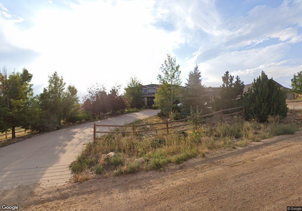
1351 Red Ash Ln Boulder, CO 80303
Estimated Value: $2,049,387 - $2,393,000
3
Beds
4
Baths
3,913
Sq Ft
$556/Sq Ft
Est. Value
About This Home
This home is located at 1351 Red Ash Ln, Boulder, CO 80303 and is currently estimated at $2,177,462, approximately $556 per square foot. 1351 Red Ash Ln is a home located in Boulder County with nearby schools including Monarch K-8 School, Monarch High School, and The Goddard School - Louisville.
Ownership History
Date
Name
Owned For
Owner Type
Purchase Details
Closed on
Jun 19, 2006
Sold by
Smith Philip and Smith Ellen
Bought by
Benson Jon H and Benson Cyndi R
Current Estimated Value
Purchase Details
Closed on
Dec 15, 2003
Sold by
Elite Homes Inc
Bought by
Smith Philip and Smith Ellen
Home Financials for this Owner
Home Financials are based on the most recent Mortgage that was taken out on this home.
Original Mortgage
$525,500
Interest Rate
1.25%
Mortgage Type
Unknown
Purchase Details
Closed on
Jul 20, 1983
Bought by
Benson Jon H and Benson Cyndi R
Purchase Details
Closed on
Jul 2, 1980
Bought by
Benson Jon H and Benson Cyndi R
Purchase Details
Closed on
Jul 6, 1979
Bought by
Benson Jon H and Benson Cyndi R
Create a Home Valuation Report for This Property
The Home Valuation Report is an in-depth analysis detailing your home's value as well as a comparison with similar homes in the area
Home Values in the Area
Average Home Value in this Area
Purchase History
| Date | Buyer | Sale Price | Title Company |
|---|---|---|---|
| Benson Jon H | $995,000 | Land Title | |
| Smith Philip | $721,500 | Land Title | |
| Benson Jon H | $46,000 | -- | |
| Benson Jon H | -- | -- | |
| Benson Jon H | $5,000 | -- |
Source: Public Records
Mortgage History
| Date | Status | Borrower | Loan Amount |
|---|---|---|---|
| Previous Owner | Smith Philip | $525,500 |
Source: Public Records
Tax History Compared to Growth
Tax History
| Year | Tax Paid | Tax Assessment Tax Assessment Total Assessment is a certain percentage of the fair market value that is determined by local assessors to be the total taxable value of land and additions on the property. | Land | Improvement |
|---|---|---|---|---|
| 2025 | $10,302 | $91,620 | $1,075 | $90,545 |
| 2024 | $10,302 | $91,620 | $1,075 | $90,545 |
| 2023 | $10,143 | $111,376 | $739 | $114,322 |
| 2022 | $7,861 | $80,487 | $1,188 | $79,299 |
| 2021 | $8,150 | $90,008 | $1,305 | $88,703 |
| 2020 | $7,012 | $74,096 | $1,073 | $73,023 |
| 2019 | $6,904 | $74,096 | $1,073 | $73,023 |
| 2018 | $13,846 | $147,046 | $32,760 | $114,286 |
| 2017 | $14,227 | $171,992 | $36,218 | $135,774 |
| 2016 | $9,863 | $103,790 | $31,442 | $72,348 |
| 2015 | $9,283 | $100,488 | $53,969 | $46,519 |
| 2014 | $8,998 | $100,488 | $53,969 | $46,519 |
Source: Public Records
Map
Nearby Homes
- 1205 Red Ash Ln
- 7171 Marshall Dr
- 9 Benchmark Dr
- 8 Benchmark Dr
- 7225 Spring Dr
- 395 Blackfoot St Unit R0128049
- 640 S 68th St
- 427 Blackfoot St
- 7233 Spring Ct
- 352 Shawnee Ln
- 368 Fox Ln
- 1599 S 76th St
- 450 Blackfoot St
- 7692 Dyer Rd
- 258 Mohawk Cir
- 110 Cayauga Way
- 7534 Skyway Ct
- 103 Cayauga Way
- 7496 Panorama Dr
- 214 Mohawk Cir
- 1223 Red Ash Ln
- 6933 Marshall Dr
- 1230 Red Ash Ln
- 6907 Marshall Dr
- 6897 Marshall Dr
- 6897 Marshall Dr
- 6897 3100 Carbon Place Apt 204 Dr
- 1221 Red Ash Ln
- 6937 Marshall Dr
- 6967 Marshall Dr
- 6977 Marshall Dr
- 6881 Marshall Dr
- 7127 Marshall Dr
- 1192 Red Ash Ln
- 6863 Marshall Dr
- 1177 Red Ash Ln
- 800 S 68th St
- 7 Benchmark Dr
- 10 Benchmark Dr
- 7440 Marshall Rd