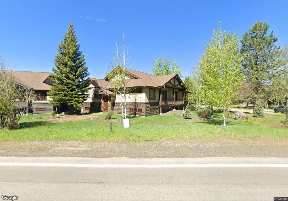
1353 Greystone Dr McCall, ID 83638
Estimated Value: $926,000 - $1,373,000
3
Beds
3
Baths
2,373
Sq Ft
$513/Sq Ft
Est. Value
About This Home
This home is located at 1353 Greystone Dr, McCall, ID 83638 and is currently estimated at $1,216,992, approximately $512 per square foot. 1353 Greystone Dr is a home located in Valley County with nearby schools including McCall-Donnelly High School, Mountain Life Education, and McCall Adventist Christian School.
Ownership History
Date
Name
Owned For
Owner Type
Purchase Details
Closed on
Apr 11, 2011
Sold by
Bank Of New York Mellon
Bought by
Higer Dale G and Higer Ramona G
Current Estimated Value
Purchase Details
Closed on
Feb 7, 2011
Sold by
Mccabe Michael W and Mccabe Catherine L
Bought by
The Bank Of New York Mellon and The Bank Of New York
Purchase Details
Closed on
Aug 25, 2005
Sold by
Prieto Julio J and Prieto Deanne B
Bought by
Mccabe Michael W and Mccabe Catherine L
Home Financials for this Owner
Home Financials are based on the most recent Mortgage that was taken out on this home.
Original Mortgage
$49,200
Interest Rate
5.61%
Mortgage Type
Credit Line Revolving
Create a Home Valuation Report for This Property
The Home Valuation Report is an in-depth analysis detailing your home's value as well as a comparison with similar homes in the area
Home Values in the Area
Average Home Value in this Area
Purchase History
| Date | Buyer | Sale Price | Title Company |
|---|---|---|---|
| Higer Dale G | -- | -- | |
| The Bank Of New York Mellon | $243,000 | -- | |
| Mccabe Michael W | -- | -- |
Source: Public Records
Mortgage History
| Date | Status | Borrower | Loan Amount |
|---|---|---|---|
| Previous Owner | Mccabe Michael W | $49,200 |
Source: Public Records
Tax History
| Year | Tax Paid | Tax Assessment Tax Assessment Total Assessment is a certain percentage of the fair market value that is determined by local assessors to be the total taxable value of land and additions on the property. | Land | Improvement |
|---|---|---|---|---|
| 2025 | $4,968 | $1,024,269 | -- | $1,024,269 |
| 2023 | $4,968 | $1,044,664 | $0 | $1,044,664 |
| 2022 | $5,049 | $971,009 | $0 | $971,009 |
| 2021 | $5,096 | $657,768 | $0 | $657,768 |
| 2020 | $4,729 | $533,576 | $0 | $533,576 |
| 2019 | $4,599 | $475,258 | $0 | $475,258 |
| 2018 | $4,704 | $444,824 | $0 | $444,824 |
| 2017 | $5,027 | $444,824 | $0 | $444,824 |
| 2016 | $4,912 | $426,072 | $0 | $426,072 |
| 2015 | $4,694 | $391,545 | $0 | $0 |
| 2013 | -- | $267,981 | $0 | $0 |
Source: Public Records
Map
Nearby Homes
- 601 Hemlock St Unit 10
- 609 Blue Water Cir
- 622 Blue Water Cir
- 703 Wooley Ave
- 715 Spruce St
- 1630 Davis Ave Unit C18
- TBD Divot Ln Unit 4
- 707 Bridle Path Way
- 911 Davis Ave
- 815 & 813 Reedy Ln
- 815 Reedy Ln
- 1607 Davis Ave Unit C6
- 1607 Davis Ave Unit E-14
- 1607 Davis Ave Unit E-12
- 1365 Divot Ln Unit 7
- 1365 Divot Ln
- 1345 Divot Ln
- 697 N Samson Trail Unit 7
- 699 N Samson Trail Unit 5
- 697 N Samson Trail
- 1353 Greystone Dr Unit 14
- 1349 Greystone Dr Unit 13
- 1349 Greystone Dr
- 1345 Greystone Dr Unit 12
- 1345 Greystone Dr
- 1357 Greystone Dr Unit 15
- 1357 Greystone Dr
- 1361 Greystone Dr Unit 16
- 1341 Greystone Dr Unit 12
- 1341 Greystone Dr Unit 11
- 1341 Greystone Dr
- 1206 Roosevelt Ave #B
- 1333 Greystone Dr
- 1365 Greystone Dr Unit 17
- 1365 Greystone Dr
- 1369 Greystone Dr
- 1369 Greystone Dr Unit 18
- 1329 Greystone Dr Unit 8
- 1329 Greystone Dr
- 507 Unit 23 Hemlock St
Your Personal Tour Guide
Ask me questions while you tour the home.