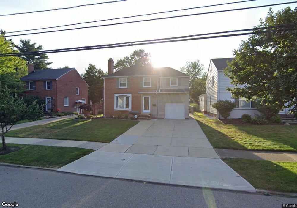
1355 Gordon Rd Cleveland, OH 44124
Estimated Value: $208,000 - $238,000
4
Beds
1
Bath
1,520
Sq Ft
$144/Sq Ft
Est. Value
About This Home
This home is located at 1355 Gordon Rd, Cleveland, OH 44124 and is currently estimated at $218,148, approximately $143 per square foot. 1355 Gordon Rd is a home located in Cuyahoga County with nearby schools including Sunview Elementary School, Greenview Upper Elementary School, and Memorial Junior High School.
Ownership History
Date
Name
Owned For
Owner Type
Purchase Details
Closed on
Sep 11, 2018
Sold by
Gambatese Karin
Bought by
Gambatese Joseph A
Current Estimated Value
Purchase Details
Closed on
Nov 26, 2008
Sold by
Gambatese Joseph A
Bought by
Gambatese Joseph A and Gambatese Karin
Purchase Details
Closed on
Jul 29, 1991
Sold by
Jukiewicz Joyce K
Bought by
Gambatese Joseph A
Purchase Details
Closed on
Dec 14, 1988
Sold by
Jukiewicz Theodore P
Bought by
Jukiewicz Joyce K
Purchase Details
Closed on
Oct 22, 1976
Sold by
Puzin Gary W
Bought by
Jukiewicz Theodore P
Purchase Details
Closed on
Jun 30, 1976
Sold by
Puzin Gary W and Puzin Rose A
Bought by
Puzin Gary W
Purchase Details
Closed on
Jan 1, 1975
Bought by
Puzin Gary W and Puzin Rose A
Create a Home Valuation Report for This Property
The Home Valuation Report is an in-depth analysis detailing your home's value as well as a comparison with similar homes in the area
Home Values in the Area
Average Home Value in this Area
Purchase History
| Date | Buyer | Sale Price | Title Company |
|---|---|---|---|
| Gambatese Joseph A | -- | None Available | |
| Gambatese Joseph A | -- | Attorney | |
| Gambatese Joseph A | $78,000 | -- | |
| Jukiewicz Joyce K | -- | -- | |
| Jukiewicz Theodore P | $40,000 | -- | |
| Puzin Gary W | -- | -- | |
| Puzin Gary W | -- | -- |
Source: Public Records
Tax History Compared to Growth
Tax History
| Year | Tax Paid | Tax Assessment Tax Assessment Total Assessment is a certain percentage of the fair market value that is determined by local assessors to be the total taxable value of land and additions on the property. | Land | Improvement |
|---|---|---|---|---|
| 2024 | $4,262 | $59,500 | $11,865 | $47,635 |
| 2023 | $4,245 | $47,880 | $9,240 | $38,640 |
| 2022 | $4,221 | $47,880 | $9,240 | $38,640 |
| 2021 | $4,187 | $47,880 | $9,240 | $38,640 |
| 2020 | $3,924 | $39,240 | $7,560 | $31,680 |
| 2019 | $3,546 | $112,100 | $21,600 | $90,500 |
| 2018 | $3,482 | $39,240 | $7,560 | $31,680 |
| 2017 | $3,464 | $36,300 | $7,390 | $28,910 |
| 2016 | $3,437 | $36,300 | $7,390 | $28,910 |
| 2015 | $3,676 | $36,300 | $7,390 | $28,910 |
| 2014 | $3,676 | $37,040 | $7,530 | $29,510 |
Source: Public Records
Map
Nearby Homes
- 1403 Churchill Rd
- 1284 Haverston Rd
- 1443 Churchill Rd
- 1368 Irene Rd
- 1399 Haverston Rd
- 1192 Blanchester Rd
- 1187 Gordon Rd
- 5268 Edenhurst Rd
- 1147 Irene Rd
- 1194 Croyden Rd
- 1151 Brainard Rd
- 1391 Iroquois Ave
- 1066 Eastlawn Dr
- 1151 Croyden Rd
- 1120 Croyden Rd
- 5204 Haverford Dr
- 5103 Eastover Rd
- 1146 Iroquois Ave
- 5118 Spencer Rd
- 5159 Haverford Dr
- 1359 Gordon Rd
- 1351 Gordon Rd
- 1367 Gordon Rd
- 1347 Gordon Rd
- 1343 Gordon Rd
- 1371 Gordon Rd
- 1360 Beaconfield Rd
- 1354 Beaconfield Rd
- 1366 Beaconfield Rd
- 1348 Beaconfield Rd
- 1356 Gordon Rd
- 1372 Beaconfield Rd
- 1339 Gordon Rd
- 1360 Gordon Rd
- 1352 Gordon Rd
- 1368 Gordon Rd
- 1348 Gordon Rd
- 1342 Beaconfield Rd
- 1378 Beaconfield Rd
- 1372 Gordon Rd