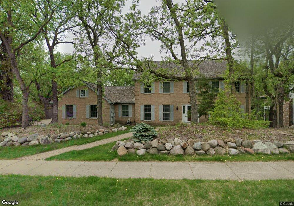
13584 Harwell Path Saint Paul, MN 55124
Alimagnet NeighborhoodEstimated Value: $562,000 - $770,000
5
Beds
4
Baths
4,580
Sq Ft
$151/Sq Ft
Est. Value
About This Home
This home is located at 13584 Harwell Path, Saint Paul, MN 55124 and is currently estimated at $693,693, approximately $151 per square foot. 13584 Harwell Path is a home located in Dakota County with nearby schools including Westview Elementary School, Falcon Ridge Middle School, and Apple Valley Senior High School.
Ownership History
Date
Name
Owned For
Owner Type
Purchase Details
Closed on
Mar 25, 2022
Sold by
Muir Cory and Levasseur Nicole
Bought by
Nelson Laura and Nelson Brian
Current Estimated Value
Home Financials for this Owner
Home Financials are based on the most recent Mortgage that was taken out on this home.
Original Mortgage
$552,000
Outstanding Balance
$514,391
Interest Rate
3.69%
Mortgage Type
New Conventional
Estimated Equity
$179,302
Purchase Details
Closed on
Oct 5, 2020
Sold by
Herskind Dennise Marie
Bought by
Muir Cory A and Levasseur Nicole J
Home Financials for this Owner
Home Financials are based on the most recent Mortgage that was taken out on this home.
Original Mortgage
$498,750
Interest Rate
2.9%
Mortgage Type
New Conventional
Purchase Details
Closed on
May 29, 2012
Sold by
Herskind Paul August
Bought by
Herskind Dennise Marie
Create a Home Valuation Report for This Property
The Home Valuation Report is an in-depth analysis detailing your home's value as well as a comparison with similar homes in the area
Home Values in the Area
Average Home Value in this Area
Purchase History
| Date | Buyer | Sale Price | Title Company |
|---|---|---|---|
| Nelson Laura | $690,000 | -- | |
| Muir Cory A | $525,000 | Cambria Title | |
| Herskind Dennise Marie | -- | None Available |
Source: Public Records
Mortgage History
| Date | Status | Borrower | Loan Amount |
|---|---|---|---|
| Open | Nelson Laura | $552,000 | |
| Previous Owner | Muir Cory A | $498,750 |
Source: Public Records
Tax History Compared to Growth
Tax History
| Year | Tax Paid | Tax Assessment Tax Assessment Total Assessment is a certain percentage of the fair market value that is determined by local assessors to be the total taxable value of land and additions on the property. | Land | Improvement |
|---|---|---|---|---|
| 2024 | $8,014 | $667,200 | $172,500 | $494,700 |
| 2023 | $8,014 | $674,600 | $172,800 | $501,800 |
| 2022 | $6,544 | $656,700 | $172,300 | $484,400 |
| 2021 | $6,386 | $552,600 | $149,800 | $402,800 |
| 2020 | $6,412 | $530,700 | $142,700 | $388,000 |
| 2019 | $5,964 | $518,700 | $135,900 | $382,800 |
| 2018 | $5,705 | $505,600 | $129,400 | $376,200 |
| 2017 | $5,904 | $463,000 | $123,200 | $339,800 |
| 2016 | $6,345 | $453,900 | $117,400 | $336,500 |
| 2015 | $6,058 | $481,900 | $115,100 | $366,800 |
| 2014 | -- | $463,400 | $110,900 | $352,500 |
| 2013 | -- | $423,100 | $102,500 | $320,600 |
Source: Public Records
Map
Nearby Homes
- 13420 Gull Ct
- 13780 Hanover Way
- 7577 138th St W
- 14010 140th Ct
- 13715 Grafton Ct
- 14080 Guthrie Ave
- 13868 Glendale Ct
- 13720 Georgia Dr
- 14132 Heywood Path
- 13413 Georgia Cir
- 13761 Hollybrook Cir
- 13751 Hollybrook Cir
- 7662 142nd St W
- 13345 Huntington Cir
- 7803 Glenda Ct
- 14172 Heywood Path
- 7291 Upper 136th St W
- 13101 Heritage Way
- 13199 Gemstone Ct
- 7342 Upper 139th St W
- 13586 Harwell Path
- 13582 Harwell Path
- 7965 Gurney Ct
- 7953 Gurney Ct
- 13589 Harwell Path
- 13588 Harwell Path
- 13587 Harwell Path
- 7975 Gurney Ct
- 7931 Gurney Ct
- 7909 Gurney Ct
- 13585 Harwell Path
- 13620 Gurney Path
- 13626 Hannibal Cir
- 13646 Hannibal Cir
- 7928 Guild Ct
- 7910 Guild Ct
- 7978 Gurney Ct
- 13664 Hannibal Cir
- 7970 Gurney Ct
- 7946 Guild Ct