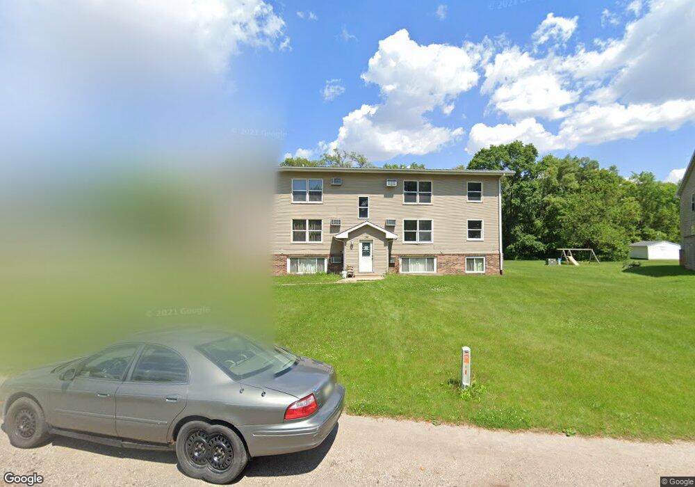
136 Earl St Unit 12 Evansdale, IA 50707
Estimated Value: $81,000 - $170,000
2
Beds
1
Bath
702
Sq Ft
$170/Sq Ft
Est. Value
About This Home
This home is located at 136 Earl St Unit 12, Evansdale, IA 50707 and is currently estimated at $119,387, approximately $170 per square foot. 136 Earl St Unit 12 is a home located in Black Hawk County with nearby schools including Poyner Elementary School, Bunger Middle School, and East High School.
Ownership History
Date
Name
Owned For
Owner Type
Purchase Details
Closed on
Nov 24, 2021
Sold by
Ramsey William E and Ramsey Margaret R
Bought by
K & L Properties Llc
Current Estimated Value
Create a Home Valuation Report for This Property
The Home Valuation Report is an in-depth analysis detailing your home's value as well as a comparison with similar homes in the area
Home Values in the Area
Average Home Value in this Area
Purchase History
| Date | Buyer | Sale Price | Title Company |
|---|---|---|---|
| K & L Properties Llc | $1,176,000 | None Listed On Document |
Source: Public Records
Tax History Compared to Growth
Tax History
| Year | Tax Paid | Tax Assessment Tax Assessment Total Assessment is a certain percentage of the fair market value that is determined by local assessors to be the total taxable value of land and additions on the property. | Land | Improvement |
|---|---|---|---|---|
| 2025 | $722 | $47,740 | $3,620 | $44,120 |
| 2024 | $722 | $47,740 | $3,620 | $44,120 |
| 2023 | $586 | $47,740 | $3,620 | $44,120 |
| 2022 | $582 | $37,740 | $2,500 | $35,240 |
| 2021 | $628 | $37,740 | $2,500 | $35,240 |
| 2020 | $622 | $37,740 | $2,500 | $35,240 |
| 2019 | $622 | $37,740 | $2,500 | $35,240 |
| 2018 | $646 | $37,740 | $2,500 | $35,240 |
| 2017 | $646 | $37,740 | $2,500 | $35,240 |
| 2016 | $642 | $37,740 | $2,500 | $35,240 |
| 2015 | $642 | $37,740 | $2,500 | $35,240 |
| 2014 | $646 | $37,740 | $2,500 | $35,240 |
Source: Public Records
Map
Nearby Homes
- 4577 Lafayette Rd
- 88 Eldene Ct
- 0.22 Acres Marion St
- Lot 10 Timberline Dr
- Lot 7 Timberline Dr
- 1107 Central Ave
- 0000 Lafayette Rd
- Lot 5 Lafayette Rd
- Lot 1 Lafayette Rd
- 421 Miner Dr
- 156 Gray St
- 101 Jackie Ave
- 1705 Michigan Dr
- 30.66 Acres Mccoy Rd
- 730 Timber Oak Rd
- 901 Brookside Ave
- 1760 Michigan Dr
- 500 Douglas Rd
- Lot 29 Fran
- Lot 13 Fran
- 136 Earl St Unit 11
- 136 Earl St Unit 10
- 136 Earl St Unit 9
- 136 Earl St Unit 8
- 136 Earl St Unit 7
- 136 Earl St Unit 6
- 136 Earl St Unit 5
- 136 Earl St Unit 4
- 136 Earl St Unit 3
- 136 Earl St Unit 2
- 136 Earl St Unit 1
- 4509 Lafayette Rd
- 4505 Lafayette Rd
- 124 Earl St Unit 12
- 124 Earl St Unit 11
- 124 Earl St Unit 10
- 124 Earl St Unit 9
- 124 Earl St Unit 8
- 124 Earl St Unit 7
- 124 Earl St Unit 6