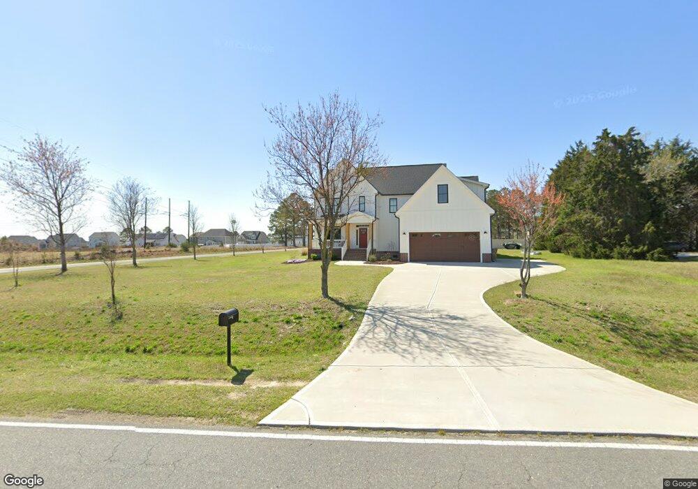
1360 Matthews Rd Clayton, NC 27520
Cleveland NeighborhoodEstimated Value: $503,000 - $803,000
3
Beds
4
Baths
3,335
Sq Ft
$190/Sq Ft
Est. Value
About This Home
This home is located at 1360 Matthews Rd, Clayton, NC 27520 and is currently estimated at $633,034, approximately $189 per square foot. 1360 Matthews Rd is a home with nearby schools including Polenta Elementary School, Swift Creek Middle, and Cleveland High School.
Ownership History
Date
Name
Owned For
Owner Type
Purchase Details
Closed on
Jul 29, 2021
Sold by
Cloudburst Investments Llc
Bought by
Bryson Donald and Bryson Amy
Current Estimated Value
Purchase Details
Closed on
Oct 5, 2020
Sold by
Parrish Gary Seba
Bought by
Cloudburst Investments Llc
Home Financials for this Owner
Home Financials are based on the most recent Mortgage that was taken out on this home.
Original Mortgage
$235,250
Interest Rate
2.9%
Mortgage Type
Future Advance Clause Open End Mortgage
Create a Home Valuation Report for This Property
The Home Valuation Report is an in-depth analysis detailing your home's value as well as a comparison with similar homes in the area
Home Values in the Area
Average Home Value in this Area
Purchase History
| Date | Buyer | Sale Price | Title Company |
|---|---|---|---|
| Bryson Donald | $85,000 | None Available | |
| Cloudburst Investments Llc | $330,000 | None Available |
Source: Public Records
Mortgage History
| Date | Status | Borrower | Loan Amount |
|---|---|---|---|
| Previous Owner | Cloudburst Investments Llc | $235,250 |
Source: Public Records
Tax History Compared to Growth
Tax History
| Year | Tax Paid | Tax Assessment Tax Assessment Total Assessment is a certain percentage of the fair market value that is determined by local assessors to be the total taxable value of land and additions on the property. | Land | Improvement |
|---|---|---|---|---|
| 2025 | $4,407 | $694,010 | $64,720 | $629,290 |
| 2024 | $3,847 | $474,880 | $36,980 | $437,900 |
| 2023 | $3,716 | $474,880 | $36,980 | $437,900 |
| 2022 | $304 | $36,980 | $36,980 | $0 |
| 2021 | $358 | $43,510 | $43,510 | $0 |
| 2020 | $362 | $43,510 | $43,510 | $0 |
| 2019 | $362 | $43,510 | $43,510 | $0 |
| 2018 | $250 | $29,370 | $29,370 | $0 |
| 2017 | $250 | $29,370 | $29,370 | $0 |
| 2016 | $250 | $29,370 | $29,370 | $0 |
| 2015 | -- | $29,370 | $29,370 | $0 |
| 2014 | -- | $29,370 | $29,370 | $0 |
Source: Public Records
Map
Nearby Homes
- 99 Barton Bay Ln
- 119 Sommerset Dr
- 13 Knotty Pine Ln
- 130 Castaway Ct
- 208 Hunting Lodge Rd
- 44 Nassau Ct
- 330 Ambassador Dr
- 280 Ambassador Dr
- 290 Ambassador Dr
- 305 Ambassador Dr
- 302 Ambassador Dr
- 320 Ambassador Dr
- 340 Ambassador Dr
- The Buford II Plan at Wellesley
- The Harrington Plan at Wellesley
- The Caldwell Plan at Wellesley
- The Braselton II Plan at Wellesley
- The Greenbrier II Plan at Wellesley
- The Bradley Plan at Wellesley
- The McGinnis Plan at Wellesley
- 0 Sonny Rd Unit 2456285
- 0 Sonny Rd
- 555 Sonny Rd
- 1350 Matthews Rd
- 1296 Matthews Rd
- 20 Ryland Dr Unit 1
- 20 Ryland Dr
- 42 Ryland Dr
- 21 Pond Mountain Dr
- 62 Ryland Dr Unit 3
- 62 Ryland Dr
- 82 Ryland Dr Unit Lot4
- 82 Ryland Dr
- 1276 Matthews Rd
- 63 Pond Mountain Dr
- 1230 Matthews Rd
- 104 Ryland Dr
- 21 Ryland Dr Unit 12
- 21 Ryland Dr
- 41 Ryland Dr Unit 11