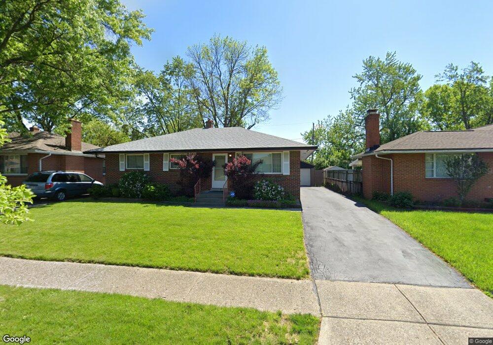
1360 Picard Rd Columbus, OH 43227
Linwood NeighborhoodEstimated Value: $196,454 - $265,000
3
Beds
2
Baths
1,160
Sq Ft
$190/Sq Ft
Est. Value
About This Home
This home is located at 1360 Picard Rd, Columbus, OH 43227 and is currently estimated at $220,864, approximately $190 per square foot. 1360 Picard Rd is a home located in Franklin County with nearby schools including Scottwood Elementary School, Johnson Park Middle School, and Walnut Ridge High School.
Ownership History
Date
Name
Owned For
Owner Type
Purchase Details
Closed on
Jul 23, 2007
Sold by
Deutsche Bank National Trust Co
Bought by
Williams Walter G and Galloway Manning
Current Estimated Value
Purchase Details
Closed on
Jul 29, 1999
Sold by
Cook Robert B and Cook Elizabeth G
Bought by
Small Stephany R
Home Financials for this Owner
Home Financials are based on the most recent Mortgage that was taken out on this home.
Original Mortgage
$78,000
Interest Rate
7.69%
Mortgage Type
VA
Purchase Details
Closed on
May 16, 1988
Bought by
Cook Robert B
Purchase Details
Closed on
Sep 1, 1986
Create a Home Valuation Report for This Property
The Home Valuation Report is an in-depth analysis detailing your home's value as well as a comparison with similar homes in the area
Home Values in the Area
Average Home Value in this Area
Purchase History
| Date | Buyer | Sale Price | Title Company |
|---|---|---|---|
| Williams Walter G | $19,900 | Chicago Tit | |
| Small Stephany R | $76,500 | Connor Title Co | |
| Cook Robert B | $59,500 | -- | |
| -- | $50,000 | -- |
Source: Public Records
Mortgage History
| Date | Status | Borrower | Loan Amount |
|---|---|---|---|
| Previous Owner | Small Stephany R | $78,000 |
Source: Public Records
Tax History Compared to Growth
Tax History
| Year | Tax Paid | Tax Assessment Tax Assessment Total Assessment is a certain percentage of the fair market value that is determined by local assessors to be the total taxable value of land and additions on the property. | Land | Improvement |
|---|---|---|---|---|
| 2024 | $2,636 | $58,730 | $13,650 | $45,080 |
| 2023 | $2,602 | $58,730 | $13,650 | $45,080 |
| 2022 | $1,547 | $29,820 | $6,930 | $22,890 |
| 2021 | $1,549 | $29,820 | $6,930 | $22,890 |
| 2020 | $1,551 | $29,820 | $6,930 | $22,890 |
| 2019 | $1,493 | $24,610 | $5,780 | $18,830 |
| 2018 | $1,482 | $24,610 | $5,780 | $18,830 |
| 2017 | $1,557 | $24,610 | $5,780 | $18,830 |
| 2016 | $1,623 | $24,500 | $4,970 | $19,530 |
| 2015 | $1,473 | $24,500 | $4,970 | $19,530 |
| 2014 | $1,477 | $24,500 | $4,970 | $19,530 |
| 2013 | $810 | $27,230 | $5,530 | $21,700 |
Source: Public Records
Map
Nearby Homes
- 3566 Seabrook Ave
- 1304 Byron Ave
- 1271 S Weyant Ave
- 3563 Astor Ave
- 3325 Towers Ct S
- 1664 Barnett Rd
- 3598 Astor Ave
- 3246 E Deshler Ave
- 3325 E Deshler Ave
- 1624 Miltwood Rd
- 3339 Towers Ct N
- 3084 Clermont Rd
- 1252 Carolwood Ave
- 1054 S Hampton Rd
- 1294 Dellwood Ave
- 1836 Penfield Ct S
- 931 E Fulton St
- 1254 Elderwood Ave
- 892 Ruby Ave
- 1220 Elderwood Ave
- 1352 Picard Rd
- 1368 Picard Rd
- 1346 Picard Rd
- 1374 Picard Rd
- 1365 Cunard Rd
- 1373 Cunard Rd
- 1359 Cunard Rd
- 1379 Cunard Rd
- 1351 Cunard Rd
- 1340 Picard Rd
- 1357 Picard Rd
- 1365 Picard Rd
- 1349 Picard Rd
- 3462 Seabrook Ave
- 3456 Seabrook Ave
- 1343 Picard Rd
- 1371 Picard Rd
- 1345 Cunard Rd
- 3470 Seabrook Ave
- 1330 Picard Rd