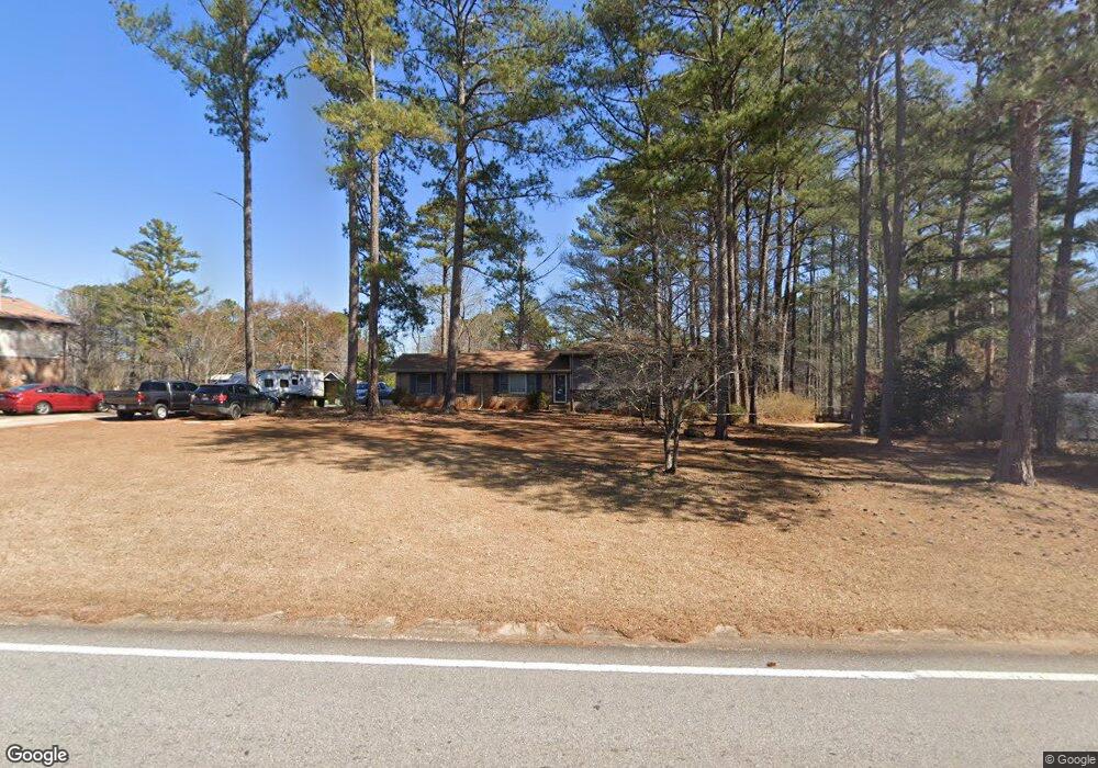
1362 Flat Rock Rd Stockbridge, GA 30281
Estimated Value: $248,000 - $286,000
3
Beds
2
Baths
2,004
Sq Ft
$134/Sq Ft
Est. Value
About This Home
This home is located at 1362 Flat Rock Rd, Stockbridge, GA 30281 and is currently estimated at $268,982, approximately $134 per square foot. 1362 Flat Rock Rd is a home located in Henry County with nearby schools including Cotton Indian Elementary School, Stockbridge Middle School, and Stockbridge High School.
Ownership History
Date
Name
Owned For
Owner Type
Purchase Details
Closed on
Aug 21, 2020
Sold by
Dewolfe Leonard
Bought by
Clinton Darrin
Current Estimated Value
Home Financials for this Owner
Home Financials are based on the most recent Mortgage that was taken out on this home.
Original Mortgage
$157,712
Outstanding Balance
$139,902
Interest Rate
3%
Mortgage Type
New Conventional
Estimated Equity
$129,080
Purchase Details
Closed on
Dec 17, 1998
Sold by
Pancake Linda M
Bought by
Dewolfe Leonard and Dewolfe Judy A
Home Financials for this Owner
Home Financials are based on the most recent Mortgage that was taken out on this home.
Original Mortgage
$89,150
Interest Rate
6.94%
Mortgage Type
New Conventional
Purchase Details
Closed on
Dec 22, 1995
Sold by
Martin Ralph
Bought by
Pancake Linda
Create a Home Valuation Report for This Property
The Home Valuation Report is an in-depth analysis detailing your home's value as well as a comparison with similar homes in the area
Home Values in the Area
Average Home Value in this Area
Purchase History
| Date | Buyer | Sale Price | Title Company |
|---|---|---|---|
| Clinton Darrin | $155,000 | -- | |
| Dewolfe Leonard | $104,900 | -- | |
| Pancake Linda | $90,000 | -- |
Source: Public Records
Mortgage History
| Date | Status | Borrower | Loan Amount |
|---|---|---|---|
| Open | Clinton Darrin | $157,712 | |
| Previous Owner | Dewolfe Leonard | $89,150 | |
| Closed | Pancake Linda | $0 |
Source: Public Records
Tax History Compared to Growth
Tax History
| Year | Tax Paid | Tax Assessment Tax Assessment Total Assessment is a certain percentage of the fair market value that is determined by local assessors to be the total taxable value of land and additions on the property. | Land | Improvement |
|---|---|---|---|---|
| 2025 | $2,981 | $99,800 | $12,600 | $87,200 |
| 2024 | $2,981 | $97,200 | $12,600 | $84,600 |
| 2023 | $2,294 | $90,040 | $12,600 | $77,440 |
| 2022 | $2,502 | $77,480 | $9,000 | $68,480 |
| 2021 | $2,389 | $61,240 | $9,000 | $52,240 |
| 2020 | $508 | $51,360 | $7,200 | $44,160 |
| 2019 | $495 | $45,920 | $7,200 | $38,720 |
| 2018 | $389 | $38,720 | $7,200 | $31,520 |
| 2016 | $301 | $32,760 | $5,400 | $27,360 |
| 2015 | $247 | $28,080 | $5,400 | $22,680 |
| 2014 | $217 | $25,880 | $3,960 | $21,920 |
Source: Public Records
Map
Nearby Homes
- 0 Flakes Rd Unit 24
- 30 Hickory Dr
- 0 Freeman Dr Unit 128 10480940
- 0 Freeman #128 Dr
- 90 Chimney Rise Ct
- 297 Edison Dr
- 0 Chimney Smoke Dr Unit 10640945
- 0 Chimney Smoke Dr Unit 182111
- 277 Edison Dr
- 128 Belair Ln Unit 1
- 1527 Old Conyers Rd Unit 4
- 0 Oakview Dr Unit 10472931
- 0 Oakview Dr Unit 7533331
- 193 Edison Dr
- 0 Old Conyers Rd Unit 10574658
- 364 Sound Cir
- 109 Greenwood Dr
- 115 Lakeview Dr
- 176 Swan Lake Dr
- 110 Wildwood Dr
- 1348 Flat Rock Rd
- 1376 Flat Rock Rd
- 10 Oakridge Ct
- 70 Smoke Rise Ct
- 1338 Flat Rock Rd
- 1359 Flat Rock Rd
- 1369 Flat Rock Rd
- 80 Smoke Rise Ct
- 20 Oakridge Ct
- 1349 Flat Rock Rd
- 1398 Flat Rock Rd
- 1398 Flat Rock Rd Unit 2
- 1381 Flat Rock Rd
- 1339 Flat Rock Rd
- 60 Smoke Rise Ct
- 0 Smoke Rise Ct
- 40 Oakridge Ct
- 1389 Flat Rock Rd
- 30 Oakridge Ct
- 20 Chimney Ridge Trail Unit 1