Estimated Value: $115,838 - $161,000
3
Beds
1
Bath
1,480
Sq Ft
$90/Sq Ft
Est. Value
About This Home
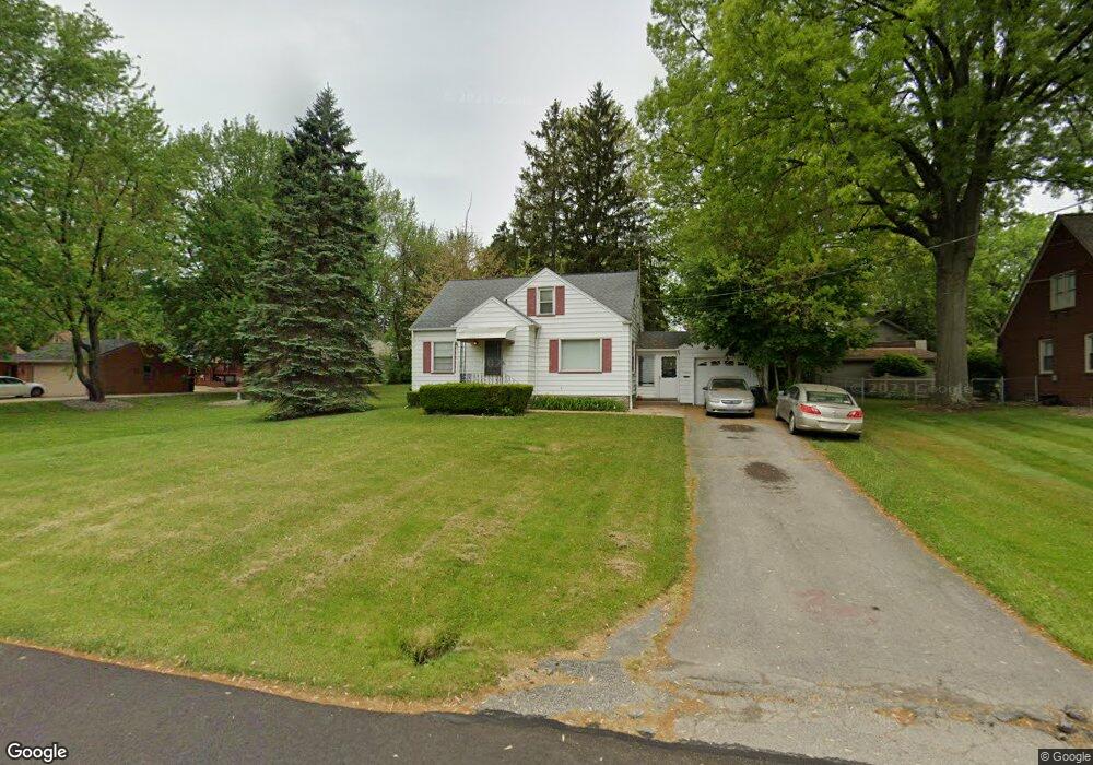
This home is located at 1364 Clark St, Niles, OH 44446 and is currently estimated at $133,210, approximately $90 per square foot. 1364 Clark St is a home located in Trumbull County with nearby schools including Niles Primary School, Niles Intermediate School, and Niles Middle School.
Ownership History
Date
Name
Owned For
Owner Type
Purchase Details
Closed on
Jan 13, 2006
Sold by
Dechristopher Rose
Bought by
Cook Michelle A
Current Estimated Value
Home Financials for this Owner
Home Financials are based on the most recent Mortgage that was taken out on this home.
Original Mortgage
$80,000
Outstanding Balance
$49,794
Interest Rate
8.15%
Mortgage Type
Adjustable Rate Mortgage/ARM
Estimated Equity
$83,416
Purchase Details
Closed on
Sep 13, 2001
Sold by
Dechristopher Peter S
Bought by
Dechristopher Rose
Purchase Details
Closed on
Jan 1, 1990
Bought by
Peter S Dechristopher
Create a Home Valuation Report for This Property
The Home Valuation Report is an in-depth analysis detailing your home's value as well as a comparison with similar homes in the area
Home Values in the Area
Average Home Value in this Area
Purchase History
| Date | Buyer | Sale Price | Title Company |
|---|---|---|---|
| Cook Michelle A | $80,000 | -- | |
| Dechristopher Rose | -- | -- | |
| Peter S Dechristopher | -- | -- |
Source: Public Records
Mortgage History
| Date | Status | Borrower | Loan Amount |
|---|---|---|---|
| Open | Dechristopher Rose | $80,000 |
Source: Public Records
Tax History
| Year | Tax Paid | Tax Assessment Tax Assessment Total Assessment is a certain percentage of the fair market value that is determined by local assessors to be the total taxable value of land and additions on the property. | Land | Improvement |
|---|---|---|---|---|
| 2024 | $1,312 | $31,150 | $2,660 | $28,490 |
| 2023 | $1,299 | $31,150 | $2,660 | $28,490 |
| 2022 | $1,094 | $22,400 | $2,660 | $19,740 |
| 2021 | $1,149 | $22,400 | $2,660 | $19,740 |
| 2020 | $1,159 | $22,400 | $2,660 | $19,740 |
| 2019 | $1,218 | $22,400 | $2,660 | $19,740 |
| 2018 | $1,214 | $22,400 | $2,660 | $19,740 |
| 2017 | $1,208 | $22,400 | $2,660 | $19,740 |
| 2016 | $1,132 | $20,790 | $2,660 | $18,130 |
| 2015 | $1,119 | $20,790 | $2,660 | $18,130 |
| 2014 | $1,123 | $20,790 | $2,660 | $18,130 |
| 2013 | $1,191 | $23,280 | $2,660 | $20,620 |
Source: Public Records
Map
Nearby Homes
- 1442 Youll St
- 340 Mcevoy Ct
- 1236 Robbins Ave
- 352 N Rhodes Ave
- 21 Summit Ave
- 1436 Clinton St
- 32 Summit Ave
- 45 Summit Ave
- 126 S Rhodes Ave
- 412 Orchard Ave
- 214 N Bentley Ave
- 29 S Bentley Ave
- 404 N Bentley Ave
- 166 Oak Knoll St SE
- 311 High Ave
- 812 Hartzell Ave
- 307 Peffer Ave
- 820 Hartzell Ave
- 1919 Carnegie Heights Dr
- 1675 Roosevelt Ave
Your Personal Tour Guide
Ask me questions while you tour the home.