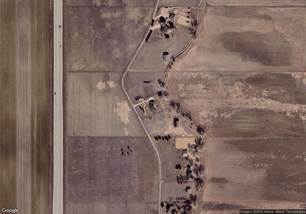
13660 Davis Ln Longmont, CO 80504
Estimated Value: $1,494,000 - $3,074,257
5
Beds
5
Baths
7,559
Sq Ft
$276/Sq Ft
Est. Value
About This Home
This home is located at 13660 Davis Ln, Longmont, CO 80504 and is currently estimated at $2,085,419, approximately $275 per square foot. 13660 Davis Ln is a home located in Boulder County with nearby schools including Mead Elementary School, Mead Middle School, and Mead High School.
Ownership History
Date
Name
Owned For
Owner Type
Purchase Details
Closed on
Mar 3, 2008
Sold by
Parker Adam and Parker Jodi L
Bought by
Neveu Linda K and Newton Grant L
Current Estimated Value
Home Financials for this Owner
Home Financials are based on the most recent Mortgage that was taken out on this home.
Original Mortgage
$412,500
Interest Rate
5.47%
Mortgage Type
Purchase Money Mortgage
Purchase Details
Closed on
Feb 5, 1999
Sold by
Holt John M and Holt Cynthia A
Bought by
Department Of Transportation
Purchase Details
Closed on
Jul 21, 1993
Bought by
Neveu Linda K and Newton Grant L
Purchase Details
Closed on
May 18, 1993
Bought by
Neveu Linda K and Newton Grant L
Purchase Details
Closed on
Dec 31, 1984
Bought by
Neveu Linda K and Newton Grant L
Create a Home Valuation Report for This Property
The Home Valuation Report is an in-depth analysis detailing your home's value as well as a comparison with similar homes in the area
Home Values in the Area
Average Home Value in this Area
Purchase History
| Date | Buyer | Sale Price | Title Company |
|---|---|---|---|
| Neveu Linda K | $550,000 | Utc Colorado | |
| Department Of Transportation | $9,870 | -- | |
| Neveu Linda K | $150,000 | -- | |
| Neveu Linda K | -- | -- | |
| Neveu Linda K | $999,000 | -- |
Source: Public Records
Mortgage History
| Date | Status | Borrower | Loan Amount |
|---|---|---|---|
| Closed | Neveu Linda K | $412,500 |
Source: Public Records
Tax History Compared to Growth
Tax History
| Year | Tax Paid | Tax Assessment Tax Assessment Total Assessment is a certain percentage of the fair market value that is determined by local assessors to be the total taxable value of land and additions on the property. | Land | Improvement |
|---|---|---|---|---|
| 2025 | $17,062 | $147,892 | $7,714 | $140,178 |
| 2024 | $17,062 | $147,892 | $7,714 | $140,178 |
| 2023 | $17,062 | $175,240 | $6,468 | $172,457 |
| 2022 | $13,797 | $135,223 | $7,973 | $127,250 |
| 2021 | $14,211 | $141,411 | $8,758 | $132,653 |
| 2020 | $14,164 | $141,354 | $7,917 | $133,437 |
| 2019 | $13,944 | $141,354 | $7,917 | $133,437 |
| 2018 | $9,283 | $94,599 | $8,033 | $86,566 |
| 2017 | $8,735 | $103,736 | $8,033 | $95,703 |
| 2016 | $8,367 | $88,763 | $7,627 | $81,136 |
| 2015 | $7,968 | $82,815 | $5,539 | $77,276 |
| 2014 | $7,627 | $82,815 | $5,539 | $77,276 |
Source: Public Records
Map
Nearby Homes
- 12910 Woodridge Dr
- 12924 Woodridge Dr
- 13103 Woodridge Dr
- 1140 Parker Dr
- 14619 N 115th St
- 841 Crisman Dr Unit 9
- 2339 Whistler Dr
- 2391 Whistler Dr
- 221 Homestead Pkwy
- 10650 Yellowstone Rd
- 2220 Meadow St
- 2213 Emery St Unit C
- 1512 Flemming Dr
- 2217 Steppe Dr
- 2143 Meadow Ct
- 2144 Collyer St
- 2148 Meadow Ct
- 13168 N 95th St
- 2217 Medford St
- 2258 Whistler Dr
- 0 Davis Ln
- 13770 Davis Ln
- 10901 Vermillion Rd
- 10905 Vermillion Rd
- 10900 Vermillion Rd
- 11197 Vermillion Rd
- 13224 N 107th St
- 13103 N 107th St
- 11313 Vermillion Rd
- 13497 Darby Ln
- 11399 Vermillion Rd
- 13431 Darby Ln
- 11419 Vermillion Rd
- 14222 N 107th St
- 13172 Woodridge Dr
- 13455 Darby Ln
- 13154 Woodridge Dr
- 13685 N 115th St
- 13651 N 115th St
- 11435 Vermillion Rd
