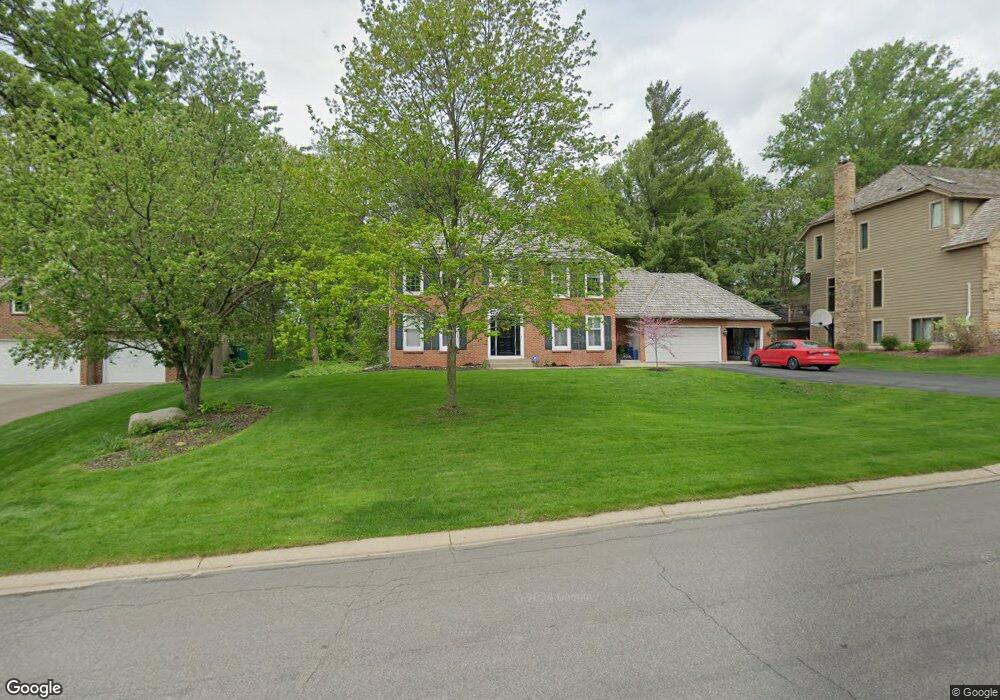
13663 Hannibal Cir Saint Paul, MN 55124
Alimagnet NeighborhoodEstimated Value: $539,000 - $652,000
4
Beds
3
Baths
2,676
Sq Ft
$219/Sq Ft
Est. Value
About This Home
This home is located at 13663 Hannibal Cir, Saint Paul, MN 55124 and is currently estimated at $586,093, approximately $219 per square foot. 13663 Hannibal Cir is a home located in Dakota County with nearby schools including Westview Elementary School, Falcon Ridge Middle School, and Apple Valley Senior High School.
Ownership History
Date
Name
Owned For
Owner Type
Purchase Details
Closed on
Jul 28, 2005
Sold by
Beres Robert O and Rackliffe Paige
Bought by
Hoster Stephen M and Hoster Sheila B
Current Estimated Value
Purchase Details
Closed on
Jun 12, 2003
Sold by
Hoster Stephen M and Hoster Sheila B
Bought by
Beres Robert and Beres Paige Rockliffe
Create a Home Valuation Report for This Property
The Home Valuation Report is an in-depth analysis detailing your home's value as well as a comparison with similar homes in the area
Home Values in the Area
Average Home Value in this Area
Purchase History
| Date | Buyer | Sale Price | Title Company |
|---|---|---|---|
| Hoster Stephen M | $425,000 | -- | |
| Beres Robert | $390,500 | -- |
Source: Public Records
Tax History Compared to Growth
Tax History
| Year | Tax Paid | Tax Assessment Tax Assessment Total Assessment is a certain percentage of the fair market value that is determined by local assessors to be the total taxable value of land and additions on the property. | Land | Improvement |
|---|---|---|---|---|
| 2024 | $6,180 | $527,400 | $179,100 | $348,300 |
| 2023 | $6,180 | $537,800 | $179,500 | $358,300 |
| 2022 | $5,202 | $524,300 | $178,900 | $345,400 |
| 2021 | $5,120 | $446,700 | $155,600 | $291,100 |
| 2020 | $5,146 | $429,900 | $150,900 | $279,000 |
| 2019 | $4,818 | $419,000 | $143,700 | $275,300 |
| 2018 | $4,643 | $409,600 | $136,800 | $272,800 |
| 2017 | $4,866 | $379,200 | $130,300 | $248,900 |
| 2016 | $5,195 | $376,700 | $124,100 | $252,600 |
| 2015 | $4,905 | $394,182 | $121,202 | $272,980 |
| 2014 | -- | $374,453 | $116,292 | $258,161 |
| 2013 | -- | $335,649 | $106,356 | $229,293 |
Source: Public Records
Map
Nearby Homes
- 13420 Gull Ct
- 13780 Hanover Way
- 13902 Herald Way
- 13910 Herald Ct
- 14010 140th Ct
- 14080 Guthrie Ave
- 14132 Heywood Path
- 7577 138th St W
- 13761 Hollybrook Cir
- 13715 Grafton Ct
- 13751 Hollybrook Cir
- 14172 Heywood Path
- 13731 Hollybrook Cir
- 13727 Hollybrook Cir
- 13345 Huntington Cir
- The Sophia Plan at Eagle Pointe - Townhomes
- The Amelia Plan at Eagle Pointe - Townhomes
- The Magnolia Plan at Eagle Pointe - Townhomes
- The Nolan Plan at Eagle Pointe - Townhomes
- 13868 Glendale Ct
- 13645 Hannibal Cir
- 13681 Hannibal Cir
- 13644 Harmony Way
- 13600 Harwell Path
- 13664 Hannibal Cir
- 13646 Harmony Way
- 13701 Hannibal Cir
- 13625 Hannibal Cir
- 13646 Hannibal Cir
- 13682 Hannibal Cir
- 13610 Harwell Path
- 13626 Hannibal Cir
- 13648 Harmony Way
- 13702 Hannibal Cir
- 13620 Harwell Path
- 7975 Gurney Ct
- 13721 Hannibal Cir
- 13630 Harwell Path
- 7978 Gurney Ct
- 13588 Harwell Path