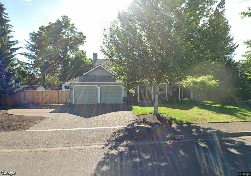
1367 Barrington Ave Eugene, OR 97401
Harlow NeighborhoodEstimated Value: $607,819 - $703,000
3
Beds
3
Baths
1,922
Sq Ft
$343/Sq Ft
Est. Value
About This Home
This home is located at 1367 Barrington Ave, Eugene, OR 97401 and is currently estimated at $659,705, approximately $343 per square foot. 1367 Barrington Ave is a home located in Lane County with nearby schools including Holt Elementary School, Monroe Middle School, and Sheldon High School.
Ownership History
Date
Name
Owned For
Owner Type
Purchase Details
Closed on
Apr 17, 2025
Sold by
Cowin Don
Bought by
Donald R Cowin Trust and Cowin
Current Estimated Value
Purchase Details
Closed on
May 19, 2004
Sold by
Wichmann Richard A and Wichmann Kelly L
Bought by
Cowin Susan and Cowin Don
Home Financials for this Owner
Home Financials are based on the most recent Mortgage that was taken out on this home.
Original Mortgage
$222,300
Interest Rate
5.77%
Mortgage Type
Purchase Money Mortgage
Create a Home Valuation Report for This Property
The Home Valuation Report is an in-depth analysis detailing your home's value as well as a comparison with similar homes in the area
Home Values in the Area
Average Home Value in this Area
Purchase History
| Date | Buyer | Sale Price | Title Company |
|---|---|---|---|
| Donald R Cowin Trust | -- | None Listed On Document | |
| Cowin Susan | $277,900 | Fidelity National Title Insu |
Source: Public Records
Mortgage History
| Date | Status | Borrower | Loan Amount |
|---|---|---|---|
| Previous Owner | Cowin Susan | $222,300 | |
| Closed | Cowin Susan | $41,600 |
Source: Public Records
Tax History
| Year | Tax Paid | Tax Assessment Tax Assessment Total Assessment is a certain percentage of the fair market value that is determined by local assessors to be the total taxable value of land and additions on the property. | Land | Improvement |
|---|---|---|---|---|
| 2025 | $7,854 | $403,087 | -- | -- |
| 2024 | $7,756 | $391,347 | -- | -- |
| 2023 | $7,756 | $379,949 | -- | -- |
| 2022 | $7,266 | $368,883 | $0 | $0 |
| 2021 | $6,825 | $358,139 | $0 | $0 |
| 2020 | $6,788 | $347,708 | $0 | $0 |
| 2019 | $6,546 | $337,581 | $0 | $0 |
| 2018 | $6,167 | $318,203 | $0 | $0 |
| 2017 | $5,831 | $318,203 | $0 | $0 |
| 2016 | $5,516 | $308,935 | $0 | $0 |
| 2015 | $5,380 | $299,937 | $0 | $0 |
| 2014 | $5,251 | $291,201 | $0 | $0 |
Source: Public Records
Map
Nearby Homes
- 1491 Victorian Way
- 1270 Calvin St
- 0 Sprig Ln Unit Lot 3
- 0 Sprig Ln Unit Lot 3 766109892
- 3025 Bailey Ln
- 1564 Regency Dr
- 3090 Willakenzie Rd
- 1271 Arcadia Dr
- 1038 President St
- 860 N van Duyn St
- 1794 Kings St N
- 3700 Babcock Ln Unit 119
- 3700 Babcock Ln Unit 106
- 825 Waverly St
- 1993 Best Ln
- 2872 Suffolk Ct
- 950 Coburg Rd
- 2746 Harlow Rd
- 2994 Dapple Way
- 2727 Gateway St Unit 27
- 1345 Barrington Ave
- 1387 Barrington Ave
- 1364 Victorian Way
- 0 Barrington Ave Unit 19009921
- 0 Barrington Ave Unit 8104599
- 0 Barrington Ave Unit 9 9039204
- 0 Barrington Ave Unit 1-4
- 0 Barrington Ave Unit 5-9
- 1368 Barrington Ave
- 1396 Victorian Way
- 1332 Victorian Way
- 1346 Barrington Ave
- 1388 Barrington Ave
- 1411 Barrington Ave
- 1323 Barrington Ave
- 1414 Victorian Way
- 1324 Barrington Ave
- 1389 Bogart Ln
- 1310 Victorian Way
- 1410 Barrington Ave
Your Personal Tour Guide
Ask me questions while you tour the home.