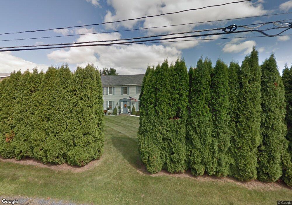
1367 Brookside Rd Allentown, PA 18106
Estimated Value: $504,910 - $530,000
4
Beds
3
Baths
2,184
Sq Ft
$235/Sq Ft
Est. Value
About This Home
This home is located at 1367 Brookside Rd, Allentown, PA 18106 and is currently estimated at $513,728, approximately $235 per square foot. 1367 Brookside Rd is a home located in Lehigh County with nearby schools including Wescosville Elementary School, Lower Macungie Middle School, and Emmaus High School.
Ownership History
Date
Name
Owned For
Owner Type
Purchase Details
Closed on
Apr 19, 2004
Sold by
Salabsky James J and Salabsky Deborah K
Bought by
Iusmen Aurica
Current Estimated Value
Home Financials for this Owner
Home Financials are based on the most recent Mortgage that was taken out on this home.
Original Mortgage
$186,560
Outstanding Balance
$104,629
Interest Rate
8.5%
Mortgage Type
Purchase Money Mortgage
Estimated Equity
$409,099
Purchase Details
Closed on
Sep 8, 1987
Sold by
Yasitshik Andrew
Bought by
Salabsky James J and Salabsky Deborah K
Purchase Details
Closed on
Apr 30, 1980
Bought by
Yasitshik Andrew
Create a Home Valuation Report for This Property
The Home Valuation Report is an in-depth analysis detailing your home's value as well as a comparison with similar homes in the area
Home Values in the Area
Average Home Value in this Area
Purchase History
| Date | Buyer | Sale Price | Title Company |
|---|---|---|---|
| Iusmen Aurica | $233,200 | -- | |
| Salabsky James J | $123,000 | -- | |
| Yasitshik Andrew | -- | -- |
Source: Public Records
Mortgage History
| Date | Status | Borrower | Loan Amount |
|---|---|---|---|
| Open | Iusmen Aurica | $186,560 | |
| Closed | Iusmen Aurica | $34,980 |
Source: Public Records
Tax History Compared to Growth
Tax History
| Year | Tax Paid | Tax Assessment Tax Assessment Total Assessment is a certain percentage of the fair market value that is determined by local assessors to be the total taxable value of land and additions on the property. | Land | Improvement |
|---|---|---|---|---|
| 2025 | $6,375 | $249,700 | $41,400 | $208,300 |
| 2024 | $6,168 | $249,700 | $41,400 | $208,300 |
| 2023 | $6,044 | $249,700 | $41,400 | $208,300 |
| 2022 | $5,901 | $249,700 | $208,300 | $41,400 |
| 2021 | $5,776 | $249,700 | $41,400 | $208,300 |
| 2020 | $5,721 | $249,700 | $41,400 | $208,300 |
| 2019 | $5,623 | $249,700 | $41,400 | $208,300 |
| 2018 | $5,550 | $249,700 | $41,400 | $208,300 |
| 2017 | $5,453 | $249,700 | $41,400 | $208,300 |
| 2016 | -- | $249,700 | $41,400 | $208,300 |
| 2015 | -- | $249,700 | $41,400 | $208,300 |
| 2014 | -- | $249,700 | $41,400 | $208,300 |
Source: Public Records
Map
Nearby Homes
- 1385 Brookside Rd
- 5133 Meadow Ln
- 4881 Spruce Rd
- 5300 Hanover Dr
- 5280 Townsquare Dr
- 1675 Hamlet Dr
- 997 Village Round Unit K
- 997K Village Round Unit 104K
- 1037 Village Round Unit L
- 1270 Minesite Rd
- 5524 Stonecroft Ln
- 4626 N Hedgerow Dr
- 5673 Wedge Ln
- 5475 Hamilton Blvd Unit 7
- 1045 Barnside Rd
- 5175 Meadowview Dr
- 5619 Stonecroft Ln
- 5736 Greens Dr
- 1991 Autumn Ridge Rd
- 2173 Brookside Rd
- 1345 Brookside Rd
- 1340 Brookside Rd
- 1402 Dayspring Dr
- 1335 Brookside Rd
- 1350 Brookside Rd
- 1362 Dayspring Dr
- 1425 Brookside Rd
- 1398 Brookside Rd
- 1386 Brookside Rd
- 1346 Dayspring Dr
- 1424 Dayspring Dr
- 1368 Brookside Rd
- 1373 Dayspring Dr
- 1393 Dayspring Dr
- 1428 Dove Terrace
- 1316 Dayspring Dr
- 1408 Brookside Rd
- 5065 Faith Cir
- 1325 Brookside Rd
- 1434 Dove Terrace