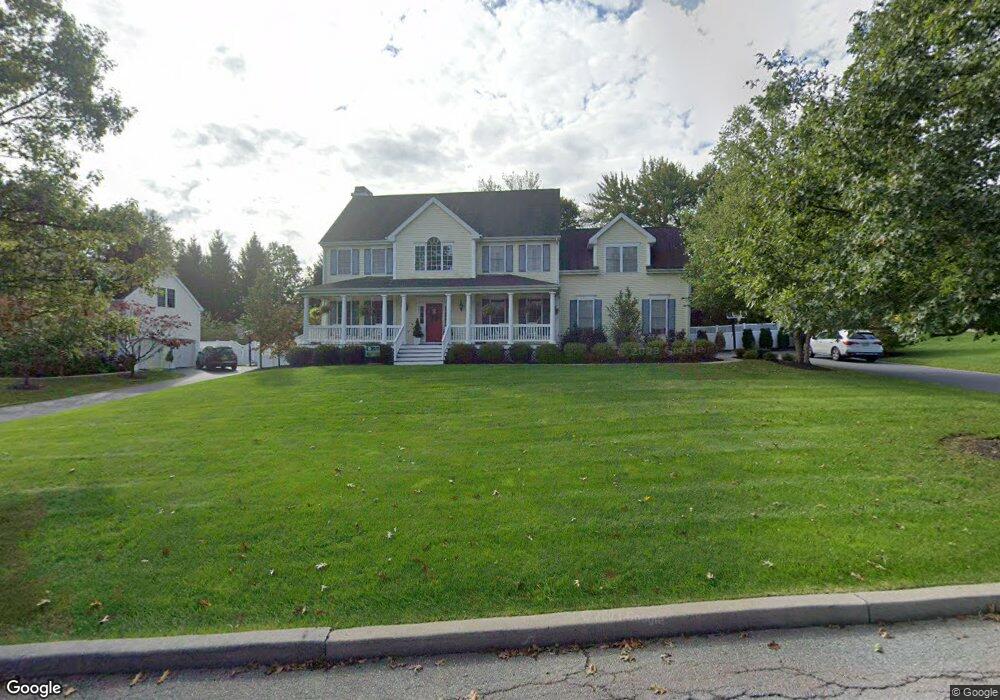
1369 High Point Dr Mohegan Lake, NY 10547
Estimated Value: $894,000 - $1,167,000
4
Beds
2
Baths
2,667
Sq Ft
$374/Sq Ft
Est. Value
About This Home
This home is located at 1369 High Point Dr, Mohegan Lake, NY 10547 and is currently estimated at $998,339, approximately $374 per square foot. 1369 High Point Dr is a home located in Westchester County with nearby schools including Benjamin Franklin Elementary School, Lakeland-Copper Beech Middle School, and Shrub Oak International School.
Ownership History
Date
Name
Owned For
Owner Type
Purchase Details
Closed on
Jul 5, 2005
Sold by
Depaoli Louis G and Depaoli Kathleen
Bought by
Farroni Anthony and Farroni Natalie
Current Estimated Value
Home Financials for this Owner
Home Financials are based on the most recent Mortgage that was taken out on this home.
Original Mortgage
$250,000
Outstanding Balance
$129,912
Interest Rate
5.59%
Mortgage Type
Purchase Money Mortgage
Estimated Equity
$868,427
Purchase Details
Closed on
Feb 28, 2001
Sold by
Wb Yorktown Llc
Bought by
Depaoli Louis G and Depaoli Kathleen
Home Financials for this Owner
Home Financials are based on the most recent Mortgage that was taken out on this home.
Original Mortgage
$411,200
Interest Rate
6.96%
Mortgage Type
Purchase Money Mortgage
Create a Home Valuation Report for This Property
The Home Valuation Report is an in-depth analysis detailing your home's value as well as a comparison with similar homes in the area
Home Values in the Area
Average Home Value in this Area
Purchase History
| Date | Buyer | Sale Price | Title Company |
|---|---|---|---|
| Farroni Anthony | $815,000 | -- | |
| Depaoli Louis G | $516,056 | -- |
Source: Public Records
Mortgage History
| Date | Status | Borrower | Loan Amount |
|---|---|---|---|
| Open | Farroni Anthony | $250,000 | |
| Previous Owner | Depaoli Louis G | $411,200 |
Source: Public Records
Tax History Compared to Growth
Tax History
| Year | Tax Paid | Tax Assessment Tax Assessment Total Assessment is a certain percentage of the fair market value that is determined by local assessors to be the total taxable value of land and additions on the property. | Land | Improvement |
|---|---|---|---|---|
| 2024 | $20,885 | $13,600 | $2,950 | $10,650 |
| 2023 | $19,359 | $13,600 | $2,950 | $10,650 |
| 2022 | $18,935 | $13,600 | $2,950 | $10,650 |
| 2021 | $18,298 | $13,600 | $2,950 | $10,650 |
| 2020 | $18,342 | $13,600 | $2,950 | $10,650 |
| 2019 | $18,296 | $13,600 | $2,950 | $10,650 |
| 2018 | $18,067 | $13,600 | $2,950 | $10,650 |
| 2017 | $11,778 | $13,600 | $2,950 | $10,650 |
| 2016 | $25,209 | $13,600 | $2,950 | $10,650 |
| 2015 | $12,591 | $13,600 | $2,950 | $10,650 |
| 2014 | $12,591 | $13,600 | $2,950 | $10,650 |
| 2013 | $12,591 | $13,600 | $2,950 | $10,650 |
Source: Public Records
Map
Nearby Homes
- 3370 Spruce St
- 3300 Baker St Unit 16
- 1523 Kimble Ave
- 3481 Lakeside Dr
- 0 Sagamore Ave
- 1708 Fieldstone Manor Dr
- 1713 Jessica Ct
- 3183 Dale St
- 108 Sunfish Landing
- 54 Tennis Court Ln Unit 54
- 172 Ridgeview Ln
- 13 Acorn Ln
- 422 Panorama Dr
- 103 Norfolk Ct
- 24 Leisure Way
- 1728 Decatur Rd
- 3167 Lincoln Dr
- 21 Kenneth Stuart Place Unit A
- 2950 Stony St
- 1645 Amazon Rd Unit 1645
- 1363 High Point Dr
- 1375 High Point Dr
- 1320 Lydia Ct
- 1312 Lydia Ct
- 1355 High Point Dr
- 1328 Lydia Ct
- 1368 High Point Dr
- 1376 High Point Dr
- 3344 Spruce St
- 1384 High Point Dr
- 3336 Spruce St
- 1360 High Point Dr
- 1306 Lydia Ct
- 3328 Spruce St
- 1321 Lydia Ct
- 1315 Lydia Ct
- 1313 Lydia Ct
- 3361 Peach Ct
- 3360 Spruce St
- 3318 Spruce St