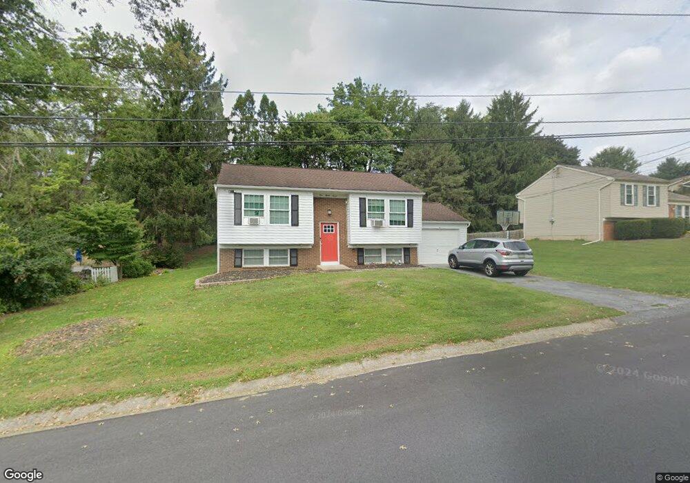
137 Kent Rd Lancaster, PA 17603
Wheatland NeighborhoodEstimated Value: $316,317 - $336,000
3
Beds
2
Baths
1,480
Sq Ft
$219/Sq Ft
Est. Value
About This Home
This home is located at 137 Kent Rd, Lancaster, PA 17603 and is currently estimated at $323,579, approximately $218 per square foot. 137 Kent Rd is a home located in Lancaster County with nearby schools including Hambright Elementary School, Manor Middle School, and Penn Manor High School.
Ownership History
Date
Name
Owned For
Owner Type
Purchase Details
Closed on
Dec 23, 2010
Sold by
Fulmer Linda M
Bought by
Weinlein Paul Andrew
Current Estimated Value
Home Financials for this Owner
Home Financials are based on the most recent Mortgage that was taken out on this home.
Original Mortgage
$133,075
Outstanding Balance
$89,164
Interest Rate
4.5%
Mortgage Type
FHA
Estimated Equity
$234,415
Create a Home Valuation Report for This Property
The Home Valuation Report is an in-depth analysis detailing your home's value as well as a comparison with similar homes in the area
Home Values in the Area
Average Home Value in this Area
Purchase History
| Date | Buyer | Sale Price | Title Company |
|---|---|---|---|
| Weinlein Paul Andrew | $146,900 | None Available |
Source: Public Records
Mortgage History
| Date | Status | Borrower | Loan Amount |
|---|---|---|---|
| Open | Weinlein Paul Andrew | $133,075 |
Source: Public Records
Tax History
| Year | Tax Paid | Tax Assessment Tax Assessment Total Assessment is a certain percentage of the fair market value that is determined by local assessors to be the total taxable value of land and additions on the property. | Land | Improvement |
|---|---|---|---|---|
| 2025 | $2,972 | $136,100 | $45,200 | $90,900 |
| 2024 | $2,972 | $136,100 | $45,200 | $90,900 |
| 2023 | $2,972 | $136,100 | $45,200 | $90,900 |
| 2022 | $2,916 | $136,100 | $45,200 | $90,900 |
| 2021 | $2,842 | $136,100 | $45,200 | $90,900 |
| 2020 | $2,842 | $136,100 | $45,200 | $90,900 |
| 2019 | $2,763 | $136,100 | $45,200 | $90,900 |
| 2018 | $2,112 | $136,100 | $45,200 | $90,900 |
| 2017 | $2,737 | $112,800 | $34,400 | $78,400 |
| 2016 | $2,737 | $112,800 | $34,400 | $78,400 |
| 2015 | $563 | $112,800 | $34,400 | $78,400 |
| 2014 | $1,868 | $112,800 | $34,400 | $78,400 |
Source: Public Records
Map
Nearby Homes
- 129 Townhouse Ln
- 2210 Berkshire Rd
- 1522 Manor Blvd
- 408 Fairway Dr
- 323 Millersville Rd
- 1113 Williamsburg Rd
- 1038 Monticello Ln
- 266 Redwood Dr
- 4 Bunker Hill
- 1098 Monticello Ln
- 203 Thrush Ct N
- 105 Silverwind Ct S
- 526 White Chapel Rd
- 104 Fox Run Ct
- 215 Fawn Meadow Crossing
- 121 Pheasant Ridge Cir
- 114 Pheasant Ridge Cir
- 549 Oak Ridge Dr
- 31 Manor Ave
- 2707 Kimberly Rd
- 133 Kent Rd
- 141 Kent Rd
- 118 Townhouse Ln
- 120 Townhouse Ln
- 129 Kent Rd
- 148 Kent Rd
- 131 Townhouse Ln
- 152 Kent Rd
- 145 Kent Rd
- 144 Kent Rd
- 125 Kent Rd
- 127 Townhouse Ln
- 156 Kent Rd
- 121 Kent Rd
- 140 Kent Rd
- 0 Manor Blvd Unit 1004579047
- 0 Manor Blvd Unit 172669
- 0 Manor Blvd Unit PALA2030054
- 0 Manor Blvd Unit PALA2022494
- 0 Manor Blvd Unit PALA177794
Your Personal Tour Guide
Ask me questions while you tour the home.