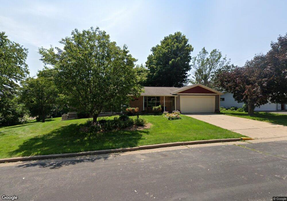
137 W Grove St Ellsworth, WI 54011
Estimated Value: $256,000 - $342,565
2
Beds
1
Bath
--
Sq Ft
0.28
Acres
About This Home
This home is located at 137 W Grove St, Ellsworth, WI 54011 and is currently estimated at $300,391. 137 W Grove St is a home located in Pierce County with nearby schools including Ellsworth High School.
Ownership History
Date
Name
Owned For
Owner Type
Purchase Details
Closed on
Aug 1, 2006
Sold by
Hines Elaine J and Kenneth G Krause Family Trust
Bought by
Foss Darrin and Foss Tammy
Current Estimated Value
Home Financials for this Owner
Home Financials are based on the most recent Mortgage that was taken out on this home.
Original Mortgage
$100,000
Outstanding Balance
$60,234
Interest Rate
6.82%
Mortgage Type
New Conventional
Estimated Equity
$240,157
Create a Home Valuation Report for This Property
The Home Valuation Report is an in-depth analysis detailing your home's value as well as a comparison with similar homes in the area
Home Values in the Area
Average Home Value in this Area
Purchase History
| Date | Buyer | Sale Price | Title Company |
|---|---|---|---|
| Foss Darrin | $155,000 | Pierce County Abstract And T |
Source: Public Records
Mortgage History
| Date | Status | Borrower | Loan Amount |
|---|---|---|---|
| Open | Foss Darrin | $100,000 |
Source: Public Records
Tax History Compared to Growth
Tax History
| Year | Tax Paid | Tax Assessment Tax Assessment Total Assessment is a certain percentage of the fair market value that is determined by local assessors to be the total taxable value of land and additions on the property. | Land | Improvement |
|---|---|---|---|---|
| 2024 | $5,874 | $309,200 | $35,200 | $274,000 |
| 2023 | $5,449 | $309,200 | $35,200 | $274,000 |
| 2022 | $4,652 | $309,200 | $35,200 | $274,000 |
| 2021 | $3,714 | $171,300 | $31,300 | $140,000 |
| 2020 | $3,758 | $171,300 | $31,300 | $140,000 |
| 2019 | $3,652 | $171,300 | $31,300 | $140,000 |
| 2018 | $3,731 | $171,300 | $31,300 | $140,000 |
| 2017 | $3,779 | $171,300 | $31,300 | $140,000 |
| 2016 | $3,742 | $171,300 | $31,300 | $140,000 |
| 2015 | $3,503 | $171,300 | $31,300 | $140,000 |
| 2014 | $3,275 | $171,300 | $31,300 | $140,000 |
| 2013 | $3,433 | $165,400 | $31,300 | $134,100 |
Source: Public Records
Map
Nearby Homes
- 166 E Main St
- 146 E Main St
- 227 S Piety St
- 230 S Chestnut St
- 232 S Chestnut St
- 332 Pleasant Ave
- 314 N Maple St
- 841 N Grant St
- 269 S Chestnut St
- 185 S Maple St
- 195 W Humble Ave
- 829 N Grant St
- 000 S Maple St
- XXX S Maple St
- 871 N Grant St
- 883 N Grant St
- 893 N Grant St
- 256 W Panther Dr
- N5196 732nd St
- W7366 US Highway 10
- 149 W Grove St
- 164 N Beulah St
- 138 W Grove St
- 162 N Beulah St
- 214 N Beulah St
- 175 W Grove St
- 165 N Beulah St
- 238 N Beulah St
- 185 W Grove St
- 163 N Beulah St
- 258 N Beulah St
- 161 N Beulah St
- 2075 117th Ave
- 228 W Grove St
- 214 W Grove St
- 238 W Grove St
- 213 W Grove St
- 278 N Beulah St
- 206 W Kinne St
- 130 N Beulah St