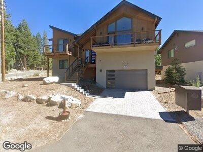
1371 Cliff Rd South Lake Tahoe, CA 96150
Estimated Value: $1,476,000 - $1,625,812
5
Beds
4
Baths
2,668
Sq Ft
$583/Sq Ft
Est. Value
About This Home
This home is located at 1371 Cliff Rd, South Lake Tahoe, CA 96150 and is currently estimated at $1,556,203, approximately $583 per square foot. 1371 Cliff Rd is a home with nearby schools including Tahoe Valley Elementary School, South Tahoe Middle School, and South Tahoe High School.
Ownership History
Date
Name
Owned For
Owner Type
Purchase Details
Closed on
Apr 1, 2022
Sold by
Provision Properties Llc
Bought by
Rezaeifakhr-Eshghi Family Trust
Current Estimated Value
Purchase Details
Closed on
Mar 23, 2021
Sold by
Johnson Richard Scott
Bought by
Provision Properties Llc
Purchase Details
Closed on
Mar 17, 2011
Sold by
Johnson Richard Scott
Bought by
Johnson Richard Scott
Create a Home Valuation Report for This Property
The Home Valuation Report is an in-depth analysis detailing your home's value as well as a comparison with similar homes in the area
Home Values in the Area
Average Home Value in this Area
Purchase History
| Date | Buyer | Sale Price | Title Company |
|---|---|---|---|
| Rezaeifakhr-Eshghi Family Trust | $1,590,000 | Placer Title | |
| Provision Properties Llc | $650,000 | Placer Title Company | |
| Johnson Richard Scott | -- | None Available |
Source: Public Records
Mortgage History
| Date | Status | Borrower | Loan Amount |
|---|---|---|---|
| Previous Owner | Johnson R Scott | $83,000 |
Source: Public Records
Tax History Compared to Growth
Tax History
| Year | Tax Paid | Tax Assessment Tax Assessment Total Assessment is a certain percentage of the fair market value that is determined by local assessors to be the total taxable value of land and additions on the property. | Land | Improvement |
|---|---|---|---|---|
| 2024 | $17,624 | $1,654,236 | $405,756 | $1,248,480 |
| 2023 | $17,316 | $1,621,800 | $397,800 | $1,224,000 |
| 2022 | $8,707 | $806,500 | $306,000 | $500,500 |
| 2021 | $718 | $56,998 | $39,237 | $17,761 |
| 2020 | $712 | $56,414 | $38,835 | $17,579 |
| 2019 | $709 | $55,309 | $38,074 | $17,235 |
| 2018 | $694 | $54,226 | $37,328 | $16,898 |
| 2017 | $684 | $53,164 | $36,597 | $16,567 |
| 2016 | $672 | $52,123 | $35,880 | $16,243 |
| 2015 | $641 | $51,342 | $35,342 | $16,000 |
| 2014 | $641 | $50,338 | $34,650 | $15,688 |
Source: Public Records
Map
Nearby Homes
- 1280 Pyramid Cir
- 1235 Mount Diablo Cir
- 657 Shoshone St
- 511 Little Mountain Ln
- 686 Cayuga St
- 581 Cochise Cir
- 733 Cayuga St
- 1842 Grizzly Mountain Dr
- 1706 Grizzly Mountain Dr
- 928 Kiowa Dr
- 1111 E San Bernardino
- 579 Kiowa Dr
- 648 Kiowa Dr
- 1774 Delaware St
- 1820 Nez Perce Dr
- 1828 Toppewetah St
- 1867 Toppewetah St
- 938 Iron Mountain Cir
- 1909 Mewuk Dr
- 1966 Nez Perce Dr
- 1371 Cliff Rd
- 1381 Cliff Rd
- 1291 Pyramid Cir
- 1285 Pyramid Cir Unit Ci
- 1395 Mount Rainier Dr
- 1311 Mount Olympia Cir
- 1281 Pyramid Cir
- 1411 Mount Rainier Dr
- 1364 Mount Rainier Dr
- 1246 Mount Diablo Cir
- 1319 Mount Olympia Cir Unit Ci
- 1319 Mount Olympia Cir
- 1266 Pyramid Cir
- 1500 Snow Mountain Dr
- 1174 Mount Shasta Cir
- 1267 Pyramid Cir
- 1504 Snow Mountain Dr
- 1327 Mount Olympia Cir
- 1180 Mount Shasta Cir
- 1508 Snow Mountain Dr