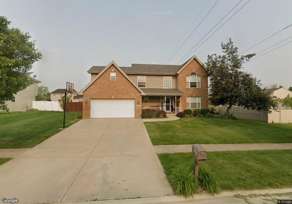
1375 Eagle Bluff Dr Bourbonnais, IL 60914
Estimated Value: $364,942 - $421,000
4
Beds
3
Baths
--
Sq Ft
17,119
Sq Ft Lot
About This Home
This home is located at 1375 Eagle Bluff Dr, Bourbonnais, IL 60914 and is currently estimated at $395,986. 1375 Eagle Bluff Dr is a home located in Kankakee County with nearby schools including Noel Levasseur Elementary School, Liberty Intermediate School, and Bourbonnais Upper Grade Center.
Ownership History
Date
Name
Owned For
Owner Type
Purchase Details
Closed on
Apr 18, 2025
Sold by
Lanum Jonathan D
Bought by
Lanum Kerri L
Current Estimated Value
Purchase Details
Closed on
Oct 15, 2010
Sold by
Robert Storako and Robert Jamie
Bought by
Lanum Jonathan D and Lanum Kerri L
Create a Home Valuation Report for This Property
The Home Valuation Report is an in-depth analysis detailing your home's value as well as a comparison with similar homes in the area
Home Values in the Area
Average Home Value in this Area
Purchase History
| Date | Buyer | Sale Price | Title Company |
|---|---|---|---|
| Lanum Kerri L | -- | None Listed On Document | |
| Lanum Jonathan D | $240,000 | Kankakee Cnty Title & Tr |
Source: Public Records
Mortgage History
| Date | Status | Borrower | Loan Amount |
|---|---|---|---|
| Closed | Lanum Jonathan D | $216,000 |
Source: Public Records
Tax History
| Year | Tax Paid | Tax Assessment Tax Assessment Total Assessment is a certain percentage of the fair market value that is determined by local assessors to be the total taxable value of land and additions on the property. | Land | Improvement |
|---|---|---|---|---|
| 2024 | $8,128 | $104,139 | $12,030 | $92,109 |
| 2023 | $7,301 | $94,753 | $11,139 | $83,614 |
| 2022 | $7,352 | $91,758 | $10,736 | $81,022 |
| 2021 | $6,959 | $86,691 | $10,500 | $76,191 |
| 2020 | $6,893 | $84,371 | $10,219 | $74,152 |
| 2019 | $6,748 | $81,913 | $9,921 | $71,992 |
| 2018 | $6,477 | $78,636 | $9,774 | $68,862 |
| 2017 | $6,348 | $76,718 | $9,536 | $67,182 |
| 2016 | $6,174 | $74,929 | $9,395 | $65,534 |
| 2015 | $6,205 | $74,398 | $8,457 | $65,941 |
| 2014 | $6,019 | $75,084 | $8,457 | $66,627 |
| 2013 | -- | $73,725 | $8,457 | $65,268 |
Source: Public Records
Map
Nearby Homes
- 1356 Eagle Bluff Dr
- 847 Tremont St
- 54 Bonds Dr
- 366 Centerpoint Dr S
- 22 Emery Dr
- 16 Kim Dr
- 180 Karen Dr
- 59 Hanson Dr
- 172 Anita Dr
- 42 Hanson Dr
- 9 Hilltop Dr
- 859 Pheasant Run
- 703 Heritage Dr
- 5659 N 1000 West Rd
- 3425 Mouton Ct
- 214 Greenbriar Ln
- 1278 Theresa Ln
- 1138 Cotes de Bourg
- 1947 Flagstone Ave
- 206 Meadows Rd S
- 1365 Eagle Bluff Dr
- 600 Winston Dr
- 610 Winston Dr
- 1355 Eagle Bluff Dr
- 620 Liberty Ct
- 620 Winston Dr
- 618 Liberty Ct
- 1380 Eagle Bluff Dr
- 1372 Eagle Bluff Dr
- 1345 Eagle Bluff Dr
- 630 Winston Dr
- 1364 Eagle Bluff Dr
- 616 Liberty Ct
- 630 Liberty Ct
- 630 Liberty Ct
- 1390 Eagle Bluff Dr
- 640 Winston Dr
- 1337 Eagle Bluff Dr
- 605 Winston Dr
- 615 Winston Dr
Your Personal Tour Guide
Ask me questions while you tour the home.