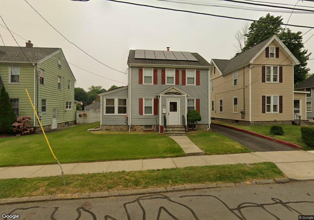
1379 Wood Ave Bridgeport, CT 06604
Brooklawn-Saint Vincent NeighborhoodEstimated Value: $407,000 - $450,644
4
Beds
2
Baths
1,682
Sq Ft
$253/Sq Ft
Est. Value
About This Home
This home is located at 1379 Wood Ave, Bridgeport, CT 06604 and is currently estimated at $425,161, approximately $252 per square foot. 1379 Wood Ave is a home located in Fairfield County with nearby schools including Blackham School, Central High School, and Assumption Catholic School.
Ownership History
Date
Name
Owned For
Owner Type
Purchase Details
Closed on
Jul 15, 2014
Sold by
Colon Ramon
Bought by
Colon Ramon
Current Estimated Value
Purchase Details
Closed on
Mar 28, 1995
Sold by
Shawmut Mtg
Bought by
Colona Ramon S and Colon Sonia J
Purchase Details
Closed on
Mar 17, 1994
Sold by
Fdic
Bought by
Miller Jill and Miller Bruce
Purchase Details
Closed on
Jun 16, 1993
Sold by
Northpoint Co
Bought by
Fdic
Create a Home Valuation Report for This Property
The Home Valuation Report is an in-depth analysis detailing your home's value as well as a comparison with similar homes in the area
Home Values in the Area
Average Home Value in this Area
Purchase History
| Date | Buyer | Sale Price | Title Company |
|---|---|---|---|
| Colon Ramon | -- | -- | |
| Colon Ramon | -- | -- | |
| Colona Ramon S | $83,000 | -- | |
| Colona Ramon S | $83,000 | -- | |
| Miller Jill | $100,000 | -- | |
| Miller Jill | $100,000 | -- | |
| Fdic | $156,000 | -- |
Source: Public Records
Mortgage History
| Date | Status | Borrower | Loan Amount |
|---|---|---|---|
| Open | Fdic | $157,750 | |
| Previous Owner | Fdic | $157,700 |
Source: Public Records
Tax History Compared to Growth
Tax History
| Year | Tax Paid | Tax Assessment Tax Assessment Total Assessment is a certain percentage of the fair market value that is determined by local assessors to be the total taxable value of land and additions on the property. | Land | Improvement |
|---|---|---|---|---|
| 2025 | $7,011 | $161,360 | $70,820 | $90,540 |
| 2024 | $7,011 | $161,360 | $70,820 | $90,540 |
| 2023 | $7,011 | $161,360 | $70,820 | $90,540 |
| 2022 | $7,011 | $161,360 | $70,820 | $90,540 |
| 2021 | $7,011 | $161,360 | $70,820 | $90,540 |
| 2020 | $6,635 | $122,890 | $42,890 | $80,000 |
| 2019 | $6,635 | $122,890 | $42,890 | $80,000 |
| 2018 | $6,682 | $122,890 | $42,890 | $80,000 |
| 2017 | $6,682 | $122,890 | $42,890 | $80,000 |
| 2016 | $6,682 | $122,890 | $42,890 | $80,000 |
| 2015 | $6,344 | $150,340 | $45,430 | $104,910 |
| 2014 | $6,344 | $150,340 | $45,430 | $104,910 |
Source: Public Records
Map
Nearby Homes
- 1473 Wood Ave
- 1213 Wood Ave
- 1480 Capitol Ave Unit 811
- 2445 Park Ave Unit 23
- 605 Brooklawn Ave
- 2625 Park Ave Unit 12L
- 2625 Park Ave Unit 12H
- 2625 Park Ave Unit 5S
- 2625 Park Ave Unit 6M
- 2625 Park Ave Unit 5N
- 2345 Park Ave
- 665 W Taft Ave
- 2675 Park Ave Unit 3
- 2675 Park Ave Unit 22
- 1275 Capitol Ave
- 366 Brooklawn Ave
- 125 Alexander Dr
- 150 Alexander Dr
- 11 Myron Ave
- 184 Pacific St