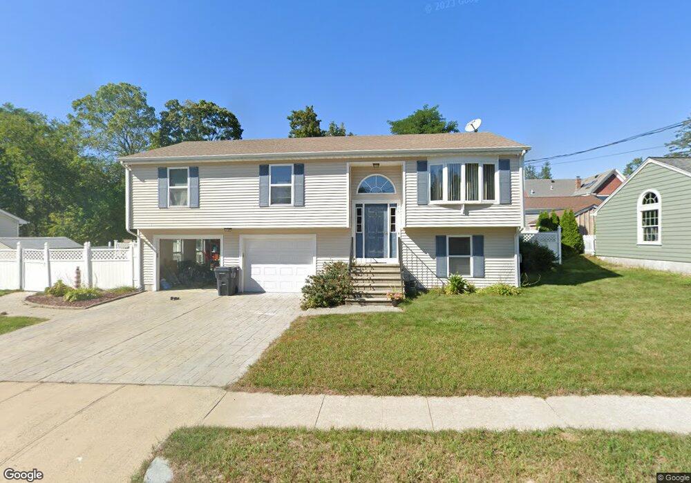
138 Burnside Ave Riverside, RI 02915
Riverside NeighborhoodEstimated Value: $476,000 - $539,000
3
Beds
1
Bath
1,376
Sq Ft
$362/Sq Ft
Est. Value
About This Home
This home is located at 138 Burnside Ave, Riverside, RI 02915 and is currently estimated at $498,414, approximately $362 per square foot. 138 Burnside Ave is a home located in Providence County with nearby schools including East Providence High School, St Mary Academy-Bay View, and St Luke Elementary School.
Ownership History
Date
Name
Owned For
Owner Type
Purchase Details
Closed on
Jan 7, 2025
Sold by
Spremulli Katalin A
Bought by
Spremulli Michael V
Current Estimated Value
Purchase Details
Closed on
May 17, 2007
Sold by
Michael West Builders
Bought by
Spremalli Michael and Spremalli Katalin
Home Financials for this Owner
Home Financials are based on the most recent Mortgage that was taken out on this home.
Original Mortgage
$294,380
Interest Rate
6.18%
Mortgage Type
Purchase Money Mortgage
Purchase Details
Closed on
Oct 8, 2004
Sold by
Raymond Francis Est and Mastranardi
Bought by
Michael West Bldrs Inc
Create a Home Valuation Report for This Property
The Home Valuation Report is an in-depth analysis detailing your home's value as well as a comparison with similar homes in the area
Home Values in the Area
Average Home Value in this Area
Purchase History
| Date | Buyer | Sale Price | Title Company |
|---|---|---|---|
| Spremulli Michael V | -- | None Available | |
| Spremulli Michael V | -- | None Available | |
| Spremalli Michael | $299,000 | -- | |
| Michael West Bldrs Inc | $175,500 | -- | |
| Spremalli Michael | $299,000 | -- | |
| Michael West Bldrs Inc | $175,500 | -- |
Source: Public Records
Mortgage History
| Date | Status | Borrower | Loan Amount |
|---|---|---|---|
| Previous Owner | Michael West Bldrs Inc | $298,795 | |
| Previous Owner | Michael West Bldrs Inc | $294,380 |
Source: Public Records
Tax History Compared to Growth
Tax History
| Year | Tax Paid | Tax Assessment Tax Assessment Total Assessment is a certain percentage of the fair market value that is determined by local assessors to be the total taxable value of land and additions on the property. | Land | Improvement |
|---|---|---|---|---|
| 2025 | $5,940 | $454,500 | $102,900 | $351,600 |
| 2024 | $5,565 | $363,000 | $85,700 | $277,300 |
| 2023 | $5,358 | $363,000 | $85,700 | $277,300 |
| 2022 | $5,050 | $231,000 | $48,500 | $182,500 |
| 2021 | $4,967 | $231,000 | $48,500 | $182,500 |
| 2020 | $4,756 | $231,000 | $48,500 | $182,500 |
| 2019 | $4,625 | $231,000 | $48,500 | $182,500 |
| 2018 | $4,835 | $211,300 | $52,100 | $159,200 |
| 2017 | $4,727 | $211,300 | $52,100 | $159,200 |
| 2016 | $4,704 | $211,300 | $52,100 | $159,200 |
| 2015 | $4,507 | $196,400 | $50,900 | $145,500 |
| 2014 | $4,507 | $196,400 | $50,900 | $145,500 |
Source: Public Records
Map
Nearby Homes
- 57 Harris St
- 25 Read St
- 25 Arnold St
- 81 Sprague Ave
- 536 Willett Ave
- 151 Willett Ave Unit 2
- 151 Willett Ave Unit 5
- 25 Woodbine St
- 36 Woodbine St
- 25 Winslow St
- 735 Willett Ave Unit 806
- 17 Oak Ave
- 33 Pine St Unit 35
- 1 Holly St
- 1 Fales St
- 88 Lincoln Ave
- 43 Bullocks Point Ave Unit 4C
- 25 Bullocks Point Ave Unit 5C
- 72 Stowe Ave
- 83 Pine Crest Dr
- 148 Burnside Ave
- 152 Burnside Ave
- 78 Harris St
- 78 Harris St Unit 2
- 147 Hoppin Ave
- 149 Hoppin Ave
- 70 Harris St
- 147 Burnside Ave
- 153 Hoppin Ave
- 62 Harris St
- 421 Willett Ave Unit 425
- 88 Harris St
- 156 Burnside Ave
- 401 Willett Ave
- 75 Harris St
- 69 Harris St
- 409 Willett Ave
- 142 Turner Ave
- 146 Hoppin Ave
- 81 Harris St