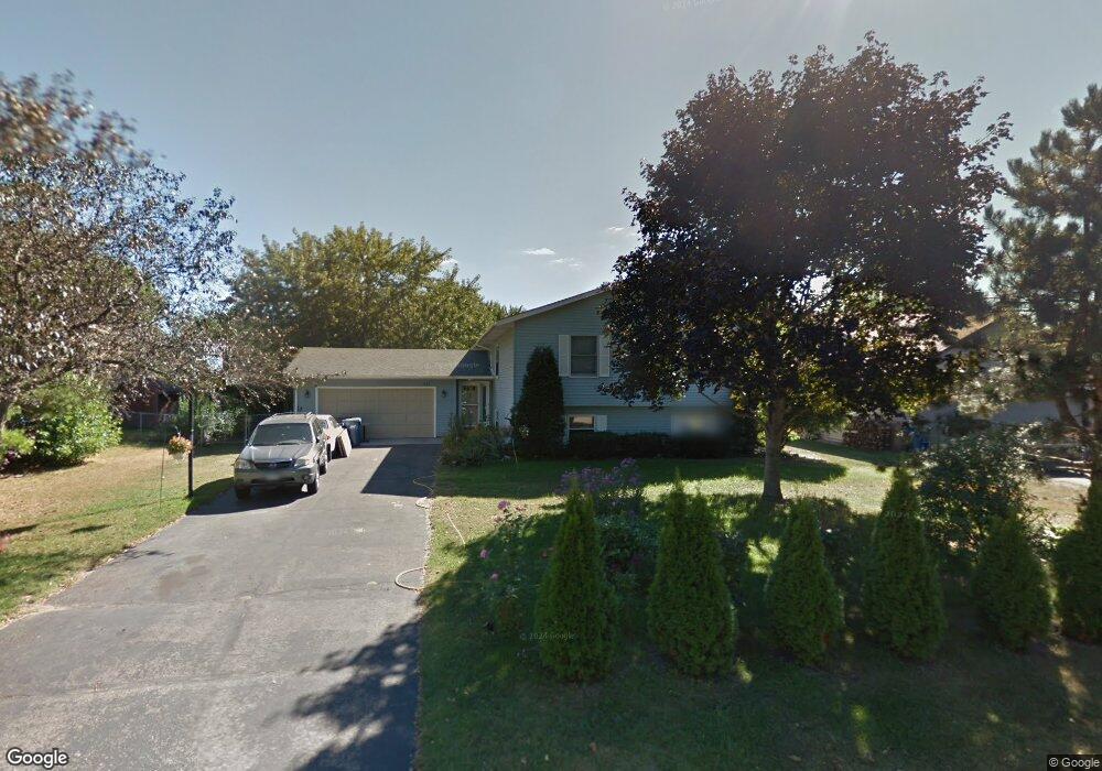
1382 Hickory Trail Saint Paul, MN 55110
Estimated Value: $443,000 - $476,000
4
Beds
3
Baths
1,512
Sq Ft
$302/Sq Ft
Est. Value
About This Home
This home is located at 1382 Hickory Trail, Saint Paul, MN 55110 and is currently estimated at $457,289, approximately $302 per square foot. 1382 Hickory Trail is a home located in Ramsey County with nearby schools including Otter Lake Elementary School, Central Middle School, and Frassati Catholic Academy.
Ownership History
Date
Name
Owned For
Owner Type
Purchase Details
Closed on
Mar 7, 2016
Sold by
Arnold Gregory W and Arnold Roswitha S
Bought by
The Arnold Family Revocable Living Trust
Current Estimated Value
Purchase Details
Closed on
Nov 20, 2015
Sold by
Shafer Dale A and Shafer Kimberly C
Bought by
Shattuck Daniel A and Jorstad Terri L
Home Financials for this Owner
Home Financials are based on the most recent Mortgage that was taken out on this home.
Original Mortgage
$255,075
Outstanding Balance
$200,561
Interest Rate
3.78%
Mortgage Type
New Conventional
Estimated Equity
$256,728
Purchase Details
Closed on
May 31, 2002
Sold by
Sokola Scott M and Sokola Menoe L
Bought by
Shafer Dale A and Shafer Kimberly C
Create a Home Valuation Report for This Property
The Home Valuation Report is an in-depth analysis detailing your home's value as well as a comparison with similar homes in the area
Home Values in the Area
Average Home Value in this Area
Purchase History
| Date | Buyer | Sale Price | Title Company |
|---|---|---|---|
| The Arnold Family Revocable Living Trust | -- | Attorney | |
| Shattuck Daniel A | $268,500 | Burnet Title | |
| Shafer Dale A | $240,000 | -- |
Source: Public Records
Mortgage History
| Date | Status | Borrower | Loan Amount |
|---|---|---|---|
| Open | Shattuck Daniel A | $255,075 |
Source: Public Records
Tax History Compared to Growth
Tax History
| Year | Tax Paid | Tax Assessment Tax Assessment Total Assessment is a certain percentage of the fair market value that is determined by local assessors to be the total taxable value of land and additions on the property. | Land | Improvement |
|---|---|---|---|---|
| 2025 | $4,864 | $417,000 | $84,800 | $332,200 |
| 2023 | $4,864 | $377,800 | $84,800 | $293,000 |
| 2022 | $4,568 | $368,400 | $84,800 | $283,600 |
| 2021 | $4,408 | $334,200 | $84,800 | $249,400 |
| 2020 | $4,440 | $333,100 | $84,800 | $248,300 |
| 2019 | $3,934 | $320,900 | $84,800 | $236,100 |
| 2018 | $3,308 | $305,600 | $84,800 | $220,800 |
| 2017 | $3,460 | $265,900 | $84,800 | $181,100 |
| 2016 | $2,762 | $0 | $0 | $0 |
| 2015 | $4,002 | $211,600 | $77,600 | $134,000 |
| 2014 | $4,238 | $0 | $0 | $0 |
Source: Public Records
Map
Nearby Homes
- 5624 Fisher St
- 5632 Fisher St
- 5697 Windmill Dr
- 1281 Greenbriar Ct Unit 5
- 5795 Otter Lake Rd
- 5807 Otter Lake Rd
- 5415 Peterson Rd
- 5391 Cottage Ave
- 5418 Prospect Ave
- 5678 Centerville Rd
- 1128 Pine Hill Ln
- 1075 Mehegan Ln
- 55 Spring Farm Rd
- 79 Spring Farm Rd
- 76 Spring Farm Rd
- 87 Spring Farm Rd
- 78 Spring Farm Rd
- 89 Spring Farm Rd
- 44 Spring Farm Rd
- 118 Spring Farm Rd
- 1374 Hickory Trail
- 1400 Hickory Trail
- 1408 Hickory Trail
- 1385 Jonquil Ln
- 5594 Fisher St
- 1393 Jonquil Ln
- 1366 Hickory Trail
- 1377 Jonquil Ln
- 1377 Hickory Trail
- 1385 Hickory Trail
- 1401 Jonquil Ln
- 5616 Fisher St
- 1416 Hickory Trail
- 1369 Jonquil Ln
- 1393 Hickory Trail
- 1409 Jonquil Ln
- 1401 Hickory Trail
- 1424 Hickory Trail
- 1376 Whisperwood Trail
- 1384 Jonquil Ln