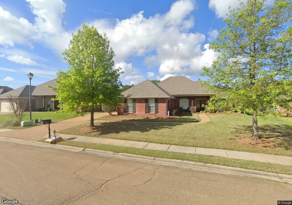
139 Memory Ln Madison, MS 39110
Estimated Value: $246,135 - $342,000
Studio
--
Bath
1,908
Sq Ft
$155/Sq Ft
Est. Value
About This Home
This home is located at 139 Memory Ln, Madison, MS 39110 and is currently estimated at $296,284, approximately $155 per square foot. 139 Memory Ln is a home with nearby schools including Mannsdale Elementary School, Germantown Middle School, and Germantown High School.
Ownership History
Date
Name
Owned For
Owner Type
Purchase Details
Closed on
Jun 29, 2012
Sold by
Laxson Jennifer King and Laxson Justin Daniel
Bought by
Laxson Justin Daniel and Laxson Jennifer King
Current Estimated Value
Home Financials for this Owner
Home Financials are based on the most recent Mortgage that was taken out on this home.
Original Mortgage
$143,500
Outstanding Balance
$98,909
Interest Rate
3.79%
Mortgage Type
New Conventional
Estimated Equity
$197,375
Purchase Details
Closed on
Jan 8, 2010
Sold by
Hollis Shoemaker Inc
Bought by
King Jennifer L
Home Financials for this Owner
Home Financials are based on the most recent Mortgage that was taken out on this home.
Original Mortgage
$144,312
Interest Rate
4.8%
Mortgage Type
New Conventional
Create a Home Valuation Report for This Property
The Home Valuation Report is an in-depth analysis detailing your home's value as well as a comparison with similar homes in the area
Purchase History
| Date | Buyer | Sale Price | Title Company |
|---|---|---|---|
| Laxson Justin Daniel | -- | None Available | |
| King Jennifer L | -- | None Available | |
| Hollis Shoemaker Inc | -- | None Available |
Source: Public Records
Mortgage History
| Date | Status | Borrower | Loan Amount |
|---|---|---|---|
| Open | Laxson Justin Daniel | $143,500 | |
| Closed | Hollis Shoemaker Inc | $144,312 |
Source: Public Records
Tax History
| Year | Tax Paid | Tax Assessment Tax Assessment Total Assessment is a certain percentage of the fair market value that is determined by local assessors to be the total taxable value of land and additions on the property. | Land | Improvement |
|---|---|---|---|---|
| 2025 | $1,378 | $16,339 | $0 | $0 |
| 2024 | $1,378 | $16,339 | $0 | $0 |
| 2023 | $1,378 | $16,339 | $0 | $0 |
| 2022 | $1,378 | $16,339 | $0 | $0 |
| 2021 | $1,286 | $15,752 | $0 | $0 |
| 2020 | $1,286 | $15,752 | $0 | $0 |
| 2019 | $1,266 | $15,552 | $0 | $0 |
| 2018 | $1,266 | $15,552 | $0 | $0 |
| 2017 | $1,243 | $15,322 | $0 | $0 |
| 2016 | $1,243 | $15,322 | $0 | $0 |
| 2015 | $1,181 | $15,322 | $0 | $0 |
| 2014 | $1,181 | $15,322 | $0 | $0 |
Source: Public Records
Map
Nearby Homes
- 125 Memory Ln
- 169 Memory Ln
- 108 Sara Scotts Cove
- 107 Memory Ln
- 124 Ashbrooke Blvd
- 103 Crabapple Grove
- 424 Stonewater Cove
- 106 Elm Ct
- 108 Elm Ct
- 308 E Lake Dr
- 242 Falls Crossing
- 157 Cotton Wood Dr
- 258 Falls Crossing
- 157 Westerly Place
- 424 Cumberland Ridge
- 313 N Falls Crossing
- 102 Wisteria Vine
- 233 Rockbridge Dr
- 304 Lois Ct
- 104 Westlake Cir
Your Personal Tour Guide
Ask me questions while you tour the home.