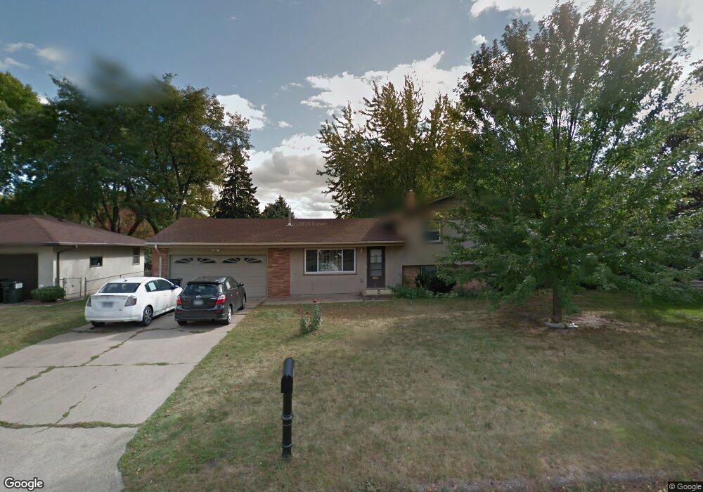
1390 Sophia Ave Saint Paul, MN 55109
Gladstone NeighborhoodEstimated Value: $289,000 - $370,000
3
Beds
2
Baths
532
Sq Ft
$605/Sq Ft
Est. Value
About This Home
This home is located at 1390 Sophia Ave, Saint Paul, MN 55109 and is currently estimated at $322,009, approximately $605 per square foot. 1390 Sophia Ave is a home located in Ramsey County with nearby schools including Weaver Elementary School, John Glenn Middle School, and Mounds Park Academy.
Ownership History
Date
Name
Owned For
Owner Type
Purchase Details
Closed on
Nov 16, 2022
Sold by
Young Richard A and Young Jodine A
Bought by
Ukatu Edward and Ukatu Hope
Current Estimated Value
Purchase Details
Closed on
Jun 11, 2018
Sold by
Gilgert Brandon J and Gilgert Mariah M
Bought by
Young Jodine A and Young Richard A
Purchase Details
Closed on
Aug 4, 2015
Sold by
Her Kong Kong
Bought by
Gilgert Mariah Mariah
Purchase Details
Closed on
Apr 20, 2010
Sold by
Larson Juanita L
Bought by
Her Kong M and Her Vickie Lee
Create a Home Valuation Report for This Property
The Home Valuation Report is an in-depth analysis detailing your home's value as well as a comparison with similar homes in the area
Home Values in the Area
Average Home Value in this Area
Purchase History
| Date | Buyer | Sale Price | Title Company |
|---|---|---|---|
| Ukatu Edward | $346,000 | Dca Title | |
| Young Jodine A | $222,000 | Liberty Title Inc | |
| Gilgert Mariah Mariah | $186,000 | -- | |
| Her Kong M | $170,000 | -- |
Source: Public Records
Tax History Compared to Growth
Tax History
| Year | Tax Paid | Tax Assessment Tax Assessment Total Assessment is a certain percentage of the fair market value that is determined by local assessors to be the total taxable value of land and additions on the property. | Land | Improvement |
|---|---|---|---|---|
| 2025 | $4,346 | $320,600 | $62,800 | $257,800 |
| 2023 | $4,346 | $302,600 | $62,800 | $239,800 |
| 2022 | $3,650 | $291,500 | $62,800 | $228,700 |
| 2021 | $3,596 | $255,300 | $62,800 | $192,500 |
| 2020 | $3,416 | $256,700 | $62,800 | $193,900 |
| 2019 | $2,912 | $230,500 | $62,800 | $167,700 |
| 2018 | $2,886 | $203,500 | $62,800 | $140,700 |
| 2017 | $2,866 | $197,000 | $62,800 | $134,200 |
| 2016 | $2,778 | $0 | $0 | $0 |
| 2015 | $2,320 | $183,600 | $57,600 | $126,000 |
| 2014 | $1,766 | $0 | $0 | $0 |
Source: Public Records
Map
Nearby Homes
- 1751 Clarence St
- 1435 Price Ave
- 1740 English St
- 1672 Manton St
- 1870 Clarence St
- 1639 Clarence St
- 1869 Birmingham St
- 1730 Atlantic St
- 1854 Barclay St
- 1714 Duluth St
- 1532 Larpenteur Ave E
- 1562 Chamber St
- 1940 Barclay St
- 1567 Atlantic St
- 1627 Christie Place
- 1201 Frost Ave
- 1849 Kennard St
- 1607 Hoyt Ave E
- 1637 Iowa Ave E
- 1450 Arlington Ave E
- 1384 Sophia Ave
- 1391 Price Ave
- 1383 Price Ave
- 1376 Sophia Ave
- 1399 Price Ave
- 1406 Sophia Ave
- 1381 Sophia Ave
- 1401 Sophia Ave
- 1375 Price Ave
- 1415 Price Ave
- 1751 Ide St
- 1414 Sophia Ave
- 1752 Ide St
- 1746 Clarence St
- 1367 Price Ave
- 1745 Birmingham St
- 1421 Price Ave
- 1392 Price Ave
- 1759 Ide St
- 1384 Price Ave